Sunday, April 06, 2014

Picador

Here's a slideshow about Picador, the second Manuel Izquierdo sculpture outside the Portland Art Museum, on the Jefferson St. side of the building near Split Ring. Unlike Eye of Orion (the other Izquierdo), it doesn't appear that anyone's started a Doomsday cult about Picador yet, but then it's a relatively new acquisition and doesn't show up in a lot of Portland art guides, so it's possible any prospective cultists simply haven't found it yet. I had a bit of trouble figuring out what this was, actually. There doesn't seem to be a museum sign for it anywhere nearby. I ended up just guessing it was one of his and rifling through the museum's online collection to see if they had any photos that looked right.

Once I knew the title I still couldn't dig up a lot of info to share about this one. The search results are swamped with Spanish-language bullfighting links. Apparently there's another unrelated Manuel Izquierdo out there who has something to do with bullfights, though I'm not sure whether he's an actual picador or not. And no, I'm not going to link to any bullfighting websites, because this is a civilized blog, for the most part.

You might recall I did a "Hey, I know who did that" with the museum's Mistral No. 2 as well; this sounds like an impressive skill until you realize that Portland's official arts world (i.e. people who made a living creating "serious" art, whatever that is) was about twelve people (nearly 100% of them old white men) from WWII through 1990 or so. Their work is found all over Portland and around the Northwest, so in a way they're important in the "Who created that?" sense. But if they were really so amazing and talented, what were they doing in a podunk Republican timber town like 1950s Portland, instead of Manhattan where all the serious action was? (Or at least where all the serious money was?) That's a question I can never seem to get a straight answer to.

Jekyll Island, GA


[View Larger Map]

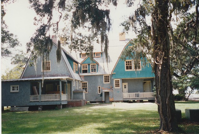
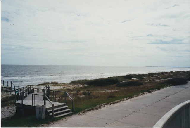
Here are a few old photos from Jekyll Island, Georgia, a barrier island on the Atlantic coast near the town of Brunswick. The island was developed in the late 1880s as a resort for northern robber barons -- J.P Morgan, various Rockefellers, Vanderbilts, Goulds, and their ilk. The island's fortunes waned (so to speak) after the stock market crash of 1929, and the state of Georgia has owned and operated it since 1947. A number of the original "cottages" (i.e. vacation mansions) still survive, as does the central clubhouse building, now a hotel.

Jekyll Island

You may have gathered this is not a comprehensive photoset about the place; I took these in the late 90s, and I had no idea at the time that I might need a bunch of photos for the internet someday. In any case, I could never muster a lot of enthusiasm for the extravagant lifestyles of ultra-rich oligarchs, so if I did have a bunch of interior photos I'd probably just snark about them anyway. The island's beaches were beautiful, though. It's worth a visit just for the beaches.

Jekyll Island

Madrina

The next item on our random walk outside the art museum is Mark Calderon's Madrina. Like his smaller Floribunda on Portland's transit mall, it takes inspiration from elaborate hairstyles. Madrina appears to be a full human figure, and seen from any angle it looks like you're seeing the statue from behind. Until you realize it's an identical hairstyle all the way around, and the joke's on you. I don't know if that makes it great art for the ages or not, but it has entertainment value, I guess.

A Seattle gallery website mentions that this is one of a series of five (another is at the art museum in Bellevue, WA), and the page offers a brief description:

Each work in this edition will be hand finished with a unique patina. A rich reddish brown appears in the crevices of this work.

The image is a reflection on the female figure. Her mystery is evident in the realization that, as the viewer moves around her, a face never appears. Instead, she is shrouded in 360 degrees with long tendrils of curled hair and a gown that is fluted with a scalloped bottom edge. She can be viewed as an abstraction of a Madonna figure but her curls also suggest the Buddhas of the Far East with their pin curls or topknots, and Grecian caryatids with their plaited hair.

"Madrina" is the Spanish word for godmother.

Lions

Our wander around the outdoor part of the Portland Art Museum (i.e the free part) continues with Alexander Phimister Proctor's Lions, a large bronze plaque mounted on an exterior wall. Proctor also created the Theodore Roosevelt equestrian statue in the South Park Blocks nearby.

A 2003 paper in the Oregon Historical Quarterly about Proctor's work in Oregon explains the winding history of Lions. It was originally commissioned for the home of Wilson B. Ayer, a museum trustee, circa 1911, where it hung over a fireplace for many years. Ayers willed Lions to the museum in 1935. Aesthetic tastes changed, and the museum eventually lost interest in Lions, and loaned it to the Oregon Zoo in May 1962 (the same week the zoo train opened for business, as it turns out). The zoo mounted it on a wall in the big cat section, in an awkward location where it was hard to see; sometimes it even had bushes growing in front of it. It eventually fell into neglect and disrepair. I remember seeing it there as a kid and thinking it was a strange thing to find lurking behind a stand of bamboo. The museum finally took it back in 1998, restored it, and put it on display in its current location.

Proctor's 1950 obit in the Oregonian referred to him as a "famed western sculptor" and continued with a rather disturbing bit: "An enthusiastic hunter as well as an artist, he often boasted he had killed every species of wildlife in North America 'except a buffalo and an Indian.'" If you ever want to know what 1950 America was like, it was a place where it was ok to say that as a boast, and ok to print it in the newspaper as a heartwarming anecdote. Yeesh.

Saturday, April 05, 2014

Mistral No. 2

Here's another object from the Portland Art Museum's free outdoor section, Frederic Littman's Mistral No. 2 (1961). Littman was a prolific local artist of the mid-20th Century, so his work shows up all over town. I've covered three other creations of his: Joy (Pioneer Woman) on Council Crest; Farewell to Orpheus in the South Park Blocks at PSU; and The Flogger at ESCO in industrial NW Portland. As I've said before, his style is generally not my cup of tea (though it works in The Flogger). Still, it was kind of fun to look around the museum's sculpture garden, see Mistral No. 2 and immediately know who had created it, even before I looked at the sign. I'm starting to feel as if I've actually learned something in this little project. It's not exactly a marketable job skill, but hey.

Meanwhile Mistral No. 3 is somewhere at Keller Auditorium, apparently. The interwebs don't seem to know where Mistral No. 1 is, or how many Mistrals there were in the series.

Hunting Island, SC


View Larger Map

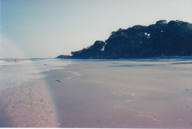
Here are a couple of beach photos from South Carolina's Hunting Island State Park, a barrier island on the coast about 15 miles from the town of Beaufort. The island's dense palmetto-filled forest comes right up to the beach, like something you'd see in a movie about remote South Pacific islands. I would have liked to have better photos of the forest, and the rest of the park, but I only have these two photos. I think I may have run out of film after this pair of photos, come to think of it. I also had a crappy camera at the time, and (more importantly) I had no idea what I was doing. I realize I keep trotting that out as an excuse when I post old photos, but it's true. I ran across a forum thread with some great photos, if you want a better look at the area.

Hunting Island, SC

I wish I'd still had some film left when we ran across an alligator, asleep and sunning itself at an inland pond. Not an enclosure, not an exhibit, just a pond with a wild alligator. At the time, we lived a couple of hours north and inland, and while alligators were known to exist in our area, there were far more rumors than sightings. And of course coming from the Northwest we weren't used to even that degree of alligator-ness. So stumbling across one here, out of the blue, was kind of a big deal. Any locals who saw us gawking and pointing must have found it hilarious. It probably wasn't even that big of an alligator, thinking back. Still, I could have walked over and touched it if I'd wanted to, which I didn't. Nobody else seemed to want to pet the gator either.

Friday, April 04, 2014

Vanport Wetlands


[View Larger Map]

Here's a slideshow from the Vanport Wetlands natural area, just south of the Portland Expo Center. I'd ridden MAX to the end of the line to get some photos of the Oregon Slough Railroad Bridge (as one does) and I had some time to burn while waiting for the train back. So I figured I'd go take a look at the nearby lake. At first glance it looks like your standard run-of-the-mill wetland area near the Columbia, like Smith & Bybee Lakes, Whitaker Ponds, and many others. While that's basically true, there's an interesting story behind this place and how it got this way.

The first thing to know is that this isn't a regular city park, or even a Metro natural area. Instead, the Port of Portland owns and maintains it. Which is strange because their main business is running the Portland Airport and various shipping terminals, not creating duck habitat. It seems they needed to fill in about 14 acres of wetlands at the airport, so they had to create wetlands elsewhere as mitigation, and thus Vanport Wetlands was born. This is how the US Army Corps of Engineers wetland process works, more or less: They'll generally give you a permit to fill and build on wetlands, so long as you create or maintain some other wetlands elsewhere. The theory is that the new wetlands are supposed to be at least as good as the old ones. I suspect that's often not the reality; certainly the little fenced mitigation areas next to suburban minimalls don't look anything like real wetlands, for instance. I'm not a wetland biologist and I can't speak to how good of a job the Port did here, but at 90 acres the Vanport Wetlands are at least larger than the filled area they're supposed to replace.

Back in 2002, toward the end of the Port's restoration effort, they decided to embrace modern technology and they put up a website about the area, its history, and its future, rather than installing the usual interpretive signs at the lake itself. That website has unfortunately been defunct for several years now, but it turns out that the (usually) trusty Wayback Machine has a copy. So I can fill in a few details about the place's unusual history.

Prior to the wetland restoration project, this site had been home to KGW radio towers since the mid-1920s. A pair of 625' towers stood near the center of today's lake. A nearby creepy-looking multistory transmitter building apparently dated to before the 1948 Vanport Flood, which devastated the once-populated surrounding area. The rest of the tower site was a forest of guywires supporting the two antennas. Less visibly, the towers were connected to a grid of buried copper grounding wires, I suppose in case of thunderstorms or something. All of this had to be removed as part of the restoration project, so it wasn't just a matter of taking down the towers and flooding the place. The towers were toppled in December 2000. It's a shame the one online video clip of the toppling is a pre-YouTube, postage-stamp-sized Windows Media file, but that was the state of the art back then. Frankly, I have no idea how we got by in those days.

I couldn't get very far during my brief visit because the Vanport Wetlands are surrounded by a chain link fence topped with barbed wire, and the only gate is closed and locked. The old website explains that this is intentional:

Until 2001, access to the site was restricted to a gate on the eastern boundary of the property off N. Expo Road. Following mitigation construction, a second gate, along the northern boundary of the property, was installed. Due to the conservation restrictions placed on the property, there is presently no public access to the site.

A chain-link fence now surrounds the site, with the only vehicle entrance being a gate at the northern end of North Expo Road. Visitors must receive Port of Portland permission to enter the property due to the sensitivity of the wetlands restoration effort underway there. Once native wetland vegetation is firmly established, the Port anticipates some public use of the property for passive recreation and educational activities.

To my untrained eye the wetlands certainly look established at this point, but clearly this maybe-someday public access hasn't come to pass yet. I can see it not being a high priority for the Port; It's not exactly their core business, after all. They do operate a couple of other public parks, though, although none of them are nature areas: McCarthy Park on Swan Island, and the Stanley Park Blocks and much of the Marine Drive Trail near the airport.

The closure may not be that big of a deal, though, since (as far as the general public goes) the Vanport Wetlands are mostly of interest to birdwatchers. If you're serious about birding, you presumably already have gear for observing from a distance -- binoculars, monster telephoto lenses, etc., and I suppose the fence isn't that big of a deal in that case, so long as you can get an unobstructed view over it from somewhere.

The water comes right up to the property line (at least on the east side of the lake), so it's not like they could put in an extensive trail system here, and I think the lake's too shallow for canoes most of the year, but I imagine a boardwalk or observation deck would be doable at some point.

For what it's worth, there seems to be a minor geographic dispute about just what the lake is called. The Port's old website says it's called "Force Lake", but Google and the Friends of Force Lake say the real Force Lake is just northwest of here, on the other side of Force Avenue. Which I think would make this lake Not The Lake You're Looking For. I'm sorry, that was lame and I apologize.

Pics: Beaufort, SC

Here are a few old scanned photos from Beaufort, SC. These few photos don't really give a full picture of the place; taking photos was expensive back in the 90s, and remember 36 shots per roll? Oh, the good old days, or not. The city, or town really, is like a tiny copy of Charleston, SC. You'll be able to see this better once I get around to scanning my Charleston photos. Or you could just Google Charleston; that will work too. Or Bing, I guess. Anyway, we lived in Augusta at the time, about a 2 hour drive inland, and Beaufort was a bit shorter drive than going to Charleston. There's much more to do in Charleston, of course, but Beaufort and nearby beaches were worth an occasional day trip.

The unusual thing about the place is that the surrounding salt marshes often stretch right up to the edge of town. There could be a row of gaudy 19th century mansions, and then what looks like howling wilderness right at the end of the street. I've always liked salt marshes (and you can probably tell that since most of the photos here are salt marshes), so I thought having them next door was a very cool aspect of the town. It may also be a reason Beaufort stayed small though; up until the late 1940s, malaria was still endemic to this part of the South. Living next to a mosquito-filled swamp maybe wasn't always the best plan back then. By the time the threat of disease abated (thanks to a massive federal public health and aerial spraying campaign) the town was old and historic, ready to be rediscovered & preserved for posterity. I hate to say it, but it's possible we have DDT to thank for this quaint little place.


[View Larger Map]

Wednesday, April 02, 2014

Eleven Very Small Sculptures

Not long ago, I dropped by NW Portland's Wallace Park to take some photos of Silver Dawn, the park's big shiny abstract sculpture over near the off-leash dog area. While I was putting that blog post together, I realized the park was home to a second, much smaller sculpture that I didn't notice during the original visit. Or rather, the park was home to a collection of tiny sculptures scattered all about the place, titled Eleven Very Small Sculptures. The RACC page describes it:

Artist: Bill Will, American, born 1951
...
A curious collection of eleven life-size bronze sculptures of common objects can be found tucked away in unexpected places throughout the park. The artist's goal for this piece was to provide artwork that would be subtle and integral to the environment, but would not compete with or obscure the elements that have already made the park an urban oasis.

Will also co-created Street Wise, the whimsical words-in-the-sidewalk thing near Pioneer Place, on the same block as the Human Comedy faces. His website doesn't seem to mention Eleven Very Small Sculptures anywhere; I suppose it counts as one of his minor works, at least size-wise.

I'm afraid I only have photos of one of the very small sculptures here, namely the book attached to a bench near the park's playground. This is because that was the only one of them I could find during a cursory look around the park. The RACC page has photos of several others: A flip-flop attached to a chain link fence (probably at one of the baseball diamonds); a coffee cup and scattered silverware somewhere I can't make out; small objects in the rafters of the park's picnic shelter; sunglasses atop a lamppost; and a milk carton atop a second lamppost. If I'm counting correctly, that comes to ten sculptures, assuming you count each piece of silverware separately. Finding these (and the mysterious eleventh one) is left as an exercise for the reader.

Eye of Orion

Some photos of Eye of Orion, a Manuel Izquierdo piece in the Portland Art Museum's outdoor sculpture court. It's not my favorite among the works of his that I've seen, but at least one random person has been spotted worshipping it, so reasonable people can disagree, I guess.

It also had a cameo role in QR/ART, a 2011 digital exhibition pairing the museum's traditional artworks with online digital remixes through the magic of QR codes. Yeah, QR codes. Which, in 2014, already seems more dated than any of the traditional works on display. What's more, Eye of Orion was paired with a page on weird-fiction.net that now comes up as a 404 (conceptual art not found).

Luckily(?) the Wayback Machine archived the page before it went away. That page turns out to be some incomprehensible yapping about the sculpture's supposed astrological significance. Or something. I"m not entirely sure what the author was getting at, other than the fact that Eye of Orion is somehow Very Very Important to the cosmos at large. Naturally the page mentions the former Masonic temple next door, because of course it would. The archived 'About' and 'Blog' pages are just spammy pages for various erectile dysfunction pills. Overall I'd rate it at about 350 to 400 milli-Timecubes. Maybe the whole thing's supposed to be deliberately loony, Subgenius-style. Or maybe we've found ourselves a second Eye of Orion cultist.

It seems like a dumb thing to start a cult about, if you ask me. I mean, worshiping a tower topped by a great lidless eye, wreathed in flame? Or at least wreathed in sorta-flame-shaped bronze bits? C'mon, guys, it's been done already. There were movies and everything. Although come to think of it, Orion and Sauron have never actually been seen at the same place at the same time, as far as I know. Waiiiit a minute...

Tuesday, April 01, 2014

Totem Pole, SW Terwilliger

SW Portland's Terwilliger Boulevard was designed as a winding road of scenic views, and there deliberately aren't a lot of structures right along the street, to avoid obstructing these views. One of the few exceptions is the Chart House restaurant, just north of the Beaverton-Hillsdale intersection. Next to the restaurant is a rather large totem pole; the idiosyncratic RACC guidelines say it qualifies as public art, and their database has this to say about it:

“Totem Pole” was carved by Chief Lelooska of Ariel Washington from red cedar harvested from the base of Mt. Adams. This totem pole is one of the most massive in existence measuring fifty feet high and four feet wide. The carved figures depict a beaver surmounted by a grizzly bear next to a raven topped by four watchmen. The totem was carved during Oregon's Centennial in 1959, to celebrate the state's role in Operation Deep Freeze, which established a scientific station at the geographic South Pole.

Born Cherokee, Lelooska (1933-1996) was adopted into the Kwakwaka'wakw, and was known for his mastery of storytelling and carving. As a scholar and educator, Lelooska was an authority on the Indians of North America with a particular emphasis on the tribes of the Northwest coastal region. He was known for his versatility in wood sculpting, creating artwork that ranged in size from hand-held rattles and feast bowls to large-scale totem poles. This piece serves as an excellent example of Lelooska’s work and is a prized part of Portland’s public art collection.

So that's the RACC account; it didn't answer all of my questions, so I dug into the Oregonian database to see what contemporary accounts had to say about it. The first thing to note is that there have been restaurants at this site (known as "Elk Point") for a very long time, stretching back to the early days of Terwilliger Boulevard. Before it became today's Chart House, for many decades it was Palaske's Hillvilla restaurant. It seems Palaske was an Indian art collector, so the idea of adding a totem pole next to his restaurant must have seemed like second nature.

Incidentally, Kenton's Paul Bunyan statue was created for the same centennial exposition, an event that's otherwise been all but forgotten. Based on the surviving art from 1959, we seem to have had sort of derpy and juvenile notions of how to commemorate the state's 100th birthday. (Lost Oregon, Vintage Portland, & Oregon Encyclopedia have interesting posts about the exposition). A totem pole is a weird way to mark the anniversary, at any rate, since it's not as if the Oregon Trail and then statehood were exactly beneficial to local tribes.

The one thing I can't confirm is the story about Antarctic exploration. It may very well be true, but I haven't found anything in the newspaper database to corroborate it.

So here's a brief timeline of the totem pole's creation and later history:
  • The log arrived March 25th 1959. The pole's design was described as a scaled up copy of one from British Columbia's Queen Charlotte Islands, more commonly known as Haida Gwaii these days.
  • A construction photo dated April 7th 1959
  • A May 14th, 1959 front page photo of the pole under construction, wit the caption "Heap Big Totem Pole". In case you were wondering just how racist the Oregonian was back then. I checked briefly and didn't see any letters to the editor calling them out about this headline, which makes me think the paper's white readers of 1959 were ok with this too.
  • Story to go with the previous photo, "Totem pole paint dries" . The article notes this pole had a concrete base, and steel bracing on the back. I didn't think to look at the back, so I don't know if that's still there or not..
  • Raising ceremony June 4th. 27 tons. quoted: "It's an artistic triumph", reports Eddie Palaske. "It's almost half as tall as Meier & Frank's. This will be here long after the Centennial exposition is torn down, perhaps right up to the time the atom bombs strike."
  • June 9th brought a story about Lelooska's indian encampment on the South Park Blocks, part of the Rose Festival Center. I can imagine an Indian encampment there, but try as I might, I can't picture carnival rides on the Park Blocks. I just can't see it.
  • August 25th brought a mention of the inconvenient fact that tribes this far south didn't really do totem poles . It's couched in the usual mocking racial terms, being 1959 and all, but the underlying claim is factually accurate.
  • A tall photo of the pole, dated October 6th . The caption mentions a pond at the base, which isn't there now.
  • January 30th, 1961: A pair of visitors from Finland marveled at the totem pole. The wife mentioned that Finland has no totems because it has no indians. Husband: "No, but we have Swedes".
  • The previous article got an indignant letter to the editor. Bigotry against Indians was still perfectly socially acceptable then, but prejudice against Swedes was on the wane on this side of the Atlantic. I suppose that may count as a form of progress, sort of.
  • A photo of it being repainted for rose festival , June 2nd 1961. The article mentions it has (or had) a gas burner on top to light on special occasions. I don't know whether that still works, and if so, what constitutes a special occasion these days.
  • A 1966 profile of Lelooska & a wider discussion about NW indian art
  • Also a 1983 profile of Lelooska (Don Smith).
  • Palaske's Hillvilla became the Chart House in 1985, and the totem pole underwent restoration at that point.
  • A followup article about the changeover gave a brief history of the place

Waterfront Flagpole

Visitors to Portland's Waterfront Park are bound to notice the giant flagpole sooner or later, north of the Morrison Bridge and near the Battleship Oregon memorial. It seems like a strange thing to have in the middle of the hip, ironic, occasionally-war-protesting Portland of 2014, but there's an interesting historical story behind it. It seems that for a large part of 20th century, Portland prided itself on having the world's largest US flag, or at least the largest one that could be flown from a flagpole. In retrospect this seems sort of like the way tiny Midwestern towns are thrilled to have the world's largest ball of twine, except far more patriotic, somehow. But back in the day this was a great source of civic pride.

The story starts with a ship. From 1925 to 1942, Portland's waterfront was home to the old battleship USS Oregon, which played a key role in the Spanish-American War, and then was loaned (not given) to the city as a museum. When World War II broke out, the Navy decided the the old ship was more valuable as wartime scrap metal than as a historical monument, and it was towed away for dismantling. So as a super-patriotic (and non-metal-using) wartime replacement, the city decided to put up a giant 100' wooden flagpole, with a giant flag to go with it. It was first proposed in 1941, but wasn't completed until 1944 because people were kind of busy with WWII at the time.

The flagpole didn't always fly the giant flag, and the flag sometimes made guest appearances elsewhere. It showed up at the 1950 Shrine game (the all-star game for local high school football players) where it was referred to as the largest American flag in existence. I haven't seen any mention of that original flag's dimensions, but a larger one was acquired in 1956, with dimensions 15' by 10'.

Then in 1960, Hawaii became the 50th state, and a new 50 star flag was needed. Naturally this was a chance to go for an even larger flag, this time 36.5' by 24.5'. Which is a huge flag by any standard, and it was already too big to fly safely during stormy winter months, but there was already talk of creating an even larger one.

So in 1969 they got a truly gigantic flag, 62' by 42'. Which presented a problem, because the new flag was too large for the current flagpole, and it was obvious that it would become entangled with the Battleship Oregon mast or nearby oak trees if the wind ever happened to blow in the wrong direction. The article mentions it superseded a 45' by 30' flag from 1960, which I assume is the larger replacement mentioned in the earlier article. The article mentions the previous flag had rivals for the "World's Largest" title, but only mentions the Meier & Frank flag. That flag is bigger (60' by 48', pre-shrinkage) but it's never flown from a flagpole; they used to hang it over 6th Avenue during the Rose Festival, and in recent years it's occasionally been hung on the SW Morrison side of the Meier & Frank store (now Macy's) during major national events, most recently in the weeks after 9/11.

The new flag rarely flew, for safety reasons, and to make matters worse a 1972 letter to the editor pointed out that the flag's dimensions were all wrong. This may seem nitpicky and unimportant to anyone who was never a Boy Scout, but let me assure you the dimensions are very, very important. If the flag isn't shaped right, you can't fold it correctly in the official manner. Which is a problem because you also can't just set it down in a big pile somewhere; that would be disrespectful and you'd probably have to burn it then. So if it's the wrong dimensions, you're stuck carrying it around with you forever, pretty much. And as desirable as that is from a patriotism standpoint, it isn't always the most convenient thing when going about one's everyday life. So yeah, misshapen flags are the worst, basically.

In any case, 1980 rolled around, and City Hall (lobbied by the Rose Festival and veterans' groups) wanted a way to fly the giant flag safely. The American Legion had wanted to fly the big flag the previous year, but the usual safety concerns had cropped up again, and since this was the cusp of the Reagan era, the city couldn't simply tell them it wasn't practical, end of story; a way had to be found to accommodate the flag. Still, chopping down nearby oak trees wasn't an option, because it was 1980 and not 1944, so they decided to go for a taller flagpole instead, 135' this time instead of 100'. This caused delays, because finding a single 135' tree suitable for a flagpole takes a while, and the flagpole wasn't ready in time for that year's Veterans Day. The kinks were sorted out eventually and the flag flew on the following 4th of July.

If you look closely at the plaque on the flagpole, you'll see a mention of Gene Autry, the famous singing movie cowboy. It turns out there's a very prosaic reason for this: The flagpole was funded in part by donations from Golden West Broadcasting, the then-owner of KGW-AM and a couple of other local radio stations, and Autry was the company's chairman. So he was involved in the project to some degree, just not in a singing movie cowboy capacity.

The glory of the new flag and flagpole combo was short-lived, however, as a new contender disputed the city's "World's Largest" claim. In 1981, a larger 82' by 43.7' flag was raised at the offices of a Long Beach, CA bumper sticker magnate, of all places. Portland was still able to claim the largest flag on a wooden flagpole, which I guess is a sort of consolation prize, but the title of overall world's largest was gone for good. There was talk at the time of creating an even larger flag for Portland, but that doesn't seem to have gotten any traction. Portland quietly bowed out of the escalating vexillological arms race at that point, perhaps realizing giant flags had become the province of whackaloons and there's no competing with those people, and since then we haven't looked back. Cultural shifts here since 1980 make it unlikely that we're going to invest in a new record-setting flag or flagpole anytime soon. Portland has far more upscale and cosmopolitan things to burn money on these days, and we've consigned the entire monster flag phenomenon to the civic memory hole.

The arms race continued on without us, though. The bumper sticker king went on to invent "Superflag", which is much too big to actually fly from a flagpole, or to hang anywhere. Instead they just unfurl it at football stadiums, NASCAR races, etc., anywhere this sort of display would be welcome. There are actually several Superflags, available for rental in 3 sizes, up to 505' x 255'. If it's impossible to unfurl in a vertical position, there's a reasonable argument that it doesn't even count as a flag at that point. It's a very large something, but not a flag.

As for other large contenders, there's a 90' x 60' one that's been hung vertically on occasion on the George Washington Bridge in NY-NJ on occasion. As for flagpole-based flags, the largest seems to be a 114' x 65' one in Gastonia, NC, which weighs only 180 lbs, which is amazingly light if that's an accurate number. That flag seems to have a steel flagpole, though. So it's possible we still have a claim to the on-a-wooden-flagpole consolation prize, if anybody out there cares to pursue it for some reason.
Surfer on a Wave

Toward the Diamond Head end of Waikiki, near the Honolulu Zoo, is a big bronze statue of a guy surfing, atop a pedestal of breaking waves. This is Surfer on a Wave, which the city describes as:

A Sculpture by Robert Pashby. The piece consists of a life-size young man riding a surfboard on the top of a pedestal representing waves. Located on Kuhio Beach near Monsarrat Avenue.

That page also points out this is a recent addition to Kuhio Beach Park, only arriving in 2001. It's already needed restoration work due to some sort of design issue with the base of the statue.

The leis around the guy's neck aren't part of the design. They're real leis with real flowers. Apparently this is just something people like to do with statues around the city. And not in a mocking sort of way, like other cities tend to do with their statues. From what I've seen, Honolulu is quite possibly the least ironic place on earth. I'm sure they've heard of irony; I think maybe they just thought it over and considered it, and decided it wasn't for them. It just wouldn't be very nice, you know? It would be a rough place to try to be a hipster. Sneering and making air quotes about everything wouldn't go over too well in Hawaii, and those fancy beards would be really hot and itchy in this climate. The lack of hipsters is a huge plus, if you ask me. I've practically got my bags packed already.

Misty of Chincoteague Statue

When I visited Virginia last fall for the LADEE rocket launch, I stayed at a hotel on neighboring Chincoteague Island, and I managed a little bit of exploring while I was there. Chincoteague and nearby Assateague Island are famous for the herds of wild horses, and particulary for Misty, the star of a long-running series of children's books. Apparently the books are enough of a tourist draw that the city put up a statue of Misty in 2006. People who are bigger horse experts than I would need to weigh in on whether it's an accurate likeness, or whether it might be a statue of some entirely different horse, and whether horses typically chase ducks like this, and what they do when they catch them. In any case, it's just one of your tourist options here. You can look at the statue, or if you're feeling a bit morbid you could go to the island's Beebe Ranch and see the actual Misty, all taxidermied up and preserved for posterity.

Misty of Chincoteague (statue)

I actually think this is a great idea, and more cities should do this with their most prominent citizens. Imagine if Memphis had a taxidermied Elvis to show off. It would really cut down on all those conspiracy theories about aliens and so forth. They could even continue making Elvis movies that way, since being taxidermied wouldn't really cut into Elvis's acting skills. Furthermore, I see that Southern Pines, NC is home to the one and only Taxidermy Hall of Fame (which exists, and doubles as a creationism museum). It seems only fitting that deceased famous taxidermists should be, you know, inducted there, so people from far and wide could come and pay their respects properly. I mean, I personally wouldn't pay to see that, but I'm pretty sure somebody out there would.

Bulloch County Courthouse

Here's an old photo, snapped from a moving car, of the historic Bulloch County Courthouse, in Statesboro, Georgia. Or most of it; I had an old point & shoot 35mm camera back then and my aim wasn't that great, as you can probably tell here. A few years after I took this, the courthouse was restored and the exterior white plaster was either removed or painted over, so it's mostly a red brick building now. I think I liked it better before the restoration, to be honest. I thought it was kind of an interesting building, though not quite interesting enough for us to stop and look around the town. I know it's a college town and supposedly is a bit more culturally lively than your average county seat in rural Georgia. Which admittedly isn't saying a lot.

If the name of the town sounds familiar at all, it might be due to the classic blues song "Statesboro Blues" by Blind Willie McTell. If you aren't familiar with it, his original version and the famous Allman Brothers cover are out there on the youtubes. Though I admit that after listening carefully to both, I'm still not sure if it's good or bad when somebody has a case of the Statesboro Blues, or maybe if it's a little of both.

Pics: Brunswick, GA

Here's another slideshow of old 1990s travel photos, this time from Brunswick, GA. That Wikipedia article makes the place sound practically bustling, which is not really how I remember it. We sort of stopped and wandered around a bit, and it was weirdly quiet and nothing was open. It might have been a Sunday, come to think of it. Plus I'm trying to remember a period of about hour or two from close to 15 years ago. And I may be misremembering it, because I remember a weird dreamlike place of enormous live oak trees and Spanish moss and tumbledown gothic buildings and 300% humidity and ghosts and pirates and time not quite flowing in a straight line, exactly. If I hadn't taken any photos, I'm not sure I'd believe the place was real. Even with photos I'm still not 100% sure.


[View Larger Map]

Flying Salmon

So, a while back I ran into a list the city put together titled "Landscapes for Rain: The Art of Stormwater". Which is exactly what it sounds like: Art that does something with rain, or sends some sort of positive message about rain. Those of you who follow the TV show "Portlandia" will find nothing surprising or unusual about this. It's a little, I dunno, twee, if you ask me, but nobody ever asks me.

One item on the list leaped out at me: Flying Salmon isn't just part of this weird stormwater art genre; it's also yet another example of Heroic Salmon Swimming Upstream, an endlessly overused and abused motif around here that local public art buyers can't seem to get their fill of. Flying Salmon is not just any set of random downspouts, either; it's part of a swanky New Seasons grocery store in rapidly gentrifying North Portland, right along Interstate Avenue. The snark practically writes itself. Here's how the city describes it:

Flying Salmon, New Seasons Arbor Lodge -
Ivan McLean, Sculptor; Richard Brown Architects AIA;
Lango Hansen, Lanscape Architects; 2005

The highlight of the sustainable approach to rain water collection at this New Seasons Market is the rooftop garden above the entry vestibule. 6400 N Interstate Ave., Portland Oregon. More information on the architects at www.langohansen.com.

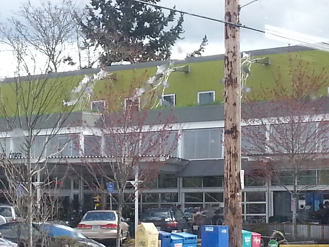
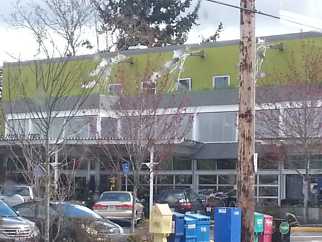
I actually took these photos from a southbound MAX train. I'd just been to the Oregon Slough Railroad Bridge, where I'd been rained on quite a bit, and I was cold, and didn't feel like it was worth getting off the train for another damn photo of salmon art. It would be hard to beat the top photo anyway; maybe in picture quality if I'd brought the DSLR along, but composition-wise... well, it's heroic salmon atop an upscale grocery store, and there's a freakin' Subaru parked out front. I couldn't beat that if I tried. Incidentally, last December was the 45th anniversary of Subaru arriving in Portland. Back in 1968, nobody could have guessed what a big deal Subaru would become here. Of course they probably figured we'd be flying atomic jetpacks around the moon colonies by now, but I digress.

It turns out that Flying Salmon was created by the same guy who did Rational Exuberance, a big bright yellow sculpture that temporarily sat outside the Pearl District's Encore condo tower. That title, of course, is a play on a famous phrase by Alan Greenspan about the overheated real estate market, and the sculpture sat outside the last condo tower built before the real estate bubble popped in 2008. I'm still not clear on how much of the irony here was intentional, and how much was a fortuitous accident. In any case, I rather liked the art itself, it was just the title I was all snarky about. And to be honest I don't actually dislike Flying Salmon either. I'm sure it's a great set of downspouts and that it's exactly what New Seasons wanted. It's just that it exists in a larger milieu of rich white hipster preciousness, and that's what I keep rolling my eyes about. I've been rolling my eyes about it for years, actually, and so far it doesn't seem to be helping.

Flying Salmon Flying Salmon

Pi, Harbor Steps

Several years ago, Seattle's Harbor Steps temporarily hosted a giant sculpture of the letter/number pi. I think it was connected to the nearby Seattle Art Museum somehow, but I haven't been able to figure out much of anything else about it: Who created it, what it was officially called, where it went, etc. Anyway, I was going to post this on March 14th (3/14, in the US date format) for Pi Day, but I was on a tough work deadline & totally forgot about Pi Day. So then I figured, hey, I can use it for April Fool's Day instead and say it's because pi actually equals 4. I can't seem to figure out how to make the joke work, though, probably because it's a dumb joke. It's barely a joke at all, to be honest. Besides, "pi equals 4" is a longstanding cheesy internet gag, and there's a nice VIHart video that explains how it works:

Monday, March 31, 2014

Pics: Savannah, GA

I recently dug out and scanned a batch of old travel photos, so here's a slideshow from historic Savannah, GA, taken sometime in the late 1990s. It was a brief visit and I haven't been back since then. (The visit wasn't motivated by Midnight-in-the-Garden mania, I hasten to add; I've never even read the book.) Much of the city is a protected historic district, and Google Street View confirms it hasn't changed a lot in the last 15 years or so.

And yes, there is a photo of the Talmadge Memorial Bridge in the slideshow. I only had dialup internet back then and blogs didn't even exist yet, but it's almost like I knew, somehow.


[View Larger Map]

Shepperds Dell Bridge

As you may have noticed by now, I've been making another pass through my old Columbia Gorge photos and digging out pictures of historic bridges along the old Columbia River Highway. This combines two of this humble blog's longtime OCD-ish preoccupations: The Gorge, and bridges, and the more I think about it the more I'm surprised I hadn't gotten around to this until now. For the benefit of anyone from out of town who's reading this, the Columbia Gorge is where the Columbia River cuts through the Cascade Mountains, forming a wide steep-sided canyon, with a large number of waterfalls where side streams drop into it. It's the only way through the Cascades that doesn't involve a high mountain pass, so it's been a main transportation route as far back as archeological records go in this part of the world, perhaps back to pre-Clovis times. Today, Interstate 84 runs along the Oregon side of the river, and Washington's SR 14 runs along the river's north bank, with busy rail lines parallel to each of these roads. A century ago, the original Columbia River Highway wound its way through the Gorge from Portland out to The Dalles. It was a showpiece of early 20th century civil engineering, as well as one of the region's first paved roads.

The old highway had to cross quite a few streams on its way east, and the state invested more than was strictly necessary in creating attractive bridges to fit their surroundings. The segment east of Hood River, which was built in the early 1920s, features a few bridges credited to Conde McCullough, the famous bridge engineer, and the guy whose designs show up in coffee table books a lot. The earlier western segment of the highway features bridges designed and built by some far more obscure names: Lewis W. Metzger (who designed the bridge at Eagle Creek, among other things), Charles H. Purcell (who created the state's bridge division, and who later was chief engineer constructing San Francisco's Bay Bridge), and Karl P. Billner, who designed many of the Gorge's more famous bridges, like the Benson Footbridge at Multnomah Falls; the Latourell and Bridal Veil Creek bridges; and the subject of today's post, the Shepperds Dell Bridge, which crosses Youngs Creek in Shepperds Dell State Park.

Like many bridges on both sides of the Gorge, the one here is a concrete deck arch bridge. That seems to have been the vogue at the time, and multiple designers went with it independently. So while the Shepperds Dell Bridge is a reasonably common design, it was a cutting edge one at the time, and it's a great example of the style. The setting doesn't hurt either, it must be said. As with a number of other bridges along the old highway, it was surveyed in 1990 for the National Park Service's Historical American Engineering Record. The resulting description goes into a great deal of detail about how the falsework was done, the exact dimensions of joists, later repairs to bridge railing spindles, that sort of thing. It's all there, if you're so inclined. Which is to say that someone who was truly obsessive about the subject could only use this humble blog as a mere starting point. It's almost as if I'm reasonably normal and well-adjusted, relative to this other hypothetical person.