Tuesday, September 29, 2009

night, mandalay bay

Mandalay Bay


View Larger Map

A few more Vegas photos, this time some night pics of the Mandalay Bay Resort, down at the south end of the Strip.

Mandalay Bay

This is mostly an ooh-purty photo post, but a quick note on the name of the hotel, since I do kind of have to dig at least a little deeper. The name comes from a Kipling poem, "Mandalay". It's not a very good poem if you ask me, but then I never liked Kipling. Perhaps this yarn of a colonial British soldier pining for the exotic Orient will speak to you in ways it doesn't to me.

So we can argue about Kipling's crimes against literature, but there's no room for debate about his offenses against geography. There is an actual city of Mandalay, the second largest in Burma/Myanmar. But it's located in the center of the country and has no bay of any kind, much less the east-facing one Kipling yammers on about.

FWIW, the king and queen mentioned in the poem ruled from Mandalay until they were deposed and exiled by the invading British army, which then proceeded to loot the city.

The hotel's quite nice, in any event.

Mandalay Bay

Also: I've been unable to discover what these winged Dinotopia-esque beasties are supposed to be. There's no obvious dino or lizard theme in the rest of the property, unless you count the Komodo dragons in the Shark Reef Aquarium. In any case this page has a few nice photos of them. Whatever the hell they are.

Mandalay Bay

Mandalay Bay

Mandalay Bay

Monday, September 28, 2009

encore, infrared

encore, infrared

A few infrared photos of the ultra-swanky (to the tune of $2.3 billion) Encore Las Vegas hotel. Yeah, I did bring my IR gear on vacation, but I ended up not using it very much. Most of the time I was too busy taking normal photos (including of the Encore, which I'll get around to later). A couple of times I tried taking infrared pics from hotel room windows, only to discover that the windows were almost totally opaque to infrared. Which I guess makes sense in such a hot climate. Anyway, I thought these turned out kind of cool, so here they are.

encore, infrared

encore, infrared

Astoria-Megler Bridge


View Larger Map

From deep in the mini-roadtrip archives, here are a few photos of the Astoria-Megler Bridge, which crosses the mouth of the Columbia out in Astoria. I just did a post on Portland's Interstate Bridge, so it seemed like a good time to post these. That way it almost looks like my posts here aren't completely random, I guess.

I'm not going to bother with a "pictures from the interwebs" section. It's on the coast, and a large chunk of the coastal workforce is employed making pictures of various bridges along the coast. Go ahead, check Flickr, or do a Google image search. You'll be inundated.

I probably ought to apologize for having so few photos of the bridge here. In my defense, these were taken the year before last, using a puny compact digicam, and I had no idea at the time that I was about to get sucked into an ongoing bridge project. If only I'd known, I'd have taken more photos, and some of them might have even been good. It's possible, but now we'll never know...

Astoria-Megler Bridge

Continuing on... As far walking goes, sadly we're faced with the same situation as with the Fremont & Marquam bridges in Portland: Generally speaking, pedestrians are banned from the bridge. The bridge was built in 1966, back when people thought walking was obsolete, and so there's no sidewalk on the bridge. However once a year they do offer something called the "Great Columbia Crossing", where you do get a chance to run or walk across the thing. It's scheduled for October 11th this year (2009) and I've thought about driving out and having a go at it. But I probably won't get to it this year, so don't hold your breath. You're free to try it without waiting for me though (in case you didn't already realize this), although I should point out that the bridge is four miles long, and no guarantees can be made about what mid-October weather on the Oregon Coast will be like. In the meantime, here's a good blog post about a trip to Astoria which included last year's Columbia Crossing, also with pastries and herons (though not all at the same time).

Actually I'm going to go ahead and violate the "no photos from the interwebs" rule I just made, briefly, to pass along a couple of photosets from the 2007 edition of the event: one on Picasa, the other on Webshots. Also, here's the Flickr set that goes with the blog post I just mentioned. Ok, there, we're done.

You might note that I don't have any photos from on the bridge itself. I was on a solo mini-roadtrip at the time, so I didn't have someone to drive as I took photos, or to take photos as I drove. And driving over the bridge is a white-knuckle experience if you don't do it on a regular basis, so I didn't seriously consider driving and taking pictures at the same time. I suppose you get used to driving the bridge if you do it regularly. Either you do that, or you drive way upstream and take the ferry at Westport. Which is kind of interesting, but it's not what you'd call fast. As it turns out, I actually drove across the bridge on this trip just so I could drive upstream and take the ferry back to the Oregon side.

Astoria-Megler Bridge

As for the semi-obligatory "links from the interwebs" part, a couple of the usual suspects come through for us again here.
  • There's a Structurae page for the bridge, although it mostly repeats the info in the Wikipedia article.

  • There's also a page at Columbia River Images that gives a bit more background on the bridge, and on the ferries that preceded it.

  • The same site has a page about Megler, which (unlike Astoria) isn't a city or even a proper town. The usual phrase for a place like this is "wide spot in the road", but I tried to find the place and didn't even notice a wide spot in the road. There isn't even a ghost town full of picturesque ruins, since abandoned wooden buildings don't last long in this climate. I suppose it could've fallen into the sea similar to Port Royal in Jamaica, and someday some lucky marine archeologist will find the drowned city and its fabulous piles of pirate booty. There might even be mermaids and mermen guarding it. But I wouldn't bet on it.

    Other than a few old pilings in the river, there seems to be nothing right on the Washington side of the river, and as far as I can tell this "Megler" place is purely mythological in nature. Or if not purely mythological, perhaps the town appears in the coastal mists just once a century, like a sort of flannel-wearing redneck Brigadoon, with banjos instead of bagpipes. But I wouldn't bet on that either.

Sunday, September 27, 2009

nonstandard

nonstandard

What you see here, o Gentle Reader(s), is downtown Portland's Standard Insurance Plaza, reflected in (& distorted by) the adjacent Congress Center tower.

Note that the Standard Insurance Plaza should not be confused with the Standard Insurance Center, the latter primarily known for the infamous "Quest" sculpture out front. And because this is a respectable blog, we will not speculate in great detail about why anyone would think that building might be the Congress Center.

nonstandard

Uh, moving right along, the Wikipedia page mentions that the Congress Center building replaced the old Congress Hotel (snicker), and arches salvaged from the old building were reused for the entrance to an underground restaurant. It's a Melting Pot fondue restaurant, to be precise. I'm all in favor of fondue, but I have to say that Gustav's is better and cheaper, and all of their locations have windows. I'm also told that Fearless Brewing out in Estacada does a highly tasty fondue. Go read their fun FAQ page while you're at it. It's great.

nonstandard

a bus stop in vegas

waiting for a bus, caesars palace

A couple of photos of the scenery while waiting for the Deuce bus in front of Caesars Palace.

It's true that Portland has art near transit stops too, but it's usually psuedo-educational crap, often done in a pseudo-Northwest Indian style, typically on themes like "Heroic Salmon Swimming Upstream" or "Why Rain Is Nice" or "Being Mean To People Is Bad". One eventually tires of that sort of thing. Gratuitous nekkidness, not so much.

waiting for a bus, caesars palace

In the second photo, you can see a small inscription on the base of the photo. It reads:
REBECHI A E G
TELEX 590009

My guess is that the first line is either the artist or the foundry the statue's from. The second line is their Telex number, I suppose in case you wanted to get in touch and buy your own copy of the statue, the way a more recent work would direct you to a website. If the artist/foundry is still operating, they probably aren't reachable by Telex anymore, so this is a rare example of a technologically obsolete statue. In Vegas, when something becomes obsolete they tend to implode it and replace it with something fancier and glitzier. Which in this case could mean a new statue, similar but with a web address on it, and upgraded a couple of cup sizes. It just stands to reason.

waiting for a bus, caesars palace

palm shadows, fremont street

palm shadow, fremont st

I suspect this photo is only interesting if you don't see palm trees every day. In my defense, this was taken while I was busy, er, researching that earlier post about Vegas brewpubs.

I believe at this point I was wandering down Fremont St. in search of a 99 cent deep fried twinkie. More about which later, probably.

How to walk the Interstate Bridge (and not die), while you still can


View Larger Map

So I thought I'd go and walk across the Interstate Bridge a while back. Back in April, actually, and I'm only getting the post together now. And prior to walking the bridge, there was a span of several months between when I decided to have a go at it and when I actually did it. Everything about the Interstate seems like an enormous undertaking. It's a very long bridge, over a very wide river, and it carries a very busy freeway; the whole thing got to be quite a daunting prospect. If it hadn't occurred to me to break the adventure up and do the North Portland Harbor Bridge on a different day, I'm not sure I'd have gotten around to it yet, quite honestly. It's not the distance exactly; I'm not that out of shape. Finding a few free (i.e. meeting-less) hours on a sunny day was the problem. It doesn't actually take a few hours, but I hate feeling rushed when I do these bridge things. If you do that, you hurry through and don't notice everything you should, and you miss out on a lot of good photos that way.

So the plan for this adventure was to park in the 'Couve, walk across to the Oregon side, cross under the freeway, and walk back on the other side of the bridge. I figured this was an important detail because the northbound and southbound sides are technically separate bridges; the northbound one was built in 1917, and the southbound companion wasn't built until 1958. It's natural to think of them as a unit though, since they're two halves of the same logical bridge, they always open in unison, and the 1958 bridge was designed to look almost identical to the original -- which showed a remarkable amount of historical sensitivity, by 1958 standards.  And since I am who I am, it was crucial to walk both sides for the sake of completeness.  I'm sorry, it's just a thing with me, I guess.

Columbia River bridges weren't originally part of the ongoing bridge project, but I figured I ought to at least cover the Interstate before the Powers That Be tear it out and replace it. That's not going to happen quite immediately; the project -- which goes by the kinda-pretentious name "Columbia River Crossing" -- is supposed to cost billions and billions of dollars, and the handwringing has only just begun, and nobody's entirely certain where the money's going to come from -- but it's reasonable to assume the clock's ticking. Not everyone's sold on the idea, though, and there's a school of thought that suggests we don't genuinely need a new bridge, and building the big 12-lane beast they're considering will just drive suburban sprawl on the far reaches of the 'Couve, and in a few years we'll be back to the level of congestion we see now.

I don't have a firm opinion about the new bridge one way or the other, and I'm not convinced the interwebs need yet another angry blogger ranting and shrieking on about it, either pro or con. I have, however, gotten a bit tired of people heaping scorn on the existing bridge all the time. It's held up rather well for a bridge from 1917, and people have mostly forgotten what a huge achievement it was back when it was first built.  People of the era really poured their hopes and dreams into the thing -- it's fair to call it obsolete, but bashing it just seems kind of tacky.

As evidence of what a big deal the Interstate Bridge once was, consider the set of plaques at both ends of the bridge, which bear a variety of inscriptions.  Some list the contractors who built the bridge, or provide various vital statistics about it. Others carry quotations by various historical figures on the subject of bridges.  The Final Report by the engineers who designed and built the bridge includes copies of the inscriptions, which I'm reproducing here:

1915
THIS BRIDGE IS DEDICATED TO THE
CITIZENS OF OREGON AND WASHINGTON BY
WHOM ITS ERECTION WAS ORDAINED. IT WAS
CONCEIVED OF THEIR VISION, ITS FOUNDA-
TIONS ARE LAID UPON THEIR SACRIFICES.
THE SPIRITUAL HERITAGE OF COURAGE, FAITH
AND HIGH ENDEAVOR BEQUEATHED TO THIS
GENERATION BY THE PIONEERS WHO WRESTED
FROM THE WILDERNESS THESE WIDE AND FRUIT-
FUL LANDS, IS BUILDED INTO ITS MEMBERS
OF STONE AND STEEL AND HERE HANDED DOWN
TO THE GENERATIONS THAT COME AFTER.

1917


THE COLUMBIA RIVER INTERSTATE BRIDGE
BUILT BY THE PEOPLE OF CLARKE COUNTY
WASHINGTON. AND MULTNOMAH COUNTY OREGON,
UNDER DIRECTION OF THE COLUMBIA RIVER
INTERSTATE BRIDGE COMMISSION, RUFUS C
HOLMAN
, CHAIRMAN, COMMISSIONERS FOR
CLARKE COUNTY, A. RAWSON, CHAIRMAN. W S.
LINDSAY, JOHN P. KIGGINS. COMMISSIONERS
FOR MULTNOMAH COUNTY, W. L. LIGHTNER.
CHAIRMAN, PHILO HOLBROOK, RUFUS C. HOLMAN.
THE GOVERNOR OF OREGON. LEGAL ADVISERS.
WALTER H. EVANS, JAMES O. BLAIR. ARTHUR
MURPHY. CONSTRUCTION BEGAN MARCH. 191S.
COMPLETED JANUARY, 1917.

The "Clarke County" bit is actually not a typo. Despite being named for non-'e' William Clark of Lewis & Clark fame, the county was named "Clarke" until 1925. Which is kind of fitting actually. If you've ever read Lewis & Clark's journals, you've probably noticed their, uh, individualistic approach to English orthography.


THE COLUMBIA RIVER INTERSTATE BRIDGE
DESIGNED AND BUILT UNDER DIRECTION OF
JOHN LYLE HARRINGTON. KANSAS CITY, MO.,
WADDELL & HARRINGTON (NOW DISSOLVED ) ,L0 UIS
R. ASH & ERNEST E. HOWARD, CONSULTING
ENGINEERS. F. M. CORTELYOU. RESDT. ENGR.


CONTRACTORS: MANUFACTURE OF STEEL.
AMERICAN BRIDGE COMPANY. NORTHWEST STEEL
COMPANY. ERECTION, PORTER BROTHERS.
FOUNDATIONS. THE PACIFIC BRIDGE COMPANY.
EMBANKMENTS. TACOMA DREDGING COMPANY,
STANDARD AMERICAN DREDGING COMPANY.
PAVEMENTS, WARREN CONSTRUCTION COMPANY.


"OF ALL INVENTIONS, THE ALPHABET
AND THE PRINTING PRESS ALONE EXCEPTED,
THOSE INVENTIONS WHICH ABRIDGE DISTANCE
HAVE DONE MOST FOR THE CIVILISATION OF
OUR SPECIES. EVERY IMPROVEMENT OF THE
MEANS OF LOCOMOTION BENEFITS MANKIND
MORALLY AND INTELLECTUALLY AS WELL AS
MATERIALLY, AND NOT ONLY FACILITATES
THE INTERCHANGE OF THE VARIOUS PRODUC-
TIONS OF NATURE AND ART, BUT TENDS TO
REMOVE NATIONAL AND PROVINCIAL ANTIPA-
THIES, AND TO BIND TOGETHER ALL THE
BRANCHES OF THE GREAT HUMAN FAMILY."

MACAULAY.
The Macaulay quote is an excerpt from a longer passage about bad roads and taxation in 17th century Britain. This is actually a comment on a website that presents the diary of Samuel Pepys in blog form, which is a clever and intriguing notion.


THE COLUMBIA RIVER INTERSTATE BRIDGE.
TOTAL LENGTH OF BRIDGE AND APPROACHES
4^ MILES. COMPLETED JANUARY, 1917. TOTAL
COST $1,760,000. THE BRIDGE OVER THE COLUM-
BIA RIVER 3,531 FT. LONG. CONSISTS OF ONE 50
FT. SPAN, THREE 275 FT. SPANS AND TEN 265 FT.
SPANS; AND CONTAINS 7350 TONS OF STEEL,
17.650 SQ. YDS. OF REINFORCED CONCRETE
DECK, 15.000 SQ. YDS. OF PAVEMENT. 21.600 CU.
YDS. OF PIERS SUPPORTED ON PILES EXTEND-
ING TO 160 FT. BELOW ROADWAY. THE TOWERS
EXTEND TO 190 FT. ABOVE ROADWAY.


"YOU MAY TELL ME THAT MY VIEWS ARE
VISIONARY. THAT THE DESTINY OF THIS COUN-
TRY IS LESS EXALTED. THAT THE AMERICAN
PEOPLE ARE LESS GREAT THAN I THINK THEY
ARE OR OUGHT TO BE. I ANSWER. IDEALS ARE
LIKE STARS. YOU WILL NOT SUCCEED IN TOUCH-
ING THEM WITH YOUR HANDS. BUT LIKE THE
SEA-FARING MAN ON THE DESERT OF WATERS.
YOU CHOOSE THEM AS YOUR GUIDES AND
FOLLOWING THEM, YOU REACH YOUR DESTINY."

-CARL SCHURZ.

The bio's worth a read. I'd never heard of Mr. Schurz before, and I had no idea anyone managed to be both an 1848 German revolutionary, and a Union general during the US Civil War, among other things. Of course you never read a lot about prominent German-American immigrants in history. World wars tend to result in that sort of thing being quietly forgotten, I suppose.


THE COLUMBIA RIVER INTERSTATE BRIDGE
APPROACHES

THE BRIDGE OVER OREGON SLOUGH. 1.137 FT.
LONG. CONSISTS OF ONE 115 FT. SPAN AND TEN
100 FT. SPANS. THE BRIDGE OVER COLUMBIA
SLOUGH IS 307 FT. LONG AND CONSISTS OF FOUR
75 FT. SPANS. THESE BRIDGES CONTAIN 1,725
TONS OF STEEL. 7.150 SQ. YDS. OF REINFORCED
CONCRETE DECK. 6,100 SQ. YDS. OF PAVEMENT,
5,700 CU. YDS. OF PIERS. THE EMBANKMENTS
HAVE A COMBINED LENGTH OF 18.000 FT. AND
CONTAIN 1,500,000 CU. YDS. PAVEMENT ON EM-
BANKMENTS 56.000 SQ. YDS.


"THEREFORE WHEN WE BUILD. LET
US THINK THAT WE BUILD FOREVER. LET
IT NOT BE FOR PRESENT DELIGHT, NOR
FOR PRESENT USE ALONE. LET IT BE SUCH
WORK AS OUR DESCENDANTS WILL THANK US
FOR, AND LET US THINK, AS WE LAY STONE
ON STONE, THAT A TIME IS TO COME WHEN
THOSE STONES WILL BE HELD SACRED BE-
CAUSE OUR HANDS HAVE TOUCHED THEM, AND
THAT MEN WILL SAY AS THEY LOOK UPON
THE LABOR. AND WROUGHT SUBSTANCE OF
THEM. 'SEE THIS OUR FATHERS DID FOR
US.'"

RUSKIN.

The Ruskin quite is also inscribed on the floor of the Chicago Tribune Tower. And undoubtedly elsewhere, as you can probably imagine how this sentiment would appeal to architects. A few other uses of it here and there on the web too, apparently now including the humble blog you're currently reading.

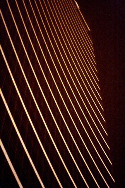
It's hard to see all those and not develop a sentimental attachment to the bridge, regardless of how obsolete it might be. People always go on about how much they love the Hawthorne, and the Interstate is a very similar design, just a lot bigger. Ok, and with noisy triple trailer semis barreling past you at slightly over the speed limit (which can't really be helped, this being an interstate freeway). But on the bright side, there's actual bridge structure between you and traffic, which you don't get on the Hawthorne, so it's almost certainly safer. (Consider this accident from last June -- if a truck's going to lose a load of rebar, I'd kind of prefer to have something solid between it and me.) And there isn't a problem with bike congestion like the Hawthorne gets these days, so there's that. Plus the view from the bridge is something you won't see any other way, unless you're stuck in traffic on the bridge, and even then it's somehow just not the same. Watch the river from the bridge for a few minutes, and you'll quickly realize that the Columbia is a serious river, fast and wide and deep and quite unlike the (mostly) tame little Willamette.

For whatever it's worth, Wikipedia's list of rivers by length has the Columbia at #51 worldwide. If you sort that list by average volume (in cubic meters per second), it comes in at #26, or at #20 if you delete everything that's a tributary of some other river. Ok, so that's almost certainly wrong (since the list is missing volume stats for a large number of rivers), and meaningless even if it was accurate. But it should at least get across the general idea that this isn't some seasonal arroyo or lazy bayou here.

As a result, it's a long walk across the bridge. This can't really be helped; in fact, under current plans the new bridge will be an even longer walk, since it will have to be built in a curve around the site of the current bridge (which will remain open while the new bridge is built).

In addition to the length, access to the bridge is an issue. It's not obvious how to get to either end of the bridge, and I had to stare at Google maps for a while before figuring it out. The bridge walkways end practically right at the water's edge on each side. On the Vancouver side it's at least sort of close to downtown Vancouver. Columbia St. continues south from the downtown core a bit and curves under the bridge, becoming Columbia Way at that point. There are spiral ramps on each side leading from the street up to the bridge; as small and obscure as they look, they're your one and only way to get on or off the bridge if you're walking or on a bike. I think the street has sidewalks the whole way through here, and it's not all that busy, so it ought to be safe once you know how to find it. On the Hayden Island side, you have to navigate the Jantzen Beach freeway interchange and the adjacent maze of big-box suburbia, and once you're done you still aren't to the other side of the river. At that point you have to make your way to the North Portland Harbor bridge, and once you've done that you're in industrial NE Portland. You still have to cross the Columbia Slough too, and as of yet there's no bike/ped lane on the I-5 slough bridge. Denver Avenue is nearby but the road's in bad shape. If you're heading into downtown Portland, your best bet is probably to go over to the Expo Center at this point and hop on the MAX train. One more thing to point out: If you're going to be using the west walkway on the bridge, you need to cross under the freeway at some point on Hayden Island, since the harbor bridge only has a bike/ped lane on the east side. It starts right next to Hooters, you can't miss it.

A BikePortland article from last year claimed that the cities of Portland and Vancouver were working on a new map that explained how to get on and off the Interstate Bridge. I can't seem to find a copy of that map online though, so I don't know if they ever followed through on the effort. Maybe they just couldn't figure it out. The article does have a couple of "sneak peek" bits of the map, so maybe if you enlarged those in Photoshop or something you might get a useful map out of it.

Updated 8/13/2010: Ok, the map does exist, and they've even created an instructional video about crossing the bridge safely, believe it or not. The goods are here, courtesy of Metro.

Another problem for pedestrians, and especially cyclists, is that the bridge walkways are very narrow, and the railings are alarmingly low if your center of gravity is up at bike level. Another BikePortland piece discusses whether it would be better to just ride on the freeway instead. The (unusually sensible) consensus there is that riding on the freeway is an exceptionally poor idea. Which brings us to the obligatory "not dying" bit. Don't ride on the freeway, especially at night, thus getting smooshed by a triple trailer semi full of rebar going 75 mph, the driver too busy texting or surfing porn or whatever to notice you puttering along on your trendy fixie bike without lights or reflectors. If I can't convince you not to do this, at least wear a freakin' helmet, or at least don't wear all black. Or if you really must wear all black and not use a helmet for reasons of hipness, well... I was about to suggest you at least do it sober, but it occurs to me that if you're going to do something this monumentally stupid, you might as well be drunk or high when you do it. At least it won't hurt as much that way. And if you survive, and you tell people what you did, and they demand to know why you did something that dumb, you have an instant excuse they can't really argue with. Not that I'm trying to help with this or anything, because I'm not. So don't.

Also, if you're crossing the whole river you'll need to cross the North Portland Harbor bridge too, and the not-dying angle there involved rogue banana peels. So watch out for those too.

Anywayyy, that cheery bit brings us to the inevitable "stuff from around the interwebs" part of the post.

Saturday, September 26, 2009

goslings, waterfront park

goslings, waterfront park, may '09

Cute photos of goslings taken back in May. Which means they (or at least the surviving ones) have grown into big ugly boring geese by now. Ah, fleeting youth...

goslings, waterfront park, may '09

It occurs to me that I probably ought to have cropped these photos, now that I look at them all tiny and interweb-sized. Maybe I'll do that and get another post out of these cute little guys. Until I get around to that, feel free to click on them and check out the larger versions, as you aren't really getting the full cuteness effect at this scale.

goslings, waterfront park, may '09

goslings, waterfront park, may '09

vegas (beer!)

One thing that surprised me about Las Vegas is that it's not a complete beer desert. You have to search around a bit, but there is good local beer to be found. It's worth the effort (assuming you like good beer), and this post is a mini (very mini) guide to some of the beery options in Las Vegas. I should point out that I didn't go to Vegas with the idea of posting about local brewpubs, and the notion only occurred to me after the fact, so I don't have a comprehensive set of photos to go with the post. Also, a couple of the pubs are right next to slot machines and blackjack tables, where photography isn't really appreciated, and I wasn't inclined to push it. So I do have a few photos of the outside of various places where beer is available, and I think we'll go with those.

Besides the four listed here, there are also several more establishments I missed entirely. This only means that I had limited time and beer wasn't part of the original plan, and no slight is intended to anywhere I missed; I'll just have to catch them next time around.

Flamingo Las Vegas at night

Flamingo Las Vegas

Sin City Brewing

Three locations on the Strip, including one that recently opened inside the Flamingo Las Vegas casino. We'd tried their Sin City Amber on a previous trip since at least one bar in the airport carries their beer. They offer a short list of beers - the amber, a wheat beer, a pilsner, etc., nothing hugely exciting. No IPA or even a pale ale, which apparently you can get away with in Vegas. I found it kind of frustrating, though, as I firmly believe "IPA" stands for "I Purchase Always". Still, we would've tried one of their other beers but were unable to get the bartender's attention, and eventually we left without beer. Granted he was busy with a bunch of wedding parties at the time, but still. They didn't seem to have food anyway, just beer, and we were hungry. I also considered getting a t-shirt but decided against it. I like the logo, but where on earth would I ever wear a t-shirt like that? Not to work. Maybe to local beer festivals, if I cared about impressing people at beer festivals, which I really sort of don't.

A general rule of mine is that any bar or restaurant (brewpubs included) that wants to sell you a t-shirt probably isn't spectacular in the food & drink department. I think that pretty much applies here. Meh.


Main Street Station, Downtown Vegas

Fremont Casino, Downtown Vegas

Triple 7 Brewing

This is a proper, decent-sized brewpub, located inside the Main Street Station casino in Downtown Vegas. I've heard the food's good here, but we were just interested in a beer at the time. The Marker Pale Ale is quite excellent. It's kind of an English-style pale ale, similar to Bridgeport's. I would happily drink more of it, whether in Vegas or here in Portland, if it was available here.

Main Street Station is one of three downtown casinos belonging to Boyd Gaming, the other two being the Fremont and the Hawaii-themed California (which is just across the street from Main Street Station). There were signs indicating that Triple 7 brews were available at least at the Fremont, so if you're on Fremont Street and don't feel like walking a couple of blocks west and north to Main Street Station, you may still be able to find some tasty beer.

4 Queens, Downtown Vegas

4 Queens, Downtown Vegas

Chicago Brewing

This is a tiny nook inside the Four Queens Casino, right on Fremont Street. It's a little triangular space in one corner, up a flight of stairs, overlooking a sea of slot machines. It has a sort of Edwardian mens-club feel to it: Dark wood everywhere, vintage photos on the walls, and a swanky little bar area. The place even doubles as the casino's cigar lounge. I think the idea is that you can pop up here for a beer, a bourbon, and a cigar, while the little lady's busy playing the slots.

The main Chicago Brewing location (including the actual brewery) is somewhere out in the 'burbs, apparently. Unless you're a local resident, the Four Queens location is probably more convenient. Plus you can get there and back without driving, so everyone gets to have a cold one, or two.

I get the sense they don't pull in a lot of beer geeks here. The menu cautions that the Hardway IPA clocks in at 6.9% ABV and is very hoppy, even highlighting it in red to make sure you know in advance what you're up against. We both saw that and immediately ordered the IPA. The waitress cautioned us it was very hoppy, and isn't to everyone's liking. We responded that we were from Portland, and she smiled knowingly and nodded and brought us our tasty IPAs. Not bad at all. Kind of a Northwest-style IPA, lots of citrusy hop goodness. My impression is that they brew the IPA they want to brew, and they warn people about it just in case, instead of toning it down for tender non-geek palates. I like that kind of attitude. And anyway (as I've said before), my policy is to always order the beer that the beer menu warns you about.

Food at this location is standard pub grub. I wouldn't go out of my way for it, but it was fine. Tasty beer, though, and a great location. Recommended.


The Orleans, Las Vegas

The Orleans, Las Vegas

Tenaya Creek Brewing

As with Chicago Brewing, the Tenaya Creek brewery itself is somewhere out in the 'burbs, which we didn't visit. Instead, we ran across that rarest of things, a local LV beer with a bit of local distribution. We ran across their Nut Brown Ale at the lounge attached to the bowling alley in the Orleans Casino. It was a good brown, malty but not overly sweet the way some can be. It was a great beer to bowl with. I would've gone back for another round, except that we were getting sore from all the bowling, and we still had to go souvenir shopping after this.

So I don't know anything about their pub, but I can recommend the Nut Brown, and I can also recommend bowling at the Orleans, for whatever that's worth.

Tuesday, September 22, 2009

shelter, 3rd avenue

shelter, third avenue

From the archives: Photos from one of the temporary bus shelters that used to be on 3rd Avenue, in downtown Portland. Also starring streetlights, neon signs, and a touch of rain.

shelter, third avenue

shelter, third avenue

shelter, third avenue

shelter, third avenue

shelter, third avenue

shelter, third avenue

at broadway & burnside

april, broadway

april, broadway

april, broadway

at broadway and burnside

at broadway and burnside

broken

broken

broken

The Ideal Scout


View Larger Map

A few photos of one of the obscurer (is that a word?) statues around town, a statue of a Boy Scout outside local Boy Scout HQ, between 1st & Naito just south of Lincoln. I probably wouldn't mention it all -- I probably wouldn't even know it existed -- except that a.) it's in my neighborhood, so I see it now and then while walking to or from work; and b.) sometimes that happens after dark, and I see it out of the corner of my eye, loitering there in the streetlit gloom, and the primitive parts of my brain go on mugger alert. No other statue does that to me. Most real live people don't do that to me either. I can't really explain it. It's not like he's brandishing a hatchet or anything, even thought that would actually be a legitimate scout thing to do.


The Scout

In any case, about the statue: It's called The Ideal Scout or sometimes just The Boy Scout, by the sculptor R. Tait McKenzie. Like a number of other statues around town (Umbrella Man, The Promised Land, Joan of Arc, etc.) it's just one of several copies scattered about the globe. The original statue dates to 1915, and the life-sized version shown here was created in 1937. Portland's copy only dates to 1972, though. Probably about the same vintage as the building it's next to. Which would also be the vintage of much of the surrounding area, come to think of it.

The Scout

When I covered the Joan of Arc statue, I mentioned the notion of travelling the globe to visit all the copies. (I mentioned something similar re: the Willamette Stone as well, although that's not strictly art.) You could, in theory, do the same for this statue too, assuming you were possessed to do so for some reason. The Wikipedia page about McKenzie (linky is above) lists a bunch of locations of copies. If it's a complete list, you'd be spending an inordinate amount of time in Pennsylvania, which cannot be recommended. Trust me on this. And I'm not sure what the point of such an expedition would be, unless your kid's doing it as a project and will get a writeup in Boys' Life for his efforts, or at least score a merit badge or something. I was going to add "or one of those metal belt loop 'Skill Award' thingys", but apparently those were discontinued way back in 1989. Who knew?

The Scout

Of course, back in my day going camping meant using our fins to slowly drag ourselves up onto dry land, and then we'd just sit there and watch the earth's crust cool. Ok, we'd also try to sing Kumbaya sometimes. What can I say, it was a dark and primitive time. You could get a merit badge for discussing what fire might be like if it existed. They added a badge for the wheel a few years after I quit, so I missed out on that one, which is too bad since I've always liked the wheel. The knot-tying stuff, though, is exactly the same all these years later. It's just that kids have it so much easier now with their opposable thumbs and all.

The Scout

The Scout

Pittman Addition expedition


View Larger Map

Today's fun adventure takes us back to North Portland, to our fair city's kinda-shiny, kinda-new Pittman Addition HydroPark, just north of Going St., and across an ooky skybridge from tiny little Stanich Park. I actually mentioned this place briefly in the Stanich Park post, under the name "Roy Beach Park". That's what a 2002 parks levy doc called it, and this now-vanished doc was the only mention of the place on the interwebs. I mean, apart from this humble blog. And now that the levy doc has exited the series of tubes, this humble blog seems to be the one mention of the place anywhere, at least by that name.

And now the Water Bureau's running the place as part of its growing HydroPark system, as they have some sort of underground "vault" (whatever that is) located here. So they're putting in some paths and a little art and generally sprucing it up a bit -- none of which you can see in the above photo because it's an old photo from 2007, taken along with my Stanich Park pics. Actually the park's official grand opening is this coming Saturday, September 26th 2009, if anyone out there happens to be interested.

FWIW, PortlandMaps indicates that the west half of the park does belong to the water bureau, while the east half belongs to the ultra-glamorous "Bureau of General Services". That's what PortlandMaps says, although in 2000 the Bureau of General Services was merged into the equally glamorous "Office of Management and Finance", and its "Facilities Services Program" is likely responsible for the land here. In case you were wondering, I mean. I know I was.

Monday, September 21, 2009

vegas (and bust)

Hotel Nevada & Casino

Here we have some photos of a few defunct casinos around Las Vegas. First up, the former Hotel Nevada and Casino, on Main St. in downtown Vegas, a bit south of Fremont St. It looks like it's been vacant for many years, but according to the only review I've found of the place it was still open in August 2005, and was a complete dump. The review's titled "Welcome to the Bates Motel", and suggests that sleeping there would make for a good "Fear Factor" episode.

For photos of the Hotel Nevada in (relatively) better shape, I ran across photos from before and shortly after it closed.

All in all, this one's probably no big loss.


Hotel Nevada & Casino

Hotel Nevada & Casino

Hotel Nevada & Casino


Next up is this ghostly sign for the former Silver City Casino, just off the Strip near the Convention Center. The casino itself was demolished a few years ago, but the sign lingers on.

Silver City Casino sign


I'm actually not sure this next one is really defunct, since I just glimpsed it from the taxi on the way to the airport. The Key Largo certainly looked like an ex-casino, but I ran across reviews here and here dating to late 2008. The small attached hotel is/was a Quality Inn, but the Quality Inn website doesn't contain any mention of the place, so it may be a recent casualty of the economy or something.

Key Largo Casino, Las Vegas


And finally, a couple of shots of the Lady Luck, which stands tall, dark and vacant just north of Fremont Street. It was one of the larger casino hotels in downtown Las Vegas until closing in February 2006. That was supposed to be temporary while the buildings were renovated, but then the developer ran out of money, and here we are going on four years later. Still, the hope is that the place isn't permanently defunct. The city's offered various incentives to the owners to renovate and reopen the place, but nothing's happened just yet. Maybe things will turn around once the economy improves. With any luck.

Lady Luck, Downtown Vegas

Lady Luck, Downtown Vegas