Saturday, July 12, 2014

Host Analog

Just outside the Oregon Convention Center's main entrance is Host Analog, a very large and very obscure public artwork. Unless you read the rather small signs around it, you may not even realize what it is. Here's the Smithsonian art inventory description:

 
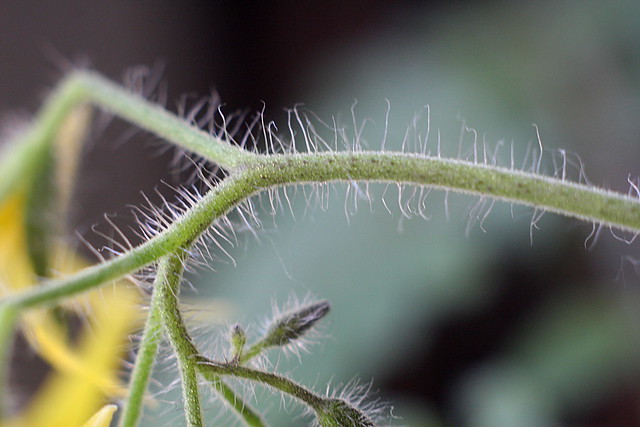
Artist: Simpson, Buster, 1942- , sculptor.
Title:Host Analog, (sculpture).
Dates: 1991.
Medium: Sculpture: metal and fir; Base: red rock and brick.
Dimensions: Sculpture: approx. H. 11 ft. x W. 6 ft. x L. 70 ft.; Base: approx. H. 2 1/2 ft. x W. 35 ft. x L. 110 ft.
Inscription: (Three plaques located at 30 ft. intervals discuss the Portland Water Works Project and general and scientific information concerning the art work) unsigned
Description: A nurse log is segmented and arranged like a fallen classical column. Indigenous seeds and seedlings are planted in each of the segments. An irrigation line is incorporated into the work to keep the log moist and fertile for new growth.

I'm partial to conceptual work like this, and there really isn't much of it in Portland outside of gallery shows (unless maybe it's even more subtle than Host Analog and I haven't noticed it yet). The artist's website has a more detailed explanation of what's going on here:

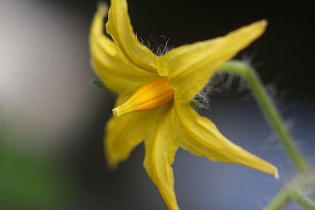
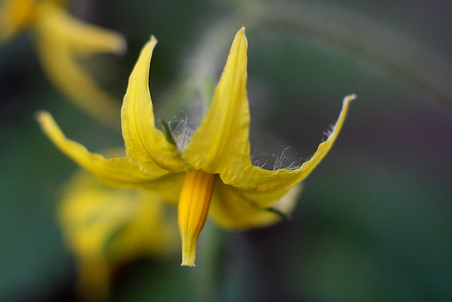
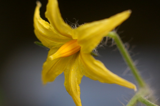
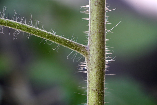
Host Analog teaches us to see the beauty found in the order of chaos dynamics. Transposing phenomena into aesthetics, this sculpture creates an anomaly with new paradigms. This old growth nursing log, decomposing and nursing a new landscape, is a work in progress. For over 500 years, this Douglas Fir was nurtured in the same watershed which sustains Portland today. In the 1960s, this monarch fell to the winds and later bucked to determine if suitable for lumber. Not harvestable, the eight sections of the old growth trunk, measuring eight feet in diameter by eight feet long each, lay host in what became the Bull Run watershed. Rediscovered by the artist in 1990, the nursing log was moved to rest adjacent to the Oregon State Convention Center to continue its regenerative processes. Over the past nine years, the Host Analog has re-established itself in this new context, nursing both its original indigenous plants, as well as a new "invasive" plantscape from the adjacent urban landscape.

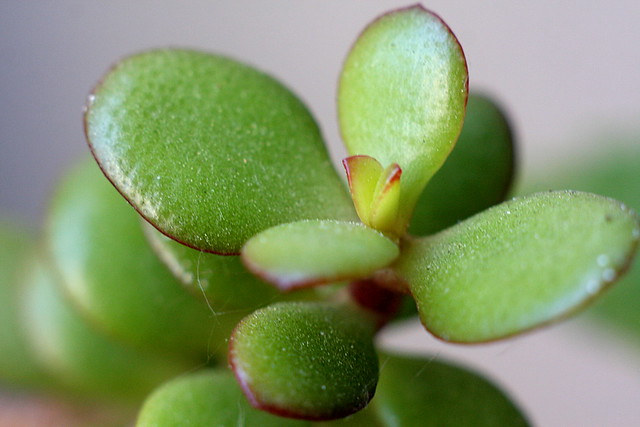
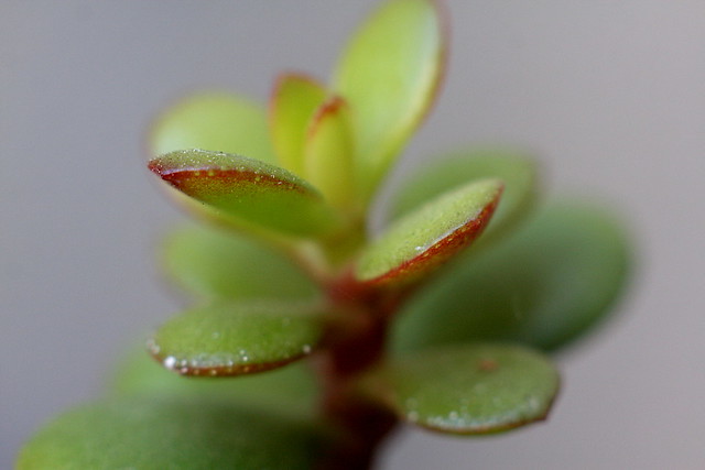
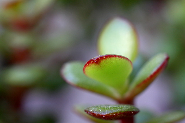
A "volunteer" Pin Oak now grows adjacent a Douglas Fir seedling, the willow, and birch roots between Western Red Cedar and Hemlock. Oregon Grape, salal, and other native ground cover commingle with imported groundcover, some perhaps hitching a ride at some time on the transcontinental railroad to Portland. During the ten years of this sculpture's nursing, the vegetation on and adjacent the sculpture has been un-hampered by human intervention. The sculpture has been prolific and informative as we become the observer of the juxtaposed phenomena, and the accommodation and expansion has taken place.

A 2011 Shockwrite article "Art in Public: Buster Simpson’s Philosophy" includes a mention of Host Analog:

It does not look like a typical public work of art, except for the signage included around it. If a viewer takes the time, they can read about many different elements relating to this idea. Simpson took this naturally felled log from a nearby forest, brought it to the city center (outside of the city’s Convention Center), to juxtapose the time it takes to cut down a tree to the time it takes to grow a forest. He included images of his daughter growing up over the years next to the tree, along with pictures of ancient Greek ruins that mirror the falling of a great column to the falling of a great tree, and images of loggers that eat from a great log table in a forest. In this seemingly simple design, Simpson incorporates art as idea and art as process for the viewer. He is able to entice both the art aficionado who revels in artistic complexity and the art novice who perhaps though contemporary art was only paint splattered on canvas.

A few other assorted items

Sunday, July 06, 2014

Columbia Boulevard Bridge

The final stop on our tour of Portsmouth Cut bridges is the one on Columbia Boulevard. It's the northernmost of the four, borders an industrial area, and carries a lot of commercial truck traffic. It seems to be in better shape than the others (at least from the standpoint of a non-civil-engineer walking across it), and it was widened to four lanes at some point. Its entry in a city bridge inventory says bridge 078 dates to 1909 and 078A dates to 1968, so I imagine that's when the widening happened. I couldn't find any news stories in the Oregonian database about that project to confirm that. I suppose it didn't merit one, as an unattractive bridge in an industrial area, bordering what was then an impoverished neighborhood. Ok, that or the database's search feature is a little substandard and misses stuff you're looking for, which wouldn't be the first time I've run into that. It also does't have Bridgehunter or Structurae pages, only an UglyBridges.com entry. That's usually a sign this whole bridge thing has gone a bit far down the rabbit hole.

This is probably a good time to point out that this entire bridge project got started because I got the notion to walk across the Morrison Bridge, back before they added the nice walkway it has now, and I realized I'd never done that before, and I thought it would be interesting to do the other Willamette bridges too and take some photos in the process, and it's sort of taken on a life of its own since then. To be honest, a lot of the motivation behind this, as well as the public art and city park things (which have long since gone down rabbit holes of their own), is that I don't travel as much as I'd like to, and I have to go to somewhat absurd lengths to continue playing tourist without leaving town. I keep thinking I'm bound to run out of material for these projects sooner or later and I'll have to go find a different silly hobby. Hasn't happened yet, though.

Fessenden Street Bridge

The third Portsmouth Cut bridge on our tour carries N. Fessenden St. over the ravine. It's about the same style as the others; same age, same designer, same disrepair. It's got the usual Bridgehunter, Structurae and UglyBridges.com pages, where we learn things like:

History
     Built 1909
Builder
     - Ralph Modjeski of Bochnia, Poland (Engineer)
Design
     Warren deck truss
Dimensions
     Length of largest span: 89.9 ft.
     Total length: 164.1 ft.
     Deck width: 40.0 ft.
...
Inspection (as of 07/2012)
     Deck condition rating: Poor (4 out of 9)
     Superstructure condition rating: Poor (4 out of 9)
     Substructure condition rating: Satisfactory (6 out of 9)
     Appraisal: Structurally deficient
     Sufficiency rating: 49.7 (out of 100)
Average daily traffic (as of 2010)
     4,931
I don't know if anyone particularly cares about bridge trivia sites, but those are often the only sources of information when a bridge isn't particularly attractive or significant. That's certainly the case here. Fessenden is not a major arterial street, or at least it's not intended to be. As one of only four streets that cross the Cut, and only six connecting St. Johns to the outside world (the others being Marine Drive much further north, and the St. Johns Bridge), it's gotten a share of truck traffic heading for the Rivergate industrial district or the St. Johns Bridge. Complaints by residents prompted the city to encourage trucks to use Columbia Blvd. instead, or else. The Columbia Blvd. route is apparently two miles longer and burns an extra 15 minutes of driver time, so I suspect compliance will be a bit spotty when nobody's looking.

The Cut bridges have a less visible role carrying utilities; the Willamette Boulevard bridge has what looks like a water main on its underside, and this bridge carries a natural gas pipeline. I suppose that would be an argument for not letting these bridges completely fall to pieces.

apparently there's a natural gas pipeline here

Friday, July 04, 2014

Lombard Street Bridge

Our tour of Portsmouth Cut bridges continues with the Lombard. St. Bridge, the next one north from the Willamette Boulevard bridge. It's a similar deck truss design and has the usual Bridgehunter and UglyBridges.com pages, for your bridge-geekery needs (if you have bridge-geekery needs). The city's 2002 St. Johns/Lombard Plan calls out this bridge (but not the others) as having high historical significance. The brief blurb about it just describes its construction and doesn't explain what's so special about it. The Portsmouth Cut itself only managed rank III, though it merited a longer description:

Railroad Cut 6929 N. Carey Boulevard The Portsmouth Cut is an approximately 6,600 foot long cut in the bluffs at St. Johns through which run two mainline and auxiliary railroad track.
Significance: Transportation. The railroad bridges, cuts, and tunnels of North Portland, all built circa 1907, were the result of competition between the principals of two major railroads: James J. Hill (Great Northern,Northern Pacific, and Spokane, Portland, and Seattle (SPSRR)) and E. H. Harriman (Union Pacific and Southern Pacific). The Great Northern did not have direct access to Portland, leading Hill to build the SPSRR to provide independent access to Portland. He built the bridge over the Willamette River, the cut through the North Portland Peninsula, and the steel bridges over the Oregon Slough and the Columbia River. On the other hand, Harriman wanted direct access to Seattle for his Union Pacific line, which passed through Portland. Around 1910, the railroads settled their differences and the Union Pacific built a tunnel through the peninsula to connect with the SPSRR at what is now called North Portland Junction.

The Lombard St. bridge has the same messy ownership & maintenance situation as the Willamette Blvd. bridge, and it seems to be in more or less the same state of repair. There's an added twist here in that Lombard doubles as US 30, an Oregon state highway, so the state transportation department is responsible for the road. The state's role regarding this bridge (if it has one) is unclear; at any rate they don't appear to have any more leverage over the railroad than the city does.

For a bridge the city thinks is an iconic landmark, I can't find much in the way of interesting links to share about it. What's more, a lot of the search results that do come up (like this city trail alignment plan) refer to an entirely different bridge, which carries Lombard over the Columbia Slough up near Kelley Point Park.

I did find an account of a 2012 protest on the bridge, in which environmental activists campaigned against coal trains running through the Portsmouth Cut. That's obviously a concern, since the cut borders residential neighborhoods on both sides. But as dirty and flammable as coal trains are, the latest controversy involves oil trains. The current North Dakota oil boom came with an infrastructure problem, in that there was no existing pipeline to get the oil out of North Dakota, and building a new one would be expensive and involve a great deal of bureaucracy and controversy. So instead the oil companies quietly began shipping oil by rail, and they aggressively lobbied state governments to keep all information about the trains private and confidential. I suppose they figured that in the wake of the Lac-Mégantic oil train disaster, running hundreds of oil tank cars through residential neighborhoods might be a tad... controversial. Some of the North Dakota oil is destined for export -- yes, the USA is actually exporting oil now -- and this oil travels by rail to an export terminal at Port Westward, OR, near Clatskanie. I didn't realize there even was an oil export terminal there; it turns out that it used to be an ethanol plant, built with public subsidies no less, and they're somehow reusing the environmental permits the plant received when it made ethanol. The route to Clatskanie takes oil trains right through the Portsmouth Cut, as many as three trains per week. The Oregonian dug this up in a rare (for them) bit of investigative journalism, despite the state's effort to shroud the whole business in total secrecy. This may seem surprising in a state with such a liberal, tree-hugging reputation, but in general the state government (and DEQ in particular) have always sided with corporations over public health and safety, at least when they think nobody's looking.

Willamette Boulevard Bridge

The ongoing bridge project takes us back to North Portland, for a different sort of bridge. You might recall an earlier series I did on railroad bridges in North Portland: The Burlington Northern railroad crosses the Columbia River on the Vancouver Railroad Bridge (and the smaller Oregon Slough Railroad Bridge), and crosses the Willamette on a bridge sometimes known as "Bridge 5.1" (meaning 5.1 miles from downtown Portland). In between, as it crosses the peninsula between the Columbia and Willamette, the railroad runs much of the way in the Portsmouth Cut, a wide man-made ravine up to 100' deep, since railroads like to avoid grade changes if possible. The cut forms a sort of artificial canyon between St. Johns and the rest of North Portland, and this gap is crossed by just four bridges, at Columbia Boulevard, Fessenden St., Lombard St., and Willamette Boulevard. We'll be visiting all four eventually, but our destination right now is the Willamette Boulevard Bridge. It has the usual Bridgehunter, Structuræ & UglyBridges.com pages, if you're interested in bridge-geek stuff; Warren deck truss bridges are not really the most visually exciting things out there, but this and some of the other Portsmouth Cut bridges were designed by Ralph Modjeski, a well-known bridge engineer who also created the aforementioned BNSF railroad bridges as well as Portland's Broadway Bridge. So at least there's a little historical significance here.

In a number of the slides you'll notice this bridge looks a bit... worse for wear. In 2007, the Oregonian sounded an alarm about this bridge, titling their article "10,000 cars a day on rusting hulk". This was the same bout of handwringing over sufficiency ratings that got us a new Sellwood Bridge (now under construction), but nothing's happened here so far. The Sellwood rated a lowly 2 out of 100, while the Willamette Blvd. bridge scored a 47. The fine print, though, indicated that the Sellwood rated so poorly due to carrying far more traffic than it was designed to handle, and was actually in better structural shape than the bridge you see here.

You might wonder how the city let it get so shabby, and why they haven't fixed it. It turns out that fixing it is not the city's job, or the state's job for that matter. Back in 1906 when the railroad line went in, the railroad needed a franchise from the city in order to dig the cut and run the rail line through it. The city noted that the dig would cut through 18 city streets, leaving St. Johns effectively an island. Some degree of haggling went on, and the resulting city ordinance required the railroad to build and maintain up to four bridges over the rail line. That arrangement continues today, and legally the bridges are the railroad's problem. They're not exactly revenue-generating assets, though, and they seem to be prioritized accordingly.

In October 1906, Mayor Harry Lane vetoed the proposal as not serving the city's interests. The four bridges had already been negotiated, but the proposed permanent franchise had no provision requiring the railroad to replace the bridges when they inevitably wore out. The 2007 Oregonian story indicated that the city council overrode Lane's veto. I can't find an archived news story about that, but I assume it must have happened that way since the Portsmouth Cut obviously exists. Here's a big excerpt of Lane's veto message, since I like his writing style:

There is no time limit placed upon this franchise, and the failure to set such a limit upon the life of its franchise is now claimed by the holders of the Fourth-street franchise to make it last forever, which, I here may remark, is an exceedingly long time.

I can see no harm in a franchise granted to last forever if at the same time it contains a provision allowing the people to recall it at any time such grounds of complaint against its further existence as would hold in a just court of law. There is no such provision in this ordinance.

No promise is made to build any new bridges when these wear out, and inasmuch as the franchise is for a cut 100 feet deep and two hundred feet wide, to last forever (if it does last that long), for that same length of time people are going to require bridges to cross the chasm, and for exactly as long as the chasm lasts, so long should bridges be provided.

Presume that lightning destroyed one or more of these bridges, or that some miscreant destroyed one or more of them with dynamite. From that day forth, so far as this franchise is concerned, they would go unbridged or the city would be compelled to build them at its own expense.

As there are 18 streets crossed by this deep cut, and steel bridges of the required type now cost, say $60,000 each, you must allow that it would prove quite expensive. I think that more specific terms should be used in regard to this matter.

In the near future many people will dwell and do business upon the peninsula, and it is within the bounds of reason to suppose that some day some other railway company will wish to enter the city there or thereabouts, and if so another 100-feet deep gash with more bridges would be necessary before it could do so. I think it not unreasonable to require that a common user clause on terms just to all be included in the franchise.

Construction was already underway in December 1906. They used much the same technology as was used to dig the Panama Canal: Steam shovels from the Columbia end of the cut, and hydraulic mining on the Willamette side. Hydraulic mining (which was also employed during the California gold rush) uses high pressure water jets to erode and wash away the land you'd like to be rid of. It's a highly efficient way of digging large holes quickly, so long as you don't really care where all the silt ends up. The Oregonian article about the dig claimed that tailings would be used to fill in low-lying areas around the Willamette River bridge, but I suspect most of the dirt just ended up in the river.

The next year, Lane also vetoed an ordinance authorizing a railroad tunnel under North Portland, on similar "perpetual franchise" grounds. As he'd predicted the year before, a second railroad needed a route through North Portland, and would be unable to use the Portsmouth Cut because the city hadn't insisted on a "common use clause" during the previous negotiations. The tunnel proposal claimed to have a common use provision, but Lane wasn't sold and saw a crucial loophole in the proposal. It's not clear to me sure whether this second veto was overridden as well, but tunnel was eventually built, and today connects Swan Island to industrial North Portland, traveling directly under N. Dana Avenue. In any case, Lane's veto message this time around had a distinct tone of I-told-you-so:

This franchise or grant has a common user clause which allows other railroad companies to use the tunnel upon payment of a just proportion of the cost of the same, but nowhere provides any right of access or egress to said tunnel. In other words, any other railroad company, upon payment of its proportion of the cost of the same, can use the tunnel, providing it can conjure up some means of getting into it, or out of it, which quite naturally it could not do unless it in some way secured a right to use the approaches to such tunnel, which is the right, in my opinion, that should be insisted upon by the representatives of the city before the grant is made.

Also, there is no time limit set upon the life of the grant so far as I can ascertain, it being a perpetual franchise with no restriction, of which grants this city has had experience in the past, and is now having.

The city's interests demand that as few bridges, tunnels and cuts through, over and under its property be made as possible, and in the event that another railroad should come to the city, ordinary foresight suggests that the provisions for the same be made as soon as possible. If the city, through its agents, had taken such a view of the matter when the deep cut across the Peninsula, now in process of construction, was suggested, it would not have been necessary to deface that section of the city with the deep gash which is both destructive to its beauty and its usefulness, nor would the present grant have been asked for.

Also it would have rendered it unnecessary to construct the bridge across the Willamette River, which is now being erected, and which, when completed, will forever be a bar to navigation and add to the cost of every shipment from this port in the future, to the detriment of the community.

The interests of the people are greater than are those of any corporation, and however much any particular company may have suffered at the hands of a most astute or canny rival, in its efforts to secure terminal facilities, the fact remains that we are but the agents of the people, and our duty is to them alone and to none other.

The ownership and maintenance situation apparently remains unchanged to this day. I ran across a 1986 incident in which a city water main broke and washed out two supports for the Willamette Blvd. bridge. The city and railroad fought over who had to pay for repairs. Reports at the time explained that the city technically owned the bridge, but the railroad was on the hook for maintaining it. The railroad argued that since the root cause was a faulty city-owned water main, the city ought to pay for repairs instead. This went on for a while and the bridge remained closed while the sides haggled. In the end, the city ended up footing the bill. Presumably they felt a bit more urgency about getting the bridge reopened than the railroad did. With a historical precedent like that, from the railroad's standpoint it's reasonable to assume that if the bridge gets bad enough, someday the city will either foot the repair bill again, or take it off their hands (and balance sheet) entirely.

Saturday, June 28, 2014

this week in instagram commute photos.

Assorted photos taken while walking to work last week. I'm told the standard hashtag for these is supposed to be "#commutestagram", but that's just too silly for words.

Wednesday, June 18, 2014

Strip Stake

You might recall that one of the many ongoing projects here at this humble blog is writing about the public art outside the Portland Art Museum. I haven't done one of these posts for a while, but there are still a few left to cover; today's item is Strip Stake by Anthony Caro is located on 10th outside the old Masonic Temple building. It's easy to overlook since it sort of looks like it might be an abandoned bit of gear left behind by carpenters or window washers. I'll try to be objective and not snark about it, but I admit this really isn't one of my favorites. Caro also created Gulf Stream just around the corner, which I'm a bit more fond of.

Caro's website includes a gallery photo of Strip Stake. The same photos shows up in a PORT review of someone's local gallery show; one of the pieces is compared to Strip Stake toward the end of the review:

It reminds me somewhat of Sir Anthony Caro's Strip Stake at the Portland Art Museum, but differs in that Reflexion isn't terribly invested in being an object… but as a project completed.

A Portland Monthly review of the same show made a similar comparison:

Remove this piece from its context in Tractor, and it becomes a crisp sculpture of scale, a Donald Judd take on Anthony Caro’s “Strip Stake” at the Portland Art Museum (find it outside on SW 10th).

Strip Stake arrived in Portland circa 2001 as part of the estate of Clement Greenberg, the prominent art critic. The museum hosted a show then to show off their new acquisitions; an SFGate review of the show praised a number of the pieces but suggested it had been inadequately curated. Strip Stake got a brief mention:

Several large pieces by sculptor Anthony Caro make him look overdue for reappraisal. His great "Strip Stake" (1971-74), all legs, and not all of them reaching the floor, is the philosophical contemporary of Richard Serra's best work.

These mentions are clearly meant as compliments, if only I was a little better at deciphering them. I gather Strip Stake possesses, or is believed to possess, deep and arcane artistic merits that I'm entirely failing to grasp. I like to think I'm a reasonably intelligent and sophisticated person, but I may have to just throw up my hands and say "I don't get it" this time around. Sigh.

Highwood Park Blocks

Our next adventure takes us to the Portland-Gresham borderlands again, to NE 162nd & Fargo St, a bit north of the Sandstone blocks I just posted about. Like that previous post, this was a reader suggestion from Gentle Reader av3ed, and we're here because of the median strip down the main street of a subdivision. This area is called "Highwood", and it's roughly contemporary to the "Sandstone" subdivision further south that we just visited in the previous post. The same year the Street of Dreams visited there, one of the houses here was part of the "1979 Tour of Homes", which I gather was a sort of rival to the Street of Dreams, except the houses were distributed around the metro area.

There's no jogging path or anything fancy here, just sort of an ivy median down a quiet dead-end street. "Park blocks" is probably not the right term to be using here. I probably wouldn't have bothered with this place at all, to be honest, except that a.) I was already in the area, and b.) it was a reader suggestion, and reader suggestions are rare here, and I feel like I ought to run with the few I get. On the theory that this might encourage more suggestions or something.

Sandstone Park Blocks

Today's adventure takes us out to the Portland 'burbs, to a 70's-era subdivision along NE San Rafael at 162nd. 162nd marks the border between Portland and Gresham in this area; it's not my usual part of town, and I'm fairly sure I never would've ended up here but for a tip from Gentle Reader av3ed. I imagine s/he saw my "East Park Blocks" series from a few years ago & (rightly) figured I might be interested in this place. (The same person also tipped me about the old survey marker at Peninsular & Farragut. Which in turn got a comment by someone else, leading me to the old city boundary marker in the historic Columbian Cemetery. So feel free to leave your own suggestions down in the comments & keep the chain going.)

The reason we're here is that San Rafael has a wide landscaped median between about 160th and 169th, with an asphalt path down the middle, as it passes through the "Sandstone" subdivision. I was surprised by how many runners and walkers were using it when I visited. If you look at the place in Google Street View, you'll also see a few runners using the path. This alone makes it more park-like than a lot of the places I called "park blocks" in that earlier project, so I think I"ll use the term here too, for convenience. So "Sandstone Park Blocks" is really just my description, not an official name or anything.

Dedicating this much land to recreation space instead of more houses is unthinkable in today's sardine-can-like subdivisions, and it was unusual even back in the 1970s. But this isn't just any old subdivision; a portion of it was the 1979 Street of Dreams. The Street of Dreams is an annual show by Portland-area homebuilders showcasing the latest trends (or fads) in home design. In recent years they've focused on increasingly crass and ridiculous gazillionaire houses, but the 1979 show had houses just a step or two above what the average homebuyer could afford, and the show drew record crowds.

From what I can tell, the dream houses were all located on or near NE 165th, a side street off San Rafael, and the surrounding area (including San Rafael) was largely undeveloped at the time of the Street of Dreams. If you wander along 165th on Street View, you can tell that the architecture is a bit more 70's avant-garde than usual, and no two houses are alike. The landscaped median would have made for a grand entrance into the show area, and the path was probably a big selling point for people who fancied themselves as joggers (since that was a big fad at the time).

The rest of the subdivision came along later, beginning around 1985. In the intervening years, Oregon's economy experienced one of the worst recessions in its history, as the poor national economy meant no demand for wood for construction, and in those days any shock to the timber industry had a large ripple effect on the entire regional economy. So I imagine development ground to a halt for a while here, and resumed when the economy finally began improving in the late 1980s. The Sandstone subdivision was featured in a March 1986 Oregonian article "Housing industry coming out of slump", in fact. (There was also a steady stream of real estate ads as new houses came on the market; see these from April 1985 and October 1986 for example.) The ads and article mention that the subdivision was created by a division of the Weyerhaeuser Corp., the large Seattle-based timber company, so I imagine there was a forest here at some point before the houses came.

More recently, the local neighborhood association's transportation policy advocates for a marked crosswalk at 162nd & San Rafael, which they say is needed due to all the extra foot traffic along the central path. PortlandMaps says the pathway is part of the street right-of-way, but I'm not sure whether it's maintained by the cities of Portland and Gresham, or by a local HOA, or someone else. If it was located in inner NE Portland, say, or St. Johns, instead of distant Gresham, this would be a hip, trendy street. City officials would brag about the median path as a great sustainable walkability feature, or something along those lines. Actually this could still happen; Portland home prices and the general cost of living keep going up all the time, and we may reach a point where only boring rich people can live in the central city, kind of like what's already happened to San Francisco and Manhattan and parts of Seattle. If we get to that point, I've begun to wonder which Portland suburb will become our Oakland or Williamsburg. Downtown Gresham is kind of cute, and it's convenient to the Columbia Gorge, and I think getting around is generally less of a hassle than out in Washington County, so it's probably my leading candidate if I had to guess. In this hypothetical future, I could see househunting hipster couples stumbling across this neighborhood and going nuts for it, the way their predecessors did over Portland's close-in eastside neighborhoods. Not this year, likely not this decade, even, but sooner or later.

Monday, June 16, 2014

Whirlymajig

The next stop on our ongoing public art tour is Whirlymajig, a tall sorta-windmill structure outside the Charles Jordan Community Center in North Portland's University Park. The brief RACC description doesn't tell us a lot:

Sculpture is a metaphor for the mind and body developing activities that take place a University Park Community Center. Also it is meant to become a landmark for the center being the figurative (almost literal) center of the neighborhood.
The city's page for the community center elaborates a bit:
A wind-driven kinetic sculpture by Jerry Mayer was installed in front of the center on August 31, 1999. Mayer worked closely with the North Portland community to develop Whirlymajig, an altered water pump windmill with a 5-ft diameter fan wheel atop a 30-ft steel flagpole. Driven by the wind through a system of gears, drive shafts, axels, and drive chains, the sculpture's tail section consists of variously moving aluminum cutouts of arms and legs performing physically and mentally challenging tasks.

Unfortunately the wind wasn't cooperating when I stopped by, and I figured nobody would be interested in a video clip of it just sitting there doing nothing.

Jerry Mayer, the artist behind Whirlymajig, also created Cobbletale, the little cobblestone-and-streetcar-track hill on the Portland State campus. The two things look nothing alike, and I only know they're by the same artist because I usually go back and check to see if I've already covered anything else of theirs. There aren't that many local artists who are pre-approved to work on RACC public art projects, so you tend to encounter the same names a lot. Although strictly speaking I don't even know Whirlymajig and Cobbletale are by the same guy; they could be by two local artists with the same name, and as I said the two sculptures look nothing alike. This "two artists" theory seems kind of unlikely, but given the limited information I have on hand, I can't totally rule it out.

Sunday, June 15, 2014

Viking Creation Myth

Today's public art object is Viking Creation Myth, a large glass light fixture in Portland State University's new Student Rec Center. The university's public art brochure describes it:

Vibeke Skov, 2007 The Creation Myth is a unique artwork of kiln formed glass and iron in the form of a Viking ship. Pictographic compositions are set against symmetrical glass panels within the iron frame of the ship.

Skov is a well-known Danish glass artist. Here's an interview (with English subtitles) I found over on YouTube:

The reason behind all of this Viking business is that the university's sports teams are the PSU Vikings, so a Viking theme is sort of inevitable. The name dates back to the school's humble origin as the "Vanport Extension Center", offering G.I. Bill classes to returned WWII veterans. At that point they were the "Vanport Vikings". As far as I know, the name was chosen just for the alliteration. The school decided to keep the nickname in 1952 when it became Portland State and moved to the South Park Blocks.

The Student Rec Center offers surprisingly cheap gym memberships for alumni, which is the real reason I was there. I used to belong to the gym at Duniway Park, which began as a YMCA and went through a series of increasingly shady owners before it finally closed last summer, or was evicted, depending on who you ask. I think that legal saga is still ongoing, actually, though I lost interest after I got them to stop charging me for membership in a defunct club. Finding a replacement gym was annoying, since I don't like being called "bro", and I don't want to buy anyone's stupid protein shakes, and I've gone this long without ever having a conversation about "ripped glutes" (which sounds really awful) and I don't want to start now. Fortunately the PSU gym is pretty low key, and since the school serves a lot of "nontraditional" students I don't really stand out as an "old person", at least as far as I can tell. So that's good.

Saturday, June 14, 2014

SW Tyrol Circle

Today's mini-adventure takes us to another place on that list I found of obscure Portland quasi-parks and greenspaces and whatnot, which I've slowly been working my way through. SW Tyrol Circle is a little cul-de-sac off SW 18th Place, up in the West Hills. For some reason the center of the cul-de-sac was done up as a sort of roundabout, I suppose because it looks fancy and European that way. In any case, the city owns this little circle and handles the landscaping and whatnot, so it showed up on the list. I went back and forth about whether this place was worth bothering with, but it looked kind of weird on Street View, and it's definitely obscure, so here we are.

This is the part where I'd tell you all sorts of fascinating stories about the place and its origins, if only these stories existed and were on the interwebs somewhere. But no, not this time. Other than pages of boring real estate stuff, one of the top hits was actually my earlier blog post that included the full list I've been working from. The library's Oregonian database just had more boring real estate stuff stretching back into the 1950s.

I did get one semi-interesting Google result that has nothing at all to do with the little circle here. The Supplement to the Imperial Gazetteer, a British tome from 1868, includes short blurbs about various towns in the mountainous region of Tyrol, in Austria, and the location descriptions often include the word "circle", so the book contains a number of entries like this:

RATTENBERG, a tn. Austrian empire, Tyrol, circle and 28 m. N.E. Innsbruck, r. bank Inn. It was a place of some strength till 17S2, when its fortifications were destroyed, and possesses a handsome parish church, with fine wood carvings, a town-school, a female industrial school, and a Servite monastery. Pop. 1100.

I'm not sure what "circle" signifies here, and this book only comes up as a hit because Google seems to ignore commas. In any event, the aforementioned town of Rattenberg now boasts a population of only 405, and is apparently the smallest incorporated town in all of Austria. So the population's fallen by nearly 2/3 since 1868, and honestly I can't blame people for leaving. It seems the town's on a north-facing slope in a deep valley in the Alps, and receives essentially zero sunlight all winter. I'm used to not seeing the sun directly in the winter, being in Portland and all, but that would be just too much. I'd leave too. Great town if you're a vampire though. Back in 2005 the town proposed a system of computer-controlled mirrors to reflect sunlight into parts of the town, but as of 2014 this remains at the blueprint stage.

Portland's wintry grimness is nowhere near that dire, but it's fun to think about what the equivalent system would be like here. The problem isn't the angle of the sun, but the unbroken layer of clouds. But of course it's nice and sunny on the other side of that pesky cloud layer. I imagine what you'd want is an enormous periscope tower, poking up through the clouds and delivering sunlight to the huddled masses below. So, sure, this would be significantly taller than any structure that currently exists anywhere on earth. And yes, I haven't done the math but I'm fairly sure this would be more expensive than just buying everyone in town a plane ticket to Vegas over the winter. Still, this is the sort of (literally) blue-sky idea that wins all sorts of architecture and design awards, and brings fame and fortune to the designer. Even if it never gets funded, or it's flat-out impossible to build. That sounds like fun, and more importantly it sounds easy. Everybody knows the software industry (my line of work) is full of vaporware, but you do have to actually ship a product at some point or people will start to make fun of you. You certainly don't win awards for Best Vaporware. If I could just show off some PowerPoint slides and score a swanky trophy or wall plaque or something, and an invite to a glitzy awards banquet, that would save a hell of a lot of time and effort. I'm starting to think I may be working in the wrong industry.

SW Council Crest & Patrick

Our next adventure takes us back to the Healy Heights neighborhood in the West Hills, to the little triangle of land at the corner of Council Crest Drive & Patrick Place. This place is a sibling to the little triangle at Council Crest & Carl Place that we just visited; like Carl Place, Patrick Place is apparently named after a relative of Joseph Healy, the real estate developer behind Healy Heights. And like Carl Place, Patrick Place is the third name the street has worn. It was called SW Marquam Place until July 1940. In this case the city said the renaming was to eliminate duplicate street names, and didn't mention the naming nepotism connection.

This renaming was actually controversial at the time; the original name honored pioneer Philip Marquam, and the Daughters of Oregon Pioneers protested the name change. They and others were protesting against the elimination of pioneer names generally, so this may have been the last straw after a series of other events. I'm not entirely sure about that part. Portland's mayor tried to reassure people that they were only changing the name of 200' of one street, not renaming the whole surrounding area, and Marquam Road and Marquam Gulch would continue to bear this good, solid pioneer name. Except that we no longer have a Marquam Road here (as far as I know), and I'm not sure what street it is now. Meanwhile, much of Marquam Gulch was filled in to create Duniway Park not long after this controversy. There's still the Marquam nature park (about which a post is in the works), and the Marquam Bridge, as fugly as it is, and there's even a small Willamette Valley town named Marquam. So it's not as if the guy's been forgotten entirely.

In any event, the street had only been called Marquam Place since the previous Great Renaming, in February 1920; before that it was called Aupen Circle.

Unlike the Carl Place property, this spot isn't on the mysterious but official list of obscure places I've been working off of (though I noticed this one while looking at the map for the Carl Place triangle), and it doesn't have looming radio towers right at the end of the street, although the Stonehenge Tower and the others are certainly visible from here. So I don't have a lot in the way of exciting stories about this place to share. Some would argue I never have exciting stories to share, but hey.

Somewhat uniquely, though, I've actually found one reference to the little sorta-park here, not just the street or the intersection or something in the vague vicinity. July 31st 1952, a William Moyes "Behind the Mike" column included a brief reader note.

MIKE: Candidate for smallest park -- the triangle at Council Crest Drive and Patrick Place, on Healy Heights -- PAULINE KURZ, Portland
I suppose there must have been a previous column guessing about what the smallest one might be. Now, anyone versed in Portland trivia knows that the smallest official city park on Earth is Mill Ends Park, in the middle of Naito Parkway at SW Taylor. Although that's sort of a special case, and it isn't actually a piece of land owned by the city parks bureau. The more obscure Vernon Ross Veterans Memorial, in the Hollywood District, is a piece of land owned by the parks bureau, and it's reportedly the smallest city block in the city, thanks to one of those diagonal intersections where Sandy Boulevard cuts through the regular street grid. The Patrick Place site is larger than either of those two, but neither of the smaller places existed yet in 1952, so it's possible the letter writer was on to something. It's a tax lot with a PortlandMaps entry, which says it comes to 4360 square feet, or almost exactly .1 acre. The entry mentions it's owned by the city transportation bureau, and like the Carl Place triangle it was owned by Multnomah County until 2006 when the city got a hankering to own it and asked for a transfer. Beats me why they'd bother to do that.

SW Council Crest & Carl

You might have noticed by now that I have a lot of weird "ongoing projects" here at this humble blog. There's bridges, city parks, public art, the painted intersections that have been popping up around Portland in recent years, and probably a few others I don't remember off the top of my head. The common thread is that I've got a list of something to work from, the obscurer the better, and I go out and take photos of an item on the list and then try to find something interesting to write about it. The subject of today's post comes from one of the weirder "ongoing projects"; some years ago I was searching for info on the nameless city park at SW 14th & Hall, and bumped into a list in the city archives of various obscure places that the Parks Bureau had had some involvement with in the 1970-1995 timeframe or thereabouts. I'm not entirely sure what being on the list signified, and the original document is actually offline now, so it's tough to go back and check again. Fortunately(?) I included the whole list in my SW 5th & Caruthers post a while back, and I have a blog tag for the lot of them, and the really important thing here is that I have a list, and most items on the list are exceedingly obscure. Most aren't on the city parks website, and several technically belong to other city departments, like the place we're visiting this time around.

This installment takes us up into the West Hills, to the Healy Heights neighborhood around Council Crest. At the intersection of SW Council Crest Drive & Carl Place is a small landscaped triangle. It may not look like much, but it was on the list, so here I am writing about it. PortlandMaps says it's owned by the city Transportation Bureau; apparently Multnomah County owned it until 2006, when the city asked them to hand over the keys for some reason. That county document calls the triangle a "traffic divider". I prefer to think I'm not writing about mere traffic dividers, though, because if I am writing about mere traffic dividers, there's just no end to that sort of thing, and I'll blaze boring new trails in internet tediousness.

I checked the library's Oregonian database on the off chance that something fascinating had happened here at some point. No luck this time around, although I did notice that "Carl Place" is the third name applied to this street. I know of at least one Gentle Reader out there who's interested in street names and whatnot, so I figured this was worth noting. The street was previously known as Villard Place until June 1941, when the city council changed the name. Before that, in February 1920, the name was changed to Villard Place from Chilion Circle, which was the original name as far as I know. A mention in Laura Foster's Portland Hill Walks explains that the current street names honor relatives of Joseph Healy, the developer behind Healy Heights. That's kind of standard practice for subdivisions. I almost had a street named after me when an uncle turned his farm into a subdivision, but he decided to go with boring nature-themed street names instead, if I remember right.

If you look in the background of the first photo, you can see the big local landmark around these parts, the ginormous tripod-shaped KGON broadcast tower, sometimes nicknamed the "Stonehenge Tower" for some reason. (A Portland radio history page insists it's named after the investment group that owns it, which if true would be a lame explanation.) It's more or less Portland's answer to San Francisco's Sutro Tower. The tower site sits behind a gate at the end of Carl Place, and another at the end of Council Crest Drive a bit further south. It's off limits to the public, but someone with NorthEast Radio Watch toured the site back in 2007 and posted a bunch of photos. The tower's officially named for KGON, a local classic rock station that used to make weird TV commercials back before radio was lame and corporate; despite the name, the tower is shared by a number of other TV and radio broadcasters. Prior to the current tower, Healy Heights site was home to a forest of transmission towers owned by individual stations, including an abandoned one for Portland's short-lived Channel 27, which went bankrupt part way through tower construction. So part of the idea behind the current tower was to consolidate transmitters on a single, more robust structure.

The broadcast industry and local residents have sometimes been uneasy neighbors. The Oregonian database records ongoing local concerns about towers possibly collapsing onto residents' homes, which is apparently something that happened to at least one tower elsewhere in town during the Columbus Day Storm. A more exotic problem concerned radio-frequency interference from transmitters located here. Neighbors reportedly dubbed the area the "electronic jungle" due to the interference. A 1986 article explained that local residents couldn't videotape TV shows or have working garage door openers due to emissions from the tower farm. Voltmeters would show readings without even being plugged in, just due to electrical fields in the air. There were even reports of residents' toasters "singing" due to the transmitters, though the paper was unable to confirm that story. The article suggests the "close proximity of homes to such a dense collection of transmitters may be unmatched anywhere in the United States".

Before it became a tower farm, the land at the end of Carl Place was home to a very different sort of structure, equally huge in its own way. During the 1920s, the Richfield oil company (now the 'R' in "ARCO") had a penchant for bold advertising. Their basic idea was to advertise their gas stations with signs saying "RICHFIELD", visible from a great distance by land and by air, on the off chance that a barnstorming aerialst might taxi by for a fill up. These Richfield Beacons were often on the roofs of buildings, and sometimes they had their own towers to hold the letters vertically. Portland's sign was a bit different, with the word RICHFIELD sitting along the Healy Heights ridge line, similar to the Hollywood Sign. The Hollywood Sign has 45' letters, and is about 350' long. Portland's Richfield sign was actually quite a bit larger than that, with 60' letters, and a length of 725'. Moreover, the sign was painted orange for daytime viewers, and lit with neon at night. It was supposedly the largest electric sign on the planet when it was built, readable 10 miles away and visible from 50 miles away. The sign went live in September 1928, and went dark in 1931 thanks to the Depression and the bankruptcy of the free-spending Richfield company. The lights came back on in 1933 but went off again in either the late 1930s or at the start of World War II, depending on who you ask. After that it pretty much vanished without a trace, which I find astonishing considering how big it was. It's hard to even find photos of it; I've seen exactly one so far, in a post about vintage neon signs at Vintage and Classic Car Blog. The photo was taken at one of the old OHSU buildings and shows the sign in the distance, so it's not a great photo but it at least proves the thing really existed at one time. The final demise of the sign and the birth of the Healy Heights subdivision happened around the same time, and I imagine the former made the latter possible. 60' high neon signs are great for selling avgas to distant Cessnas, but probably not so great for selling high-end view homes.

Tuesday, June 10, 2014

NE 6th & Going St.

Today's painted intersection is at NE 6th & Going, just east of MLK Boulevard and next to King Elementary. The design has trees, flowers, rainbows, birds, musical notes, local community buildings etc., arrayed around a central sun and moon. I wouldn't rely on it as a guide to how the universe is laid out, but it seems nice and cheerful. Intersection painting is often arranged by neighborhood associations, but this one seems to be spearheaded by Envirovillage, a local nonprofit, with some help from volunteers recruited through Alberta St. Last Thursdays, the trendy monthly art party.

A couple of years ago, this intersection got a post on Sonic City PDX, a Tumblr where local artists and musicians contributed interesting soundscapes from around the city. It seems there's a large tumbledown house on one corner of the intersection; parts of the house are painted a loud shade of purple, and whoever lives there is in the habit of blaring classical music at random hours of the day. Because this happened in 2012, the project also involved QR code stickers, which you could scan to take you to the appropriate Tumblr post. Those stickers may not have survived the elements, so here's the link. I'm pretty sure that's easier than scanning a QR code anyway.

I'm fairly sure that house is haunted, actually. I was looking through the Oregonian database for anything interesting that might have happened right here. A bit of juvenile delinquent car theft, but I also came across a long family saga of misfortune spanning several decades, pieced together through occasional newspaper stories. I usually go wherever the search results take me, but I went back and forth about including the story; I think I'll just give a synopsis and not link to the newspaper articles or include exact dates or people's names, since some of them might still be around, and I'm not really in the business of reopening old wounds. You'll just have to trust me that this was in the paper. Or you can find it in the Oregonian database yourself if you care to look. Or we can just call it a ghost story and leave it at that.

The family in question came to Portland during World War II to work in the shipyards, and they settled in shiny new Vanport City. (The husband also worked in construction at Hanford for a while at some point.) They lost almost everything in the Vanport flood, and the paper ran a photo of the family as refugees, showing the parents, their eight children, and their few surviving belongings. Eventually they ended up living at 6th & Going. Some years later, the husband was a witness to a drowning at Swan Island; a few months later he himself was dead, shot by his wife while they were visiting friends elsewhere in town. She insisted it was an accident; she'd never used a gun before, she said, and was just trying to scare him, with a little help from a .38. The state put her on trial anyway. The database didn't tell me how the trial turned out, but a few months later one of the now-nine kids shot and wounded his sister with a .38, possibly the very same gun that killed their father. Other siblings (I think) showed up in the paper at least through the 70s, typically drug and petty crime arrests in the police blotter, as if their world had imploded.

I don't really want to end this on a down note, since that happened a long time ago, and today's intersection is apparently 100% sweetness and light, and birds, and fish, and music, and community spirit, etc., and as far as I know you're probably OK trick-or-treating at the spooky classical music house.

Sunday, June 08, 2014

C & A

I was walking in the West Hills along SW Market St. Drive (yes, it's a street and a drive) when I noticed a pair of familiar-seeming sculptures at the entrance to the swanky Vista House condo complex. I thought, hey, those look like something Lee Kelly might have made. As you might already know, I'm not really a huge fan of his stuff, but it's gotten so I can often recognize it on sight. I went over to take a closer look. On the back, each has the cursive word "Lee". The taller one on the left has the number "90" near the signature (which I assume is the date), and a letter "C" on the base. The other has a "96" near the signature and an "A" on the base. I think then numbers are dates (1990 and 1996, the latter being the year the complex went in). I'm going to guess that the letters are titles, so one is just called "C" and the other "A". I have to guess because I can't find any info anywhere about the sculptures, and I've looked.

While searching for any more info, I ran across a 1996 Randy Gragg column detailing the long, strange history of the Vista House Condominiums. The owners of the land had been proposing various high rise tower designs for this location on and off since 1948, and were repeatedly rejected due to zoning, or neighbor concerns about significant trees. Gragg had high praise for the developer, for barreling through small-minded opposition like a true Fountainhead acolyte. But he didn't like the finished product, going so far as to compare the exterior to low income housing, which is possibly the ultimate insult in his lexicon. He may have been on to something this time, though, because the exterior was that infamous mid-1990s synthetic stucco that caused a national epidemic of black mold and leakage problems. In the mid-2000s the buildings were wrapped in protective tarps for over a year while work crews replaced the buildings' exterior surfaces. It was not a pretty sight.

Monday, June 02, 2014

Buckeye Bench

So this is one of the more minor entries in this humble blog's ongoing public art series. Buckeye Bench is a bench next to the playground in NE Portland's Woodlawn Park. The designs on the sides of the blocks are nice, certainly, but if it hadn't been in the city public art database, I doubt I would have even noticed it, much less given it a post of its own. And still, it's basically a set of low cinder blocks to sit on, so don't expect amazing ergonomics here. The RACC database says this is a One Percent for Art project, so I'm guessing the budget here was one percent of some relatively small and cheap project. RACC's description is fairly brief:

“This bench takes its inspiration from the Sweet Buckeye tree that grows in the park just southwest of here.”

The cast forms resemble three views of the tree’s leaves - a complete leaf, a close-up and an even closer view of the leaves’ ends.

Buckeye Bench was created by Anne Storrs, who also created Tall and Fallen at the SE Main MAX station on the Green Line, and Begin Again Corner at SW 5th & Columbia in downtown Portland.

I'm not sure which nearby tree was the inspiration for the bench, mostly because I can't identify buckeye trees on sight. They aren't native to the Pacific Northwest; the sweet buckeye (pictured here, apparently) is native to parts of Appalachia, while the Ohio buckeye (Ohio's state tree) has a wider range across the Midwest. Not to be confused with the buckeye candy, a chocolate-dipped peanut butter ball that happens to be Ohio's state candy. Oregon, I'm sad to say, doesn't have a state candy. Pears are the state fruit, chanterelles are the state mushroom, and hazelnuts are the state nut. Chinook salmon is the state fish, and Dungeness crab is the state crab. Milk -- not IPA or pinot noir -- is the state drink. And that's the entire list, foodwise, unless people out there are eating monarch butterflies and I don't know about it. It's a boring list. I was bored just typing it.

Sunday, June 01, 2014

Big Pipe Portal

This stop on our ongoing public art tour takes us to industrial Swan Island, home to Big Pipe Portal, a monument to... um... an enormous sewer pipe. The sculpture is a round archway at the south end of McCarthy Park, on the upstream side of Swan Island. It's a short walk from the McDonalds, in case you need somewhere to park or have a sudden craving for a McRib. The RACC description explains what's going on here:

This sculpture is sited on the banks of the Willamette River at the confluence of the East Side and West Side Combined Sewer Overflow (C.S.O.) tunnels, and is surrounded by a man-made home to heavy industry. The sculpture echoes an ecological approach to the built environment wherein manufacturing is interwoven with our shared natural resources.

Although the Big Pipe Project is the largest infrastructure project in Portland history, it is largely invisible. Working closely with the Bureau of Environmental Services, the sculpture celebrates this hidden work by revealing and readapting massive precast concrete segments of the Big Pipe. These pieces of infrastructure are now put to work in support of art and narrative. Partially buried in the alluvial bank, the sculpture traces out the circumference of the hidden pipe and transforms it from an industrial artifact into a woven arch of currents and eddies.

The page also notes it was created by the design firm rhiza A + D, which also designed Cloud Cavu at the Cascades MAX station near the airport.

The Big Pipe project is a long-running city project intended to keep raw sewage out of the Willamette. Early on, the city made the unfortunate (but common) decision to have city sewers and storm drain runoff use the same pipes. This obviously saved money, and it generally did the job, except when the combined system was overloaded. When that happened, the overflow, um, material had to go somewhere, and unfortunately the only place it could go was directly into the river. And even more unfortunately, the system was overloaded a lot, because it rains here. So the idea behind the Big Pipe was to install enormous underground pipes on each side of the river to catch the outflow before it got to the river, and eventually direct it to the big sewage plant in North Portland. The westside Big Pipe actually tunnels under the Willamette right around here, and a huge (and mostly underground) pumping station here on Swan Island (next door to Big Pipe Portal) sends it uphill for the last leg of its journey to North Portland. As the description above explains, this was the largest and most expensive infrastructure project in Portland history, and yet the only parts of it visible to ordinary citizens are higher sewer bills, and a drop in the number of "ZOMG Don't Touch The River" alerts on the evening news. Don't get me wrong; like most people over eight years old, I'm basically ok with the sewer system being invisible. I can see how the Bureau of Environmental Services (the oh-so-delicately-named sewer agency) might feel their $1.4 billion investment has gone unappreciated, though. So the art helps the public imagine just how big the pipe is, without making people dwell on what's burbling through the pipe.

Coyote VI

Today's item from outside the Portland Art Museum is Coyote VI by Gwynn Murrill. As the name indicates, it's part of a series of coyote designs: Coyotes V and VII are in Jackson, WY, and the latter once was (or another copy of it now is) in Venice, CA. Coyote III, made of koa wood, remains in the artist's collection. Where the others are is left as an exercise for the reader. A post at Fifty Two Pieces has more about Coyote VI, as well as a cute real coyote that managed to sneak onto a MAX train a few years ago.

The collar isn't part of the sculpture, by the way. Some joker must have added that. Wasn't me. Honest.

Here's an article by the artist describing a recent exhibition of her work in Century City, CA. The city took the unusual step of designating the median strip of a major road as a rotating sculpture garden, and it hosted a collection of Murrill's animal and bird sculptures from November 2012 to January of this year, for the enjoyment of passing drivers. That is an extremely Californian idea. Not only would it not happen her; the idea it wouldn't even occur to anyone here. Which is fine, I mean, we aren't really a city of grand boulevards anyway, and I'm not sure where you'd put something like this. Probably out in the 'burbs somewhere, and then nobody would notice except metal-thieving tweakers. I can see how this would work in Southern California though.

Old City Boundary Marker

Here's an odd little object. Along the east edge of NE Portland's Columbian Cemetery, next to a tree and buried in underbrush, is a small stone that isn't a headstone. Its northern and southern faces are inscribed "CITY BOUNDARY", with a scratch mark along the east and west faces that (presumably) indicates the exact line of what was once Portland's northern city limit. I don't have even a rough date for it; I'd guess early 20th century, maybe 1910-1920 going by the typeface, and the fact that it's concrete and sort of shaped like Columbia River Highway mile markers, not the older milestones along Stark St. I don't think there is anything particularly special about this spot, so I assume there are (or were) other boundary stones like this. But I have no idea where any of them might be. The city has a handy Annexations by Decade map, which tells us that this became the city limit between 1891-1900, and stopped being the city limit some time in 1971-1980 when the city annexed up to the Columbia River. So the map's interesting, but it doesn't really give us a narrow date window. It might be a guide to where other city boundary markers are (or were), though. Vintage Portland has a 1915 annexation map with a note that the exact boundary ran "150' N. of and parallel to NL of Columbia Slough Boulevard", and further that it had been annexed in 1891 by the erstwhile City of Albina, the same year Albina and East Portland merged with the City of Portland.

When I visited, I knew precisely two things about this marker: A blog comment from Gentle Reader Aimee Wade alerting me to its existence (thanks!), and someone else's Panoramio photo showing what it looks like. That photo was crucial, and I never would have found the marker otherwise. I sort of wandered around the cemetery for a while, looking for a spot that matched the photo. The surrounding brush was taller than in the photo, partially obscuring the marker, which complicated the search a bit, but I eventually found it. For anyone who's interested in this sort of thing, it's right on the eastern edge of the cemetery. The blank wall of a giant warehouse is just inches away; I think they built it right up to the property line. I found the marker by going to the SE corner of the cemetery, near the entrance, and following the wall north, looking around the base of each tree until I found it. I'd say the marker's about 1/4 to 1/3 of the way back along the wall, on the south side of a small tree. (Alternately you could just measure out 150' from the north edge of Columbia Blvd. and look there, although I assume the street's been widened since 1915.) The marker was shorter than I'd expected, and I had to rummage around in the bushes to get these photos. As I was doing this, an elderly volunteer wandered over and we chatted a bit. He didn't seem know anything more about the marker than I did. He had some other trivia to share about sorta-famous, uh, residents of the place, but I'll save that for another post.

The Lavare Lions

The main entrance to Portland's Washington Park dates back to the early 20th century, and has a formal, old-fashioned feel. SW Park Place ends at the park, becoming the park loop road (Sacajawea Blvd. / Lewis and Clark Way). At the intersection, brick stairs lead to a small garden crowned by a monument to Lewis and Clark. Embedded in the brickwork, greeting visitors, are a trio of stone panels with Art Deco lions. They're low-relief designs and the lions are easy to overlook. I've always liked them, even if they're a bit anachronistic: Everything else in this corner of Washington Park is Victorian or at best Edwardian, so Art Deco looks sort of futuristic in this context. Until recently I didn't know anything about the two lions. None of the public art resources I usually check have anything to say about them. Fortunately the artist signed his work (protip to artists: always do this), and that was enough for me to figure out the rest.

The lions are the work of Gabriel Lavare, who I gather was fairly well known in his day but who seems to have vanished from the annals of Portland art in subsequent decades. Oregon, End of the Trail, the 1930s WPA travel guide to the state, lists him briefly among contemporary Oregon artists:

Gabriel Lavare, who also came from California in the early 1930's, is best known for his bas-reliefs -- carvings over the three entrane doors and the Mother and Child medallion in the foyer of the new Oregon State Library, the lion and lioness at the entrance to Washington Park, Portland -- and for the Town Club fountain.

The lions were apparently a WPA project too. A December 1934 Oregonian article raved about the lions, which had just arrived:

Those who in the future view the plaques will be impressed by the extreme simplicity with which Mr. Lavare has achieved his effect of strength, suppleness and poise which is characteristic of the cat family. Not all will realize the difficulty involved in such simple treatment and appreciate the artist's problem and the real ability which he has shown in solving it.

The designs of the lion and lioness are based on a form approximating a right-angle triangle in a square. In the lioness there is the sinuous line and alert awareness of the female, and in the lion the massive form and the unwavering strength of the male.

Mr. Lavare gives the following brief explanation of his work:

"I desired to obtain the utmost in surface decoration in the most restricted manner of carving. The style of carving was the natural outcome of working in a large, but thin, area of marble. The brittleness of the marble did not allow a depth of carving deeper than three-eighths of an inch.

"Therefore, the masses had to be arranged accordingly and every muscle which was unnecessary eliminated. Only the fewest muscles possible are depicted, and these only in order to define more distinctly the major masses."

In case you're wondering "Why lions?", it wasn't a random choice. The original Portland Zoo was somewhere nearby, just inside the entrance to the park. I haven't figured out where all the various parts of the old zoo were, but its seal pond was at the bottom of the hill near Burnside, where the Loyal B. Stearns fountain is now.

An Oregon Historical Quarterly article about the painter C.S. Price notes that he and a number of other artists, Lavare among them, had studios in the ornate but shabby Kraemer Building, at SW 2nd & Washington. The building was demolished in the name of Progress around 1951-52, and the corner is now home to the westbound offramp of the Morrison Bridge. There is nothing particularly Bohemian about the surrounding area today; like its contemporary, "The Village" on Upper Hall Street, the Kraemer Building has been quite thoroughly erased, and replaced with boring respectability.

Lavare's 1966 obituary mentions that he had moved back to California at some point. Prior to the obit he hadn't been mentioned in the Oregonian since 1941, so I gather he wasn't part of Portland's midcentury arts scene.

Here are a few other Lavare works I came across while looking for information about the Washington Park lions: