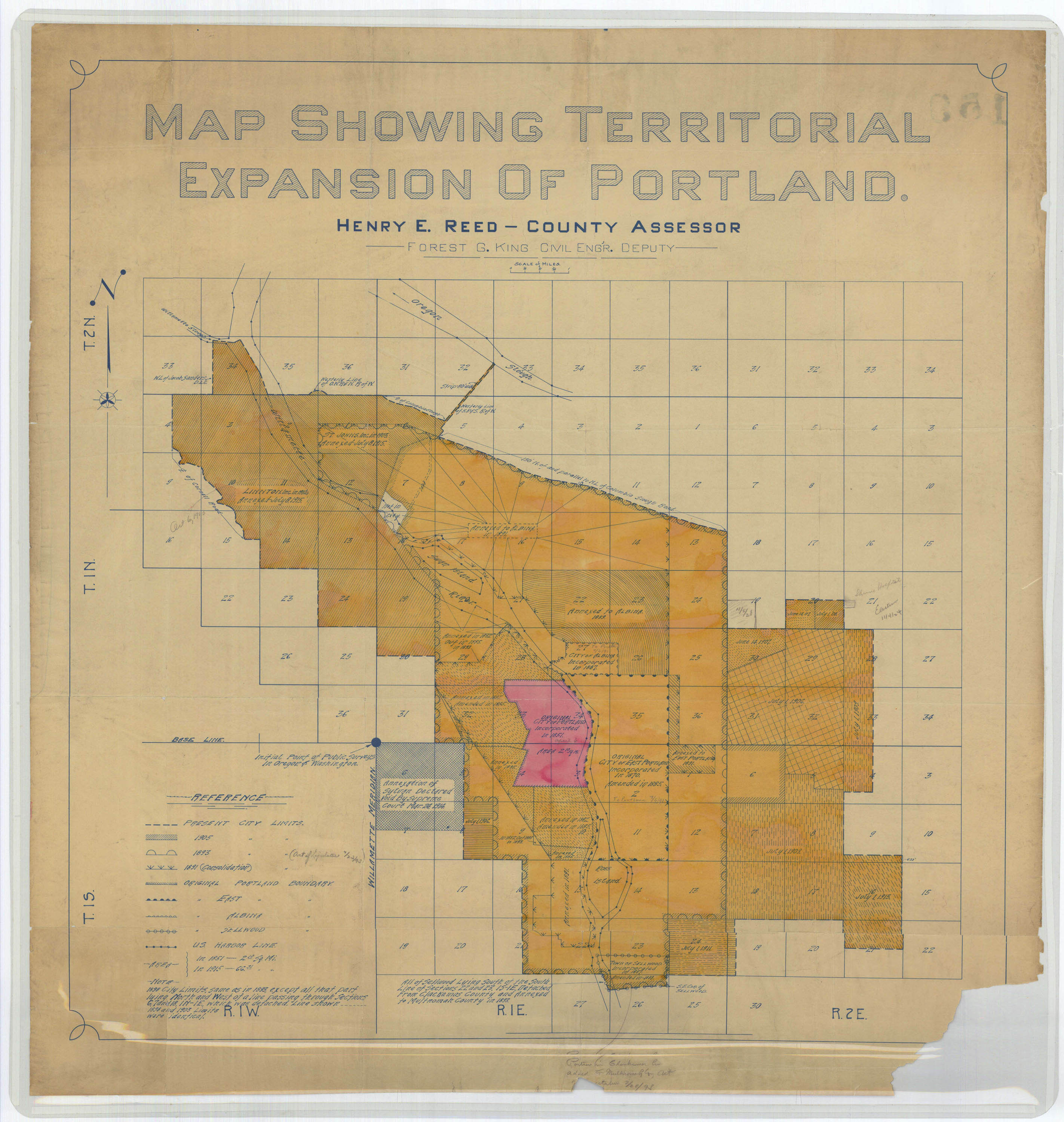
Here's an odd little object. Along the east edge of NE Portland's Columbian Cemetery, next to a tree and buried in underbrush, is a small stone that isn't a headstone. Its northern and southern faces are inscribed "CITY BOUNDARY", with a scratch mark along the east and west faces that (presumably) indicates the exact line of what was once Portland's northern city limit. I don't have even a rough date for it; I'd guess early 20th century, maybe 1910-1920 going by the typeface, and the fact that it's concrete and sort of shaped like Columbia River Highway mile markers, not the older milestones along Stark St. I don't think there is anything particularly special about this spot, so I assume there are (or were) other boundary stones like this. But I have no idea where any of them might be. The city has a handy Annexations by Decade map, which tells us that this became the city limit between 1891-1900, and stopped being the city limit some time in 1971-1980 when the city annexed up to the Columbia River. So the map's interesting, but it doesn't really give us a narrow date window. It might be a guide to where other city boundary markers are (or were), though. Vintage Portland has a 1915 annexation map with a note that the exact boundary ran "150' N. of and parallel to NL of Columbia Slough Boulevard", and further that it had been annexed in 1891 by the erstwhile City of Albina, the same year Albina and East Portland merged with the City of Portland.
When I visited, I knew precisely two things about this marker: A blog comment from Gentle Reader Aimee Wade alerting me to its existence (thanks!), and someone else's Panoramio photo showing what it looks like. That photo was crucial, and I never would have found the marker otherwise. I sort of wandered around the cemetery for a while, looking for a spot that matched the photo. The surrounding brush was taller than in the photo, partially obscuring the marker, which complicated the search a bit, but I eventually found it. For anyone who's interested in this sort of thing, it's right on the eastern edge of the cemetery. The blank wall of a giant warehouse is just inches away; I think they built it right up to the property line. I found the marker by going to the SE corner of the cemetery, near the entrance, and following the wall north, looking around the base of each tree until I found it. I'd say the marker's about 1/4 to 1/3 of the way back along the wall, on the south side of a small tree. (Alternately you could just measure out 150' from the north edge of Columbia Blvd. and look there, although I assume the street's been widened since 1915.) The marker was shorter than I'd expected, and I had to rummage around in the bushes to get these photos. As I was doing this, an elderly volunteer wandered over and we chatted a bit. He didn't seem know anything more about the marker than I did. He had some other trivia to share about sorta-famous, uh, residents of the place, but I'll save that for another post.
1 comment :
I just photographed one in SE Portland in perfect condition
Post a Comment