Sunday, December 15, 2013

Punahou Circle Apts.

A few photos of the Punahou Circle Apartments tower, in Honolulu at the corner of Beretania and Punahou Streets. I tracked this building down because President Obama lived here as a child. (I realize I'll probably get birther whackaloon trolls for saying that. But hey, that's why Blogger gives me a "Delete Comment" button.) A "Modernism + Recent Past" Google Map by the Historic Hawaii Foundation has this to say about the building:

Childhood home of President Barack Obama (from age 10-18); built by Emma Kwock Chun, who around 1936 became the first Asian to own and develop property in the exclusive Diamond Head area, and one of the first female real estate developers in Hawai‘i. The “Circle” in the building name is an homage to the Waikīkī Circle Hotel, which was developed by Mrs. Kwock Chun in 1962.
Punahou Circle Apts.

Honolulu is home to seemingly countless mid-1960s high rise towers similar to this. The Punahou Circle building has some groovy mid-60s details to it, but before its historic associations came along, it doesn't seem to have been considered an architecturally significant building. Even now, Emporis says almost nothing about it. Now, of course, it will likely be designated a historic landmark someday, thanks to its most famous former resident. For now, though, most of the search results you find for the building are actually apartment rental listings, and the place sounds fairly affordable by Hawaii standards.

Punahou Circle Apts.

One other odd item came up while searching for more info about the building. If you use Google Earth, someone went to the trouble of compiling a KML file of all Magnum P.I. locations around the state. I'm not sure why it came up in the search because the Punahou Circle building doesn't seem to have been used in the show. But I went to the trouble of downloading the file and checking, just in case, and I thought it was kind of fun even though it turned out to be a red herring, so I figured I'd pass it along anyway. So enjoy, or whatever.

Punahou Circle Apts. Punahou Circle Apts. Punahou Circle Apts. Punahou Circle Apts.

Saturday, December 14, 2013

Pods 15, 16, 19

Here are Pods 15, 16, 19, formerly located in Lake Oswego's Evergreen Park, at 3rd & Evergreen. Lake Oswego has an unusual public art program: Every year, a crop of new pieces is selected to go on display in town for the next two years. Typically they're also for sale, and the brochure even lists price tags. That would never fly in Portland; we like to pretend art isn't a commercial activity, and everyone here just does art purely for art's sake and people live off of grants, or trust funds, or working as baristas, or something, and they certainly don't sell things for cash money, like, eewww.

In any case, at the end of each two year rotation, the citizens of Lake Oswego are asked to vote for one piece to buy for the city's permanent collection; Pods 15, 16, 19 was up for a vote in May 2007, leading to the one terse description of it I can find on the interwebs: "Pods #15, 16, 19 by Kate Simmons, located in Evergreen Park, at Evergreen and Third.". Apparently the voters chose one of the other candidates, since the pods aren't there anymore. Which is a shame, I think.

The only other Pod I've seen on the interwebs is in a 2002 Seattle Times article, profiling someone's artsy Pearl District loft in Portland. In two of the photos, an unnumbered Pod can be seen leaning against a wall.

I was looking at these Pod photos, trying to figure out what they reminded me of. I think I've figured it out, but it's kind of an strange reference. They somewhat resemble birds' nests made of steel rods, which made me think of a car, oddly enough. The 1959 "Birdcage" Maserati Tipo 60/61 has an internal frame made with a ridiculous number of little metal tubes welded together. Which makes the car very light, and also very expensive and labor intensive to produce. Looking at photos of it now, I realize this frame structure looks nothing like a Pod, any more than it looks like an actual birdcage. So it's not really a useful reference or analogy or anything, but it seemed sufficiently off the wall that I figured I'd pass it along anyway, for entertainment value if nothing else. Plus this is going to be a very short post if I don't find a tangent or two to wander off on.

Speaking of which, a quick note on the location. Lake Oswego's parks department doesn't list an official Evergreen Park. This is just the mostly city-owned vacant lot behind City Hall, and "Evergreen Park" is sort of an unofficial term that's sometimes used for it. In 2011 it was considered but rejected as a site for a new police, court & emergency communications building. But the "park" could still go away if the city needs a site for something else that doesn't need quite so many parking spaces, access for emergency vehicles, or have requirements around "blast protection" (as if the Evildoers have ever even heard of Lake Oswego.) Anyway, there's different art there now than what you see here, and either next spring or the spring after that it'll rotate out in favor of something else.

Streetcar Stop for Portland

Here's a slideshow of Streetcar Stop for Portland, the shiny new structure at the NE Broadway & Ross streetcar stop (hence the name). This is one of two new public art pieces added as part of the Central Loop streetcar line, the other being Inversion: Plus Minus at the Hawthorne & Morrison bridges. From the RACC press release about it:

Jorge Pardo’s “Streetcar Stop for Portland” is located on North Broadway at the triangle of Wheeler Avenue and Weidler Street. Fabricated of steel, wood and fiberglass, the new shelter measures 35’ long by 18’ wide by 16’ tall. The multi-faceted structure includes over 300 individual panels in vibrant shades of orange, yellow, red and grey.

Jorge Pardo was born in Havana, Cuba, and emigrated to the United States in 1969. He studied at the Art Center College of Design in Pasadena from 1984-1988 and has exhibited globally since his first solo show in Los Angeles in 1988. In 2010 he was awarded a MacArthur Foundation Fellowship (see http://www.macfound.org/fellows/38/). Pardo lives and works between Merida, Mexico, Los Angeles and Long Island; currently his studio is in the Yucatan. This is his first municipal project in the United States.

PORT has an interesting (if somewhat fanboy-ish) interview with Pardo, with photos of Streetcar Stop (which apparently lights up at night) and several other projects of his.

I really like Streetcar Stop, in general. It's bright orange and has all sorts of interesting crazy angles, and it lights up at night, and generally looks like 1977's groovy idea of what futuristic 2013 public art would be like, except that it's not located on the Moon or in a dome under the sea, and it's next to a streetcar instead of a monorail.

The one detail I would point out here is that the name says "stop", not "shelter". The top is semi-open, and if you run to it to escape a sudden downpour, you're going to end up wet and disappointed. The thing is, the city's never going to approve something that would potentially keep rain off of homeless people. If it was dry inside, someone would sleep there, and that, apparently, would be the worst possible thing ever. Especially since the whole point of the streetcar line is to help gentrify the inner eastside. This is nothing new, of course; ever since homelessness got on the public radar, roughly the mid-1980s or so, cities around the country have worked to make their public spaces unwelcoming for the homeless. So you get things like park benches with an armrest down the middle so they're hard to sleep on, the removal of awnings over sidewalks, and so forth. And I get that a park full of sleeping or drunk homeless men and their shopping carts is going to scare "respectable" people away and make the space seem unwelcoming. I guess the thing that leaps out at me in this particular case is that both the streetcar stop and Inversion: Plus Minus allude to the idea of buildings and shelter but don't actually provide any. It may not have been intentional, but it just strikes me as a gesture of unnecessary meanness: We could've built a roof for the same money and kept you dry, but we chose not to.

Fountain for a Rose

Here are a few photos of Fountain for a Rose, the fountain in downtown Portland's O'Bryant Square. I don't have any photos of it running, unfortunately. Apparently the water bureau more or less abandoned it a few years ago, and the city's web page about municipal fountains doesn't bother mentioning it anymore It's a shame because it's quite attractive when it's running (its page at PortlandWaterFountains.com includes a photo). The city's page about the park as a whole still has a blurb about the fountain:

O'Bryant Square's dominant feature is a bronze fountain in the shape of a rose, fittingly titled Fountain to a Rose. It was made possible through a $28,000 bequest from Donald Card Sloan, who was a prime minister of the Royal Rosarians in 1953. Its inscription reads "May you find peace in this garden." The fountain is surrounded by 250 rose bushes and other plants. Beneath the fountain's jets an underground parking garage accommodates 90 cars, making it the first park with parking in the city. In 1976, O'Bryant Square received a national design award from the U.S. Department of Housing and Urban Development.

There seems to be some disagreement about whether the fountain is 'to' or 'for' a rose. The plaque on it says 'for', so that's what I went with, but the city's website says 'to', and 'to' is the name the Oregonian reported when the park & fountain were dedicated, on December 6th 1973. Incidentally, the date indicates the park celebrated its 40th birthday a week ago. No festivities were held as far as I know. I'm not sure the city even realized there was an anniversary to commemorate.

Back during the real estate bubble, O'Bryant Square was included in the Portland Development Commission's Three Downtown Parks master plan. The plan envisioned a new park at South Park Block 5 (which became today's Director Park), vaguely defined & unfunded renovations at Ankeny Park, and what sounds like a complete nuke-and-pave here. Various plans were offered, but they all seemed to involve tearing out the current park, removing the underground parking structure, and replacing it with something that hit all the buzzwords of contemporary architecture. Festival streets, LEED ultra-platinum sustainable green design, that sort of thing. This was supposed to happen at the same time Director Park was being built, circa 2007-08, but it's 2013 and nothing's happened yet.

A cynic might wonder if the master plan was only meant as a response to the "Let's tear down a bunch of buildings and connect all the Park Blocks" crowd, and they never really intended to build anything beyond Director Park. I'd actually be ok with that. Connecting the North & South Park Blocks is kind of dumb idea, and would involve tearing out a lot of old historic buildings. And I also don't think O'Bryant Square needs the proposed nuke-and-pave.

Over the past four decades, the park's acquired a bad reputation as a no-go zone full of hobos and junkies. I think this is outdated now; you may see a few teen skateboarders now and then, but they're harmless and they'll probably get bored and leave soon. But there may have been a kernel of truth to the stereotype twenty-some years ago. I was walking past the park one time, probably around 1990 or so, and a car drove past me slowly and somebody asked if I wanted to buy a (presumably stolen) car stereo. I was in college then and (in retrospect) may have looked like a potential customer for a stolen car stereo. But I also didn't own a car at the time. I explained this and got a "Dude, c'mon, twenty bucks." I also didn't have twenty bucks to spare, but I just explained I really genuinely did not own a car and therefore wasn't in the market for a stereo, no matter how awesome of a deal it was, and how cool and generous they were for offering it to me. So they drove off, dejected. The End. Ok, so this wasn't actually a scary story, but it's all I've got. If you have a better scary O'Bryant Square story, feel free to leave a comment below.

Anyway, the point of all of this is that I think they figured the whole park would be torn out soon, so there was no point in spending the money to keep the fountain running. The master plan has been neither implemented nor officially abandoned, so the fountain seems to be in a state of limbo these days. It probably doesn't help that the city's fountains were handed over from the Water Bureau to the Parks & Recreation Bureau recently, so Fountain for a Rose may not even be on the parks bureau's radar.

This is kind of sad because the park's taken on a new role in recent years, as a seating area for the popular food cart pod just across Washington Street. If the city's really so concerned about the park looking "blighted", you'd think leaving its fountain dry and apparently broken for years on end, in a spot where it will increasingly be seen by tourists, is not something they'd want to be doing.

Will Martin Hat, Pioneer Courthouse Square

Here are a couple of photos of the little bronze hat atop the fountain in Pioneer Courthouse Square. Extra credit Portland points are awarded if you've ever noticed the hat, decided to be a do-gooder and take it to Lost and Found, only to discover it's not a real hat. (This actually happened to me a few years ago, the first time I noticed the hat.) The hat was added to the square circa 1999, and honors Will Martin, the square's late designer. Martin died in 1985, when the vintage aircraft he was piloting crashed in the Grand Canyon. The square had been open to the public for just over a year at that point.

wet_hat

A September 1999 Oregonian article mentions that the hat had been stolen recently. I couldn't find a follow up article, but obviously it was either recovered or replaced at some point. The article mentions that the hat had been cast from Martin's actual hat, somehow, which cost about $1800. That's the closest I've come to finding title or artist info for the thing. I can see it not having an official title, but even if you're just doing a bronze cast of someone's hat, it seems like you still ought to be credited in some form. RACC and the other usual suspects don't say a single word about the thing, though. Feel free to leave a comment below if you know who created the hat or can tell us anything more about it. Thx. Mgmt.

Fortuna

Here are a couple of photos of Fortuna, the fountain in a traffic circle next to Lake Oswego's Millennium Plaza Park. The city arts council's current walking tour brochure describes it:

Fortuna
Simon Toparovsky
The Greek myth of Icarus is used to celebrate the importance of daring and living courageously. (Part of a suite of sculptures throughout Millennium Park.)
simontoparovsky.com
bronze, basalt

Toparovsky is best known for his work on the new cathedral in Los Angeles. Locally, this is one of at least nineteen works of his in or around Millennium Plaza Park. It's not clear if they all went in at the same time or have been added over the years; if it's the latter, a steady stream of return business like that has got to be any artist's ideal arrangement.

Fortuna

Other than the official arts commission site, I haven't found a lot of mentions of Fortuna around the net. I would've thought there'd be at least one blog out there about Lake Oswego arts and the joys of upscale life by the lake, but apparently not. I've seen a number of (possibly auto-generated) mentions of the fountain on Lake Oswego-oriented real estate sites, which is somehow fitting, it being Lake Oswego and all. I did come across a few posts about Fortuna and related pieces at PDXCept, with some decent photos of each of them, so that's worth checking out at least.

Wednesday, December 11, 2013

Hamilton Mountain


View Larger Map

Here are a few photos from Hamilton Mountain, on the Washington side of the Columbia Gorge, just east of Beacon Rock. These photos were taken back in 2007 and some have already appeared here in posts about Rodney Falls / Pool of the Winds and flowers along the Hamilton Mountain trail. I also took a bunch of scenic photos from some high cliffs along the trail, but I never got around to posting them back then. I recently remembered I had them and dug them out of the archives, so here they are. I've already talked about the hike in those two previous posts, plus the post about Dry Creek Falls which I visited later the same day. So I won't go into a lot of additional depth here, in large part because it's been six years now and I mostly just remember the highlights at this point. Luckily there's info about the hike on the interwebs, including Portland Hikers' Field Guide, LocalHikes.com, and the Washington Trails Association, if the photos make you want to check the place out. The funny thing is that the parking lot trailhead gives you two trails to choose from, and they're labeled "Difficult" and "More Difficult". If I remember right this was from "Difficult", because "More Difficult" didn't hit the waterfalls along the trail. I could have that backwards though. I know I took the trail to the waterfalls, whatever the label was. That much I'm quite sure of.

The overlook these photos are taken from is an interesting place, with a great 180+ degree view of an especially scenic part of the Columbia Gorge. You come across it rather suddenly too: You're slogging away through a long stretch of typical Northwest forest, then you come around a corner, and suddenly there are these rugged rock outcrops, and beyond them a cliff dropping several hundred feet. Or at least this is how I remember it from 2007. There are a few well-worn paths out onto the outcrop area, from decades of people trying to look daring, or just trying to get a better photo. I didn't follow these all the way to the cliff's edge; I'm not afraid of heights in general, but heights plus a lack of any solid handholds tends to make me a bit anxious. It doesn't happen a lot, either. Ran into it here, in Yosemite, and at Saddle Mountain. This time I approached it as an experiment: See how far I could go before it began to seem like a bad idea. (Answer: Not very far.) Then take a step back, wait, see if I can go a bit further. That helped a bit, though I still hit NOPE.GIF territory well before the actual edge. So I think I'm going to chalk that up to having survival-oriented DNA, coming from a long line of not-falling-off-cliffs people, and leave it there.

The upside here is that I ended up with bits of foreground scenery in the photos too, which I'm told adds visual interest. If anyone asks (obviously other than you guys, o Gentle Reader(s)), I'll just pretend I did it that way on purpose.

Sunday, December 08, 2013

Chain of Life / Pioneer Quilts

By now you're probably getting sick of crappy old Blackberry photos. Believe me, I sympathize, I really do, and at least this one marks the end of the Green Line. As I said in an earlier post, I realize I ought to have gone back and taken better photos, but I realized I wasn't going to get around to it any time soon. Doubly so in this case; this stop is at the Clackamas Town Center MAX station, and taking better photos right now would involve visiting a suburban mall during the Christmas shopping season. I'll go to surprising lengths for y'all, o Gentle Reader(s), and I never get tired of pointing that out, but I have to draw the line somewhere, and I'm drawing it at mall Santas.

In any event, here's TriMet's blurb about the art here:

The Chain of Life, by Richard "Dick" Elliott, includes patterns found in indigenous basketry, pioneer quilts and the spiral shape of DNA. The work appears in the brick pavers of the station platform, in the cut steel designs of the walkway guardrails and in windows of the parking garage elevator shaft.

The photo I have is of one of the pioneer quilt designs, on an elevated walkway from the mall parking lot to the MAX station. It's a better photo than most of my Green Line photos because I had to actually get off the train this time, but it's still just a Blackberry photo and I only took one. In my defense, I didn't realize Chain of Life was a multipart thing, and I wasn't able to look it up on the go with 2010's primitive mobile internet technology. In any case, the artist's website describes the pioneer quilt designs:

The next link in time relates to the settling of Oregon. The cut steel designs on the railings that connect the parking garage to the platform were created to honor pioneer quilt makers. They allow an expression of my long-standing study and appreciation of quilts. Mary Bywater Cross, author of Quilts of the Oregon Trail, was a consultant on this part of the project.

Waving Post

The next stop on the Green Line tour is the Fuller Road MAX station, home to Waving Post, which you can barely make out in this terrible Blackberry photo. It's the sort of curved spiky-looking thing in the distance, toward the right of the photo. TriMet's description of it:

The SE Fuller Rd station is located in a section of the Con Battin neighborhood that was isolated from the rest of the neighborhood by the freeway in the late 1970s. Pete Beeman's Waving Post invites viewers to turn the crank, bring the sculpture to life and wave to the neighbors.

Beeman also created Pod (a.k.a. "Satan's Testicle"), the stainless steel kinetic whatzit across the street from Powell's on Burnside. A 2006 Stumptown Stumper at the Tribune explains Pod a bit, and mentions Waving Post briefly as a coming attraction.

I realize this is a crappy photo, but even a great still photo can only tell you so much about a thing like this that's designed to move. Fortunately Beeman posted a short Vimeo video that shows what happens when you turn the crank. It looks cooler, and more graceful, than you'd expect given the whole "waving at the neighbors" concept.

Another TriMet page with statements from various Green Line artists includes this about Waving Post:
The forms of Waving Post are visually suggestive without being too explicit. When I designed the yellow and red horizontal elements, I wanted them to suggest different things to different viewers. One person might come to it and see a human spine; another might see a dinosaur bone, bird wings or even a building truss.

The Fuller Road station is located in an old neighborhood named for an Oregon Trail family. When the freeway went in, the neighborhood was bisected and mostly eliminated. When I realized that a one-block piece of Con Battin Road continued on the other side of I-205, I wanted to make a sculpture that could wave hello at that distant piece of street across the way.

I don't claim to be an expert on this part of town, but I'd never heard of a "Con Battin neighborhood" before. I checked the Oregonian historical database but didn't see anything interesting; I imagine this area was just too far from town to merit discussing in print, from their point of view. Luckily TriMet rides to the rescue again, something they almost never do in real life. As part of the Green Line project, they put together a "Cultural History" of neighborhoods along I-205, and it includes a history blurb about the area:

Formerly known as the Battin neighborhood, this area takes its name from the Battin family who lived here from the 1870s to about the 1950s. Thomas E. Battin came to Oregon from Pennsylvania in 1865, at the age of 19. He came unaccompanied, working as a hired cattle drover for another migrating family. He met his future wife, Caroline, while wintering in Boise. Upon arriving in Oregon, he worked at cutting cord wood and investing in real estate—usually buying portions of claims from earlier settlers. He was the first owner of a parcel of school land in the present- day Brentwood-Darlington neighborhood in Portland, which he bought from the state for $200. Two weeks later, he sold the land for $1000. He settled down on a farm that stretched from Fuller Road to now-gone Jacobson Road (at approximately 90th Avenue) and from Battin Road to Otty Road. Over the years, the Battin property was subdivided among family members, and local streets were named for these children: Battin Road was originally Cleo Battin Road and Con Battin Road was named for C.E. Battin. William Otty Road and J.E. Jacobsen Road were named for claim-holders to the east. Fuller Road was originally Fuller-Price County Road.

The Battin neighborhood was divided, and much of it was removed, when I- 205 was built through the area. Mary Alice Clay, who lived up the hill from the Solid Rock Baptist Church where her husband was the pastor, remembers that church attendance dropped considerably because the freeway forced members to move away. The church survives today with a congregation that primarily live in more distant neighborhoods. Cresslyn Clay, granddaughter of Mary Alice, still lives in her grandparents’ house. Battin Elementary School dates from the 1930s, although Clackamas County School District #54 held a deed as far back as 1917. The school was demolished and replaced with a Home Depot and other stores in 1989.

Lents Hybrids

The next stop along the Green Line is the Lents Town Center / Foster MAX station, home to Lents Hybrids:

Brian Borrello's Lents Hybrids is a series of spiraling plant forms with "buds" that generate energy through a hybrid system of wind and solar generators. The pieces are evocative of the native long grasses that may have once grown near the station area, while the buds are symbolic of the unfolding beauty and potential for the Lents neighborhood.

I only managed to capture one of the sets of hybrids while riding by on the train. There's at least one more at the station, with four spiraling stems instead of two. And I didn't do the two-stem one justice either, this being yet another crappy Blackberry photo taken from a moving MAX train.

Lents Hybrids Lents Hybrids

Borrello also created People's Bike Library of Portland in downtown Portland, Silicon Forest on the MAX Yellow Line, the blue ox feet at the Kenton MAX station, and apparently much, much more, including some giant filberts he's creating for the City of Tigard. Like Lents Hybrids, Silicon Forest is a collection of tall, skinny solar-powered tree structures. Add in More Everyday Sunshine and Nepenthes, and it starts to look like solar-powered art is a hot local trend right now. Or at least it will probably look that way to art historians a century from now.

Neighborhood Notes has a few construction photos. East PDX News has a few more, plus one of the finished product glowing blue at night, which looks kind of cool in a Lothlorien/Vegas sort of way. Lents Grown mentions a second artwork at the MAX station, Out of the Brambles by Wayne Chabre (who also created Connections at the Multnomah County building on Hawthorne). It looks like I would've needed to get off the train in order to see it, though, and even if I'd been in the mood to get off at each stop and look around, TriMet's website neglects to even mention that it's there.

As with Sky to Earth elsewhere on the Green Line, Lents Hybrids was created with help from a local pipe bending company. That sounds kind of esoteric, but their photo galleries showcasing their work are actually pretty interesting. Go take a look if you don't believe me.

Shared Vision

The next stop on our tour of MAX Green Line art is Shared Vision, at the SE Holgate MAX station. TriMet's description:

Lanterns are popular festival decorations associated with gaiety and rejoicing, and are reminders of the security of a light in the window. By using light as a metaphor for expanded awareness, Suzanne Lee's Shared Vision represents prosperity as the richness of positive social interaction and communication—the very essence of neighborhood.

Another TriMet page elaborates a bit:

Five ornate lanterns developed by Suzanne Lee are the central elements of this multicultural sculpture. Sited above the station platform, the illuminated sculpture appears like a beacon at night.

I haven't found a lot of info to pass along about this one. Oldtrails.com has a better photo of it, and OregonLive has an interesting close up construction photo, showing a level of detail that ordinary MAX passengers probably can't see.

One other item, unfortunate in light of all this talk about security and positive social interaction. Two people were shot at the Holgate MAX station in October 2013, one fatally. A few days ago, a grand jury concluded the suspect had acted in self defense, and declined to indict him.

Money Tree

The MAX Green Line's Powell Boulevard station is home to Money Tree, the sort of winged post in the distance in the above photo. TriMet's description of it:

Valerie Otani created a contemporary Money Tree to symbolize the revitalization of the neighborhood and hope for the prosperity of the new immigrant communities. The overall form evokes the Douglas fir, and each branch takes its design from traditional folk art of cultures living in the neighborhood

This photo was taken from inside a MAX train, with an inferior-grade phone camera, so you can't really see the branch details, but an Examiner article about Green Line art has a detail photo of part of one branch, which gives a better idea of what it looks like up close.

Otani's work has appeared here a few times before, including Folly Bollards at the downtown Performing Arts Center, and Prescott Biozone on the MAX Yellow Line. She doesn't appear to have a website, so I'm having trouble elaborating on TriMet's rather terse description. They don't even mention which immigrant communities are represented here. I did run across a few mentions of a female Saudi-American artist who collaborated on part of Money Tree. An interview with her describes this segment of the tree:

You may also see one of Huda’s art pieces live in a neighborhood of Portland, Oregon called the “Money Tree” sculpture. It is a beautiful and creative joint public art project designed by both Huda Totonji and a Japanese American artist, Valerie Otani. Dr. Huda Totonji designed a branch of the “Money Tree” 20 feet tall sculpture. It stands tall on Powell Boulevard Station, TriMet, I 205. The theme of the sculpture is the revitalization with new immigrants as they bring prosperity and cultural strength. Dr. Huda’s design incorporates Arabic calligraphy that communicates good wishes for prosperity from the Muslim traditions.

As we continue through the Green Line sculptures, you'll notice a theme developing. With a few exceptions, they tend to be tall poles (such as the one here) with much of the design elements overhead and out of reach. I imagine this is to thwart casual vandals, metal thieves, and teenage boys who want to impress people by climbing them, because this part of the outer eastside isn't the most upscale part of town, and TriMet's afraid of whatever mischief the restless natives might get up to. That's my theory, anyway.

Saturday, December 07, 2013

Sky to Earth

The MAX Green Line's SE Division station is bordered by a curving blue chain-link fence. The is actually the art installation for this MAX stop, which Trimet describes thusly:

Sky to Earth, by Carolyn Law, is a vivid sky blue fence that rides the visual edge between the light rail tracks on one side and the expansive topography of the surrounding land along the other side. The artwork's flowing and changing sculptural line shifts between solid and transparent, activating the site and the experience of MAX riders.

The artist's website has photos from various angles (all of which seem to be better than my viewpoint aboard a MAX train), and a longer explanation:

The design of the artwork relates specifically to the nature of the site and the alignment of the light rail track as well as dealing with the striking openness and topography of the land where the station and access paths will be located. The artwork rides the visual and experiential edge between all the site’s characteristics.

The site is an intense place with an expansive, open landscape framed by freeway lanes on one side. It can be viewed at many speeds and angles. The other sensory and physical undercurrent here is the sky and the wind. The wind appears to be nearly a constant. The grasses ripple elegantly and somewhat hypnotically, registering the caprice of the wind’s directions from moment to moment.

Within this landscape, the fence is a flowing, changing sculptural line of one color and a form that shifts between solid.

The same page also links to a story about Sky to Earth from "World Fence News", a trade paper that apparently exists. As a trade paper, it points out that a couple of local companies, Portland Fence Co. & Albina Pipe Bending, were key to putting this together. Not mentioned in that article, but found elsewhere on the net, a third company did post sizing and foundation design for the project.

In 2010 the national Chain Link Fence Manufacturers Institute awarded Sky and Earth its 2010 Les Grube Memorial Design Award; previous winners include the prominent architect Frank Gehry, so it seems like this is kind of a big deal, at least within the fence industry. The 2011 award went to a somewhat similar project in Boston, and the 2012 one went to a fence project for an overpass in Kansas City. The 2012 link goes to a page by the design firm explaining the project and going on about what a cool (and unfairly overlooked) material chain link fencing is.

The same year, the group Americans for the Arts named Sky to Earth one of 40 exemplary public artworks completed the previous year.

I suppose I'm pointing out the awards it's won, and the local construction and art fabrication jobs involved in creating it, because this is an artwork that would be easy to demagogue. It's easy to imagine people on talk radio or Facebook ranting about how it's not really art, it's just a chain link fence, we paid how much for it, the citified liberal elitists are trying to pull one over on us, etc., etc. It got a brief and mostly positive mention in an OregonLive article about some weird & alarming art along the WES commuter rail line. Surprisingly the article only has four comments, and they aren't all negative. I suppose modern art just isn't the conservative hot button issue it once was in decades past. That, or they just figure anything within Portland city limits is a lost cause at this point.

Tall and Fallen

Back in the naïve, low-tech days of yore (mid-2010), I'd just gotten a shiny new Blackberry phone, one with both a camera and a Twitter app, and I was pretty stoked about living in the future. The MAX Green Line was less than a year old then and I hadn't yet ridden it to the end at Clackamas Town Center, so one day I decided to make the trip and try this newfangled "live-Tweeting" thing I'd heard so much about. I even used the hashtag "#greenline", so, I guess, the entire world could follow my fearless expedition into Darkest Clackamas. Most of the photos I ended up with were of the new public art along the MAX line, although I wasn't really doing a public art blog project at the time. I think I was just trying to post at least one photo from each MAX station, without actually getting off the train, and the art seemed like a good way to tell the MAX stations apart.

In any case, I recently tracked these photos down in my old Twitpic account, and figured I could maybe reuse them here. None of them are that fabulous (though most are at least better than the one in this post), and if I was truly dedicated to this art project I really ought to go back, get off at each stop, and shoot some quality photos instead, and maybe hit the RAM Brewpub at the mall instead of grabbing tacos and tater tots at the food court like last time. But it's a rather long train ride just to get photos of things I already have photos of, and I'm positive it would be a long wait before I got around to it. Long story short, I'm going to go ahead and post with the photos I have, not with the ones I wish I had.

So this is one of the less successful photos of the series, from the SE Main St MAX station near Mall 205. If you look between the closing MAX doors and beyond the shelter you can see Tall and Fallen, the tall pillar with the jutting triangular bits. TriMet describes it:

The fan-shaped leaf of the ginkgo tree inspired Anne Storrs to create Tall and Fallen. Tall consists of seven abstracted ginkgo leaves cast in concrete and stacked inside four stainless steel poles. Fallen, constructed with the same leaves appearing singly or in pairs, suggests the gingko trees' fallen leaves.

I really do like this one, and I feel kind of bad my only photo of it is so terrible. The artist's web page about it has vastly better photos than mine, with a brief caption:

Inspired by the ancient ginkgo tree, this sculpture is created by stacking seven interlocking ginkgo-like concrete leaf forms in a stainless steel framework, 20’ x 3’ x 3’. More concrete ginkgo elements stacked singly or in pairs are found in the stations' landscape.

Looking around Storrs's website, I realized she also created Begin Again Corner, along the downtown Portland segment of the Green Line. I point this out because my photos in that post are actually pretty decent, in case you're wondering whether I ever take anything besides crappy camera phone shots.

If this was a professionally run blog on a platform less orphaned than Blogger, right about here is where you'd see a "Related Posts" or "You Might Also Enjoy" widget, with results probably generated by a simple keyword match, say on the word "ginkgo" for instance. In which case you'd see links to posts about ginkgo trees in the Plaza Blocks, and maybe the Ginkgo Petrified Forest in Eastern Washington, to pick two random examples with photos better than the one you see here. And if the algorithm looked at geotags, you might also get a link to Milestone P6, just north of Mall 205. Ok, there'd also be a "From Around The Web" section with links to crappy fad diets, celebrity news, anti-Obama rants, and bad investment advice, which is a big reason why I don't have a widget like that here.

Stone, Water and Heaven (Daedalus to Icarus)

Stone, Water and Heaven (Daedalus to Icarus) is one of a trio of Rose Quarter sculptures, along with Little Prince and Terra Incognita. This one is a bit more obscure than the other two, and is probably my favorite of the three. It's smaller, and sits at the corner of N. Winning Way & Center Court St. (and yes, those are stupid street names), streets that only see a lot of traffic on game days. I don't recall ever seeing it (or at least ever noticing it) before I tracked it down for this blog post. It's obscure enough that both the Smithsonian art db (the first link, above), and RACC call it by the wrong name, "Earth, Water and Heaven". The sign next to the piece says "Stone", not "Earth", as does an essay on the artist's website, which suggests to me that "Stone" is the correct name. Sadly (if we're going to be really pedantic about it), neither variation on the name includes an Oxford comma . Sigh.

RACC's description of the piece, wrong name and all:

Earth Water and Heaven (from Daedalus to Icarus), in contrast to the other two sculptures located in the Rose Quarter by Averbuch, is of moderate scale. It is also more quiet and meditative. This work deals with the dichotomy and integration of two different levels of meaning. One is the ring of stone and water tied in an everlasting balance of nature (rivers and mountains, oceans and continents). The other concept is about us as humans and our expressive aspirations for "heaven" represented by the image of a wing - an age-old icon that reappears in many cultures, describing our aspiration for greatness, fantasy and the supernatural. It is about the heroic feathers that we strive to have and that drive us further in life, about our aspirations that rise like the tower of Babylon, and about the actual gravity and balance of the earth that keeps us intact.

The artist's website also mentions a very similar 2003 piece, The Wing and the Ring, located at the city cultural center in Nahariya, Israel. The cultural center was built in the early 2000s and saw scandalous cost overruns, including all manner of lavish (and garish-sounding) furnishings.

Terra Incognita

At the east end of the Broadway Bridge is a sort of frontier fort-looking structure, guarding the northern approaches to the Rose Quarter area. It kind of looks like a children's play structure from a time before personal injury lawsuits, but it's actually Art. Terra Incognita is one of a trio of sculptures around the Rose Quarter, the others being Little Prince at the south end of the Rose Quarter, and the smaller Stone, Water and Heaven (which I haven't posted about yet), over toward the northeast corner of the district. RACC says of this one:

Terra Incognita is a massive gate-like sculpture at the foot of the Broadway Bridge. It forms a strong positive negative pattern of five cubes. The three lower cubes are bundles of tree trunks. In between these are two cubes made of piles of stone that are held in the air by the lower cubes. This work relates to its site in a broad context. It plays off the power of the natural landscape, the rivers, hillsides and mountains, as well as the power and scale of the man-made elements such as surrounding bridges and buildings. Averbuch felt that the dramatic relationship between wood and stone are appropriate for Portland. This sculpture has a feeling of fortification and frontier, elements the artist associates with Oregon.

I could be reading too much into it, but that description is phrased a bit oddly. It's as if they're gently pointing out the artist had some fanciful notions about our fair city. That is, we aren't actually a rugged Old West frontier city these days. We also weren't a frontier city back in 1995 when Terra Incognita went in, or at least it didn't seem that way at the time. The Old West may, however, be the one thing people outside the US know (or think they know) about Oregon, since we don't appear in the world's history books very often after 1859 or so. So when you ask someone from overseas (Israel in this case) to make something Oregon-themed, you could easily end up with something Western. Old West themes carry a lot of historical baggage around here, and the whole subject's been deeply unfashionable for several decades now, at least in the "serious" art world. You can probably still drive out to Bend or Joseph and pick up some bronze cowboy-n-Indian statues for your backyard, if you're into that sort of thing.

I suppose that's a danger when you insist your art has to somehow be "about" its location; you either hire artists from out of town and get headscratching stuff like this ( 'C" at Portland Public Art said of it "The first impression of the artwork is RACC (in 1995) was too cheap to mail Averbuch a Polaroid of the site." ); or you just hire locally and get a hundred variations on Heroic Salmon Swimming Upstream, or whatever the current fad happens to be.

Friday, December 06, 2013

Silicon Forest

Here are a few photos of Silicon Forest, the solar powered earth-o-licious tree structures at the Interstate/Rose Quarter MAX station. TriMet's Yellow Line art guide describes it:

Brian Borrello presents a three-part metaphor for displacement and change.
  • Illuminated metal trees generate their own electricity from solar panels.
  • A virtual campfire flickers with light at night, surrounded by stainless steel stump seats.
  • Light filtering through colored glass on shelter roofs simulates the dappled light of a forest.
  • Concrete tree rings in the platform symbolize the forest once abundant on the site.
  • Custom guardrails feature branching tree limbs and roots.

So it was created by the same guy who created People's Bike Library of Portland, and the blue ox feet at the Kenton MAX stop, and a number of other public art doodads around town that I haven't covered yet. Apparently he designed the entire MAX station, not just the trees, but I didn't realize that at the time and only have photos of the trees.

The usual idea with MAX station art, on any of the various MAX lines, is that it's supposed to be somehow inspired by or related to the surrounding neighborhood. I don't really envy the task here. Today it's just sports arenas and mass transit, and making MAX art about being a MAX hub might be too self-referential even for Portland. Until the early 1960s there was a thriving majority-black neighborhood here, before the bulldozers of urban renewal came and swept it away. That would be an obvious choice for a theme, but the excesses of urban renewal aren't exactly a happy, self-esteem-boosting topic, and TriMet probably wouldn't go for that. Maybe "metaphor for displacement and change" is an oblique reference to the area's history, I'm not really sure.

In any case, the name "Silicon Forest" has been a nickname for the Portland-area tech industry, coined (and trademarked) by Lattice Semiconductor in 1984 and swiftly adopted by local boosters, by analogy with "Silicon Valley". Though a proper pedantic engineer (such as, um, myself) would point out that the industry's westside office parks typically replaced farmland, not forests, technically. We do, at least, have a decent claim on the "Silicon" part of the name, since the design & initial manufacturing of Intel chips happens here. And the Trail Blazers (who play in the nearby Moda Center) are owned by a certain Microsoft mega-billionaire, and Microsoft products generally rely on said Intel chips. As far as I know that's the one tech industry connection to this particular spot in Portland.

Snowpocalypse 2013

Scenes from the snow day today. It doesn't rank among our top ten Snowpocalypses, to be brutally frank about it. It's no 2008 or 2007. It's not even a 2010. Still: Two cheers for (light & temporary) snow!

Little Prince

Some photos of Little Prince, the giant crown lying on its side in front of the Rose Garden Moda Center sports arena. The RACC page for it says:

The Little Prince is a partially buried copper crown located at the south end of the arena in the Rose Quarter. It is a piece about imagination, desires and aspirations, conquests and struggles. It is the job of the viewer to create the story that goes along with the crown. Is it a victory and position of honor waiting to be claimed, or is there another story? Only the viewer can say. Ilan's inspiration for this piece was the "Little Prince" by Antoine De Saint-Exupery, in particular, the first chapter where he talks about his drawing of a boa constrictor swallowing an elephant being misunderstood as a hat.

I have to say this crown really doesn't evoke The Little Prince for me. The baobab tree I saw recently did, but the crown seems to miss the point, somehow. I mean, it's been ages since I read the book, maybe there was a tipped-over crown in it that I've completely forgotten about, one that symbolized a key idea of the book, or was the focus of a major plot twist. I kind of doubt it though.

Legend has it that the crown will be tipped vertical if the Trail Blazers (who play at the, uh, Moda Center) ever win an NBA championship. It's been there since 1995 and we've never been in serious danger of finding out whether the legend's true or not. Some might argue that the tipped crown (or just the crown, period) brings bad mojo, sort of like the inverted trident logo the Seattle Mariners used to use. Others might argue that the Blazers have been cursed by the sports gods since 1984, when they chose not to draft Michael Jordan, picking the fragile, all-but-forgotten Sam Bowie instead, along the lines of the 84-year curse incurred by the Boston Red Sox when they traded Babe Ruth to the Yankees. On the bright side, if it's an 84 year curse, it won't be long until we're fully 1/4 of the way done with it. So there's that.

Speaking of baobab trees and such, it turns out there really is an asteroid B612, more or less: Asteroid 46610 Besixdouze, discovered in 1993 and named (I think) in 2002. The name is "B six twelve" in French, and the hexadecimal number B612 is 46610 in decimal. It was a cute idea, and why not? As of right now, there are over 380,000 asteroids whose orbits are known well enough to earn permanent ID numbers, and only 16,000 have been given actual names so far. Further off on a tangent, my first desktop PC at my first real cubicle-based job was named "\\Asteroid B612", which gave the IT department fits because of the space character in the name. I seem to recall that Windows versions after Windows 95 refused to let you create hostnames containing spaces. I could be wrong, I haven't tried it recently.

Friday, November 29, 2013

Lyon Arboretum


[View Larger Map]

Here's a slideshow of the University of Hawaii's Lyon Arboretum, at the uphill end of Oahu's Manoa Valley, next door to Manoa Falls. It's at the same city bus stop as Manoa Falls, so it's just as easy to get to: Ride bus #5 to the edge of suburbia, get off and walk uphill, and follow the signs. Or, of course, you can just drive there if you have a car, which I didn't. Then go to the little visitor center next to the parking lot, drop a few bucks in the donation box, and get a map. You're going to need the map, because you'll probably get lost. I did, briefly, and I almost never get lost. Having a map at least gets you un-lost eventually. There's mobile phone service around the visitor center -- some of the plants in the adjacent garden even have QR codes to scan for more information -- but cell service quickly fades out once you're in the forest, sadly preventing me from going on an Instagram rampage while wandering around, or from checking Google Maps while I was lost.

I'd love to be able to tell you all about all the tropical plants here, or at least about the ones I have photos of. The place is kind of overwhelming, though. I spent a couple of hours here and felt like I'd barely scratched the surface. I skipped most of the various side trails and took the main trail to the far end of the arboretum, trying to find the waterfall. Which is a different, and much smaller (and less impressive) waterfall than Manoa Falls. This seems to confuse visitors a lot. I had a group of Japanese tourists ask me for directions to Manoa Falls, and they were a bit crestfallen to find out they were in completely the wrong place. I gave them directions and later ran into them on the Manoa Falls trail, and they thanked me for pointing them in the right direction. So I felt like I'd done my good deed for the day.

It would be really easy to spend an entire day here, taking it slow and just wandering around looking at things and filling up a memory card with flower photos. Though I'd recommend taking the Manoa Falls trail too, for contrast. If you only visit the Lyon Arboretum, you might come away thinking this is what a regular Hawaiian rainforest looks like, and not realize how much selective planting and pruning and manicuring has gone into it.

Most plants aren't labeled, so knowing your way around tropical plants would enhance the experience, I'd imagine. I was surprised to learn that a heliconia is not quite the same thing as a banana plant, if that gives you some idea of my inexperience with tropical plants. The arboretum specializes in heliconias, ginger plants, palms, and bromeliads, among other things, so it wouldn't hurt at least know what those look like.

Two items of practical advice. First, there are mosquitoes. Wear DEET, or cross your fingers and try some supposed DEET alternative, or wear long pants & sleeves and hope for the best, whichever option you prefer. Second, it rains a lot here. 165 inches per year, or nearly half an inch per day, on average. The arboretum is just a few miles up the road from Waikiki and downtown Honolulu, but it's not unusual to have torrential rain here while it's sunny at the beach. Oahu microclimates are like that. At least the rain isn't cold, and individual storms don't seem to last long, so you can sort of work around the weather and explore between downpours.

chimney fountain (twitpics)

Chimney Fountain Chimney Fountain Chimney Fountain

lovejoy fountain (even more twitpics)

Lovejoy Fountain Lovejoy Fountain Lovejoy Fountain Lovejoy Fountain Lovejoy Fountain Lovejoy Fountain Lovejoy Fountain

keller fountain (more twitpics)

Keller Fountain Keller Fountain Keller Fountain Keller Fountain Keller Fountain Keller Fountain

carwash fountain (twitpics)

Carwash Fountain

Some old Twitpics from several years ago, back when having a phone that combined a camera and Twitter seemed like a magical new thing, full of artsy possibilities...

Updated 9/17/14: Except that they aren't Twitpics anymore, as Twitpic's shutting down in a few days. Sic transit gloria mundi, or something.

Carwash Fountain Carwash Fountain Carwash Fountain

MSL, 2 years ago

Two Black Fridays ago, I was in Florida for the launch of the Curiosity mars rover. I've posted launch photos, photos of the rocket, etc, before, but just recently I remembered I'd posted a series of phone photos on Yfrog as part of the tweeting component of the tweetup. I had to do a bit of searching to find my old Yfrog account, which I really haven't used since I upgraded to an Instagram-capable Android phone. So these were all taken with a rather subpar Blackberry camera, but they still sort of capture the spirit of the event.

Thursday, November 28, 2013

Vancouver Lake expedition


View Larger Map

Here's a slideshow from Vancouver's Vancouver Lake Park, mostly of the far side of the lake near where the road peters out. I always forget there's a lake this big in the Portland area. Partly because it's up in Vancouver, and partly because it's your basic Pacific Northwest wetland nature area, the same as everywhere else but larger, and with the ongoing water quality issues of a suburban lake. It's not exactly Crater Lake, is what I'm saying. These photos were taken back in 2007, the same "mini-roadtrip" week that I went to Crater Lake, which may be why posting these didn't seem like a high priority. I had actually forgotten I'd ever been to Vancouver Lake until I ran across these photos in an old iPhoto library recently.

Since my visit there wasn't particularly eventful, I think we'll just go ahead and dive into the Oregonian historical database instead. (If there was a database of the Vancouver Columbian newspaper, that would be even better, or at least more comprehensive, but as far as I know it's not available online.) Most of the news items in the database are fairly routine: Hunting and fishing reports, real estate ads, farming news, occasional drownings, that sort of thing. I tried to only include items that stood out from the crowd or seemed relevant to why today's lake is the way it is, so hopefully it's an interesting list, as far as these things go. The pattern that emerges over the last century or so is one of Vancouver looking west, seeing this big lake, and thinking it ought to be useful for something or other. One grand scheme after another was proposed and argued about endlessly, and yet in 2013 much of the lake and the surrounding area still looks like the back of beyond, even though it's right next to the city proper.

For clarity I've broken the news items out into pre-1965, 1965-1983, and post-1983 sections, for reasons that will be come clear after the jump.

Wednesday, November 27, 2013

Foster Botanical Garden


View Larger Map

Here's a slideshow from the Foster Botanical Garden in downtown Honolulu. It's a large slideshow because the place kind of fascinated me. I was expecting to see (and photograph) a lot of flowers, but this botanical garden is focused more on trees. Enormous tropical trees, a grove of palm trees of all descriptions, and a whole section of commercial trees that produce products you vaguely knew came from plants, including black pepper and various other spices. I enjoyed visiting because almost everything was unfamiliar, but I later ran across a blog post by someone who enjoyed it for exactly the opposite reason: Having grown up in Jamaica, many of the plants here brought back childhood memories.

I already knew the garden had a baobab tree, and that was actually a big reason I decided to visit. It's possible I'd read The Little Prince one too many times as a kid, but I was absurdly pleased to see a real live baobab tree. Being in the middle of a stand of coffee trees was ok too. I posted a couple of Instagram photos from the coffee thicket so people back home in the rainy and coffee-mad Northwest could see what it's like, but I think that may have elicited more jealousy than curiosity.

There's also a strychnine tree, believe it or not, set well back from the path so visitors can't just walk up to it and give it a hug or lick it or something. It occurred to me that a botanical garden in Hawaii, featuring a bunch of toxic plants, and run by elderly volunteer ladies-who-lunch, would be the ideal setting for a series of cozy murder mystery novels. It's probably been done already. I haven't checked.

The garden does have a greenhouse with orchids and other smaller plants. I seem to have just missed the blooming of a giant corpse flower (so named because of its disgusting odor). This is probably just as well, as far as I'm concerned.

Wednesday, November 20, 2013

More Everyday Sunshine

As a general rule of thumb, Portland's public art buyers don't usually go for conceptual stuff. Abstract stainless steel whatzits are still the safe choice here, made by the same usual suspects who've been making them since the 70s, and who will happily cobble together yet another one whenever a new public works project needs to burn its one percent for art. Our subject today is one of the few rare exceptions to the rule of thumb, one which made a quick cameo here in a post back in 2006:

... I've finally figured out something that's been puzzling me for months now. At several spots along the streetcar line, and at other locations in the Pearl, there are these motion-sensored spotlights with solar panels attached, aimed at the sidewalk. Sometimes they trigger and click on when you walk by, which can be a little surprising. There's one on SW 10th around Stark or Alder or Washington that clicks on and illuminates a manhole cover in the sidewalk. The first time I saw this it startled me. I thought it must be some sort of inexplicable homeland security measure or utility maintenance aid or something. Turns out the spotlights are part of an art installation titled More Everyday Sunshine, by Harrell Fletcher. It all makes sense now. I had a feeling it might be art, but it isn't labelled anywhere, and the equipment for each light is quite utilitarian, so it was hard to be sure.

I like the fact that the spotlights come with no signs or explanations attached, adding a touch of mystery to ordinary downtown streets. Knowing their purpose is like belonging to a secret society, without all the funny handshakes and world domination. The Tribune dug into this mystery in a 2007 Stumptown Stumper, which included a brief interview with their creator. The lights have also gotten a five-star Yelp review, oddly enough, which is possibly the Internet's only source of art criticism even less authoritative than the humble blog you're reading now. Elsewhere in the blogosphere (a word I haven't used in years, to be honest -- is there still a blogosphere?), More Everyday Sunshine is the nightcap on someone's tour of interesting Portland attractions and it gets a mention in a post at The Hallucinogenic Toreador that also covers murals from China's Cultural Revolution and a few of the author's ideas for future art projects.

This post took a while to create. At first I only had some daytime photos of the solar panels and lighting gear, which aren't very photogenic, and I had no pictures of it actually in operation. I felt this post couldn't go live with just the daytime photos, since I wasn't really capturing the essence of the thing that way, and I take that seriously for some reason. It's not that I wasn't trying to get proper nighttime photos, mind you. I wandered around a couple of times trying to get various spotlights to trigger, hopefully without arousing suspicion and getting tasered by Officer Friendly, or having to explain this quixotic internet quest to random Midwestern tourists who want to meet a real live Weird Portlander. I finally got a couple of spotlights to light up this evening, and I got a few photos, so this post could finally move forward. One photo shows an illuminated shrub outside an apartment building at 11th & Columbia, while another shows a pool of light on the sidewalk at 5th & Mill. Neither one is really all that spectacular, but I think they get the general idea across. I tried a few other spotlights but they wouldn't come on for me. So either some of the lights are out of order, or I just haven't figured out the secret trick to making them light up on command. The fact that a couple of them came on suggests that I'm probably not a vampire. So that's encouraging, at least; with my luck I'd end up as the sparkly sort of vampire, which would be embarrassing.

The RACC page for More Everyday Sunshine includes a detailed artist's statement:

As a kid I would go for walks with my father and he would point things out to me. He seemed interested in everything—an architectural detail, an old tree, a geological formation, a historical monument, an unusual shop or restaurant. Features otherwise hidden to me would be revealed and made significant while spending time with him.

Over the past eight years I have worked on projects exploring the dynamics of social spaces, communities, and environments. These projects have taken the form of installations, publications, educational activities, and public art pieces and have involved a variety of populations: middle school students in Oakland, office workers from the City of Richmond, local residents from the Sunset District in San Francisco, students living in dorms at the University of Washington, shoppers at a mall in Pleasanton, urban gardeners in the Mission District of San Francisco, among others.

My project for the Streetcar Alignment brings together my early memories of walks with my father, photography, and my involvement with community based art projects. To do this I will install a series of solar powered lights on motion sensors to literally highlight aspects of the neighborhoods that the streetcar will be running through. The units would be attached to pre-existing street car poles and operate from dusk to late evening. It’s evident that these neighborhoods already have cultural and aesthetic qualities that define them.

The idea draws strictly on what the various neighborhoods along the alignment already have—unusual architecture, old signs, specific trees, old fire hydrants and infrastructure, etc. I will choose several locations to just light a circular spot on the sidewalk that a person could walk into and for a moment stand out for their own visual or gestural significance. In a way, the lights would act as real time photographs of interesting aspects in Portland’s nighttime urban environment.

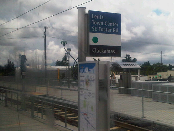
If you want to track down the spotlights yourself and see if you have better luck triggering them than I did, I came up with a list of locations from one of the RACC public art maps. They're only along the streetcar's NS line as it existed in 2004, so there's nothing on the Eastside or along the South Waterfront extension.

  1. SW 5th & Mill (platform spot)
  2. SW 4th & Montgomery (drinking fountain)
  3. SW Park & Market (tree knot)
  4. SW 10th & Mill (bench)
  5. SW 11th & Columbia (flower bed)
  6. SW 11th & Jefferson (tree)
  7. SW 10th & Yamhill (library bench)
  8. SW 11th & Yamhill (face in molding)
  9. SW 10th & Washington (manhole cover)
  10. NW 10th & Couch (manhole in sidewalk)
  11. NW 10th & Hoyt (downspout)
  12. NW 11th & Flanders (building vent)
  13. NW 11th & Irving (bench)
  14. NW 16th & Northrup (metal in asphalt)
  15. NW 21st & Northrup (word on back of building)

For extra credit, see this 2003 Mercury story on Fletcher's And Even More Everyday Sunshine, a photographic exhibit at the Multnomah County Department of Community Justice in downtown Portland. That was a decade ago, though, and it's probably long gone by now. I haven't worked up the nerve to go in and check.

Tuesday, November 19, 2013

He'eia State Park


[View Larger Map]

So here's another stop on the big bus ride around Oahu, this time from the windward (i.e. greener and wetter) side of the island. He'eia State Park is a bit of shoreline on Kane'ohe Bay, across the Ko'olau Range from Honolulu. The Ko'olaus look impossibly high and rugged from the windward side, and it's hard to believe the highest point is only around 3100 feet. I stopped here for the scenery, but the park also offers kayak rentals, snorkeling, and a large rentable meeting hall that seems to be a popular local wedding spot.

In a few of these photos you'll see what looks like a sort of breakwater or seawall structure out in the bay. This is the wall of the He'eia fishpond, an ancient aquaculture structure built by native Hawaiians an estimated 600-800 years ago. Fishponds were a common form of food production then, but many fell into disrepair after Western contact. The He'eia fishpond has seen restoration efforts, though invasive species are still a problem, and the environment here is the subject of ongoing research. A nonprofit organization now manages it in conjunction with the landowner, the omnipresent Kamehameha Schools / Bishop Estate. They offer tours, but I'm not sure you can just show up unannounced and wander around taking photos; I couldn't find a trail over to the fishpond, so I don't really know one way or the other.

Monday, November 18, 2013

autumn fog

semi-scenic seattle

A few Instagram photos from a quick trip to Seattle last weekend. I ended up staying at a chain hotel on Aurora Avenue, a few miles north of the big bridge over Lake Union, vaguely near where the funeral was at. As you can see in the top photo, it's not exactly the most scenic part of town.

The hotel offered a strange ironing board with the iron permanently attached, I suppose to prevent people from stealing the iron or something. I'd never seen this before. Is this new, or have I been staying in the right sort of hotel all this time?

These quibbles aside, it's a fantastic location, because there's an Ivar's just two blocks south, on the far side of a giant Sam's Club. It would've been easily walkable if the weather hadn't been so terrible. It's not the one on the Seattle waterfront, of course, but the fish and chowder are the same, which is the main thing.