Saturday, December 07, 2013

Tall and Fallen

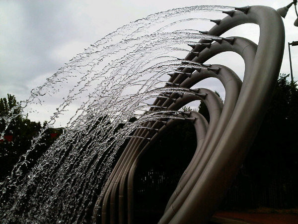
Back in the naïve, low-tech days of yore (mid-2010), I'd just gotten a shiny new Blackberry phone, one with both a camera and a Twitter app, and I was pretty stoked about living in the future. The MAX Green Line was less than a year old then and I hadn't yet ridden it to the end at Clackamas Town Center, so one day I decided to make the trip and try this newfangled "live-Tweeting" thing I'd heard so much about. I even used the hashtag "#greenline", so, I guess, the entire world could follow my fearless expedition into Darkest Clackamas. Most of the photos I ended up with were of the new public art along the MAX line, although I wasn't really doing a public art blog project at the time. I think I was just trying to post at least one photo from each MAX station, without actually getting off the train, and the art seemed like a good way to tell the MAX stations apart.

In any case, I recently tracked these photos down in my old Twitpic account, and figured I could maybe reuse them here. None of them are that fabulous (though most are at least better than the one in this post), and if I was truly dedicated to this art project I really ought to go back, get off at each stop, and shoot some quality photos instead, and maybe hit the RAM Brewpub at the mall instead of grabbing tacos and tater tots at the food court like last time. But it's a rather long train ride just to get photos of things I already have photos of, and I'm positive it would be a long wait before I got around to it. Long story short, I'm going to go ahead and post with the photos I have, not with the ones I wish I had.

So this is one of the less successful photos of the series, from the SE Main St MAX station near Mall 205. If you look between the closing MAX doors and beyond the shelter you can see Tall and Fallen, the tall pillar with the jutting triangular bits. TriMet describes it:

The fan-shaped leaf of the ginkgo tree inspired Anne Storrs to create Tall and Fallen. Tall consists of seven abstracted ginkgo leaves cast in concrete and stacked inside four stainless steel poles. Fallen, constructed with the same leaves appearing singly or in pairs, suggests the gingko trees' fallen leaves.

I really do like this one, and I feel kind of bad my only photo of it is so terrible. The artist's web page about it has vastly better photos than mine, with a brief caption:

Inspired by the ancient ginkgo tree, this sculpture is created by stacking seven interlocking ginkgo-like concrete leaf forms in a stainless steel framework, 20’ x 3’ x 3’. More concrete ginkgo elements stacked singly or in pairs are found in the stations' landscape.

Looking around Storrs's website, I realized she also created Begin Again Corner, along the downtown Portland segment of the Green Line. I point this out because my photos in that post are actually pretty decent, in case you're wondering whether I ever take anything besides crappy camera phone shots.

If this was a professionally run blog on a platform less orphaned than Blogger, right about here is where you'd see a "Related Posts" or "You Might Also Enjoy" widget, with results probably generated by a simple keyword match, say on the word "ginkgo" for instance. In which case you'd see links to posts about ginkgo trees in the Plaza Blocks, and maybe the Ginkgo Petrified Forest in Eastern Washington, to pick two random examples with photos better than the one you see here. And if the algorithm looked at geotags, you might also get a link to Milestone P6, just north of Mall 205. Ok, there'd also be a "From Around The Web" section with links to crappy fad diets, celebrity news, anti-Obama rants, and bad investment advice, which is a big reason why I don't have a widget like that here.

Stone, Water and Heaven (Daedalus to Icarus)

Stone, Water and Heaven (Daedalus to Icarus) is one of a trio of Rose Quarter sculptures, along with Little Prince and Terra Incognita. This one is a bit more obscure than the other two, and is probably my favorite of the three. It's smaller, and sits at the corner of N. Winning Way & Center Court St. (and yes, those are stupid street names), streets that only see a lot of traffic on game days. I don't recall ever seeing it (or at least ever noticing it) before I tracked it down for this blog post. It's obscure enough that both the Smithsonian art db (the first link, above), and RACC call it by the wrong name, "Earth, Water and Heaven". The sign next to the piece says "Stone", not "Earth", as does an essay on the artist's website, which suggests to me that "Stone" is the correct name. Sadly (if we're going to be really pedantic about it), neither variation on the name includes an Oxford comma . Sigh.

RACC's description of the piece, wrong name and all:

Earth Water and Heaven (from Daedalus to Icarus), in contrast to the other two sculptures located in the Rose Quarter by Averbuch, is of moderate scale. It is also more quiet and meditative. This work deals with the dichotomy and integration of two different levels of meaning. One is the ring of stone and water tied in an everlasting balance of nature (rivers and mountains, oceans and continents). The other concept is about us as humans and our expressive aspirations for "heaven" represented by the image of a wing - an age-old icon that reappears in many cultures, describing our aspiration for greatness, fantasy and the supernatural. It is about the heroic feathers that we strive to have and that drive us further in life, about our aspirations that rise like the tower of Babylon, and about the actual gravity and balance of the earth that keeps us intact.

The artist's website also mentions a very similar 2003 piece, The Wing and the Ring, located at the city cultural center in Nahariya, Israel. The cultural center was built in the early 2000s and saw scandalous cost overruns, including all manner of lavish (and garish-sounding) furnishings.

Terra Incognita

At the east end of the Broadway Bridge is a sort of frontier fort-looking structure, guarding the northern approaches to the Rose Quarter area. It kind of looks like a children's play structure from a time before personal injury lawsuits, but it's actually Art. Terra Incognita is one of a trio of sculptures around the Rose Quarter, the others being Little Prince at the south end of the Rose Quarter, and the smaller Stone, Water and Heaven (which I haven't posted about yet), over toward the northeast corner of the district. RACC says of this one:

Terra Incognita is a massive gate-like sculpture at the foot of the Broadway Bridge. It forms a strong positive negative pattern of five cubes. The three lower cubes are bundles of tree trunks. In between these are two cubes made of piles of stone that are held in the air by the lower cubes. This work relates to its site in a broad context. It plays off the power of the natural landscape, the rivers, hillsides and mountains, as well as the power and scale of the man-made elements such as surrounding bridges and buildings. Averbuch felt that the dramatic relationship between wood and stone are appropriate for Portland. This sculpture has a feeling of fortification and frontier, elements the artist associates with Oregon.

I could be reading too much into it, but that description is phrased a bit oddly. It's as if they're gently pointing out the artist had some fanciful notions about our fair city. That is, we aren't actually a rugged Old West frontier city these days. We also weren't a frontier city back in 1995 when Terra Incognita went in, or at least it didn't seem that way at the time. The Old West may, however, be the one thing people outside the US know (or think they know) about Oregon, since we don't appear in the world's history books very often after 1859 or so. So when you ask someone from overseas (Israel in this case) to make something Oregon-themed, you could easily end up with something Western. Old West themes carry a lot of historical baggage around here, and the whole subject's been deeply unfashionable for several decades now, at least in the "serious" art world. You can probably still drive out to Bend or Joseph and pick up some bronze cowboy-n-Indian statues for your backyard, if you're into that sort of thing.

I suppose that's a danger when you insist your art has to somehow be "about" its location; you either hire artists from out of town and get headscratching stuff like this ( 'C" at Portland Public Art said of it "The first impression of the artwork is RACC (in 1995) was too cheap to mail Averbuch a Polaroid of the site." ); or you just hire locally and get a hundred variations on Heroic Salmon Swimming Upstream, or whatever the current fad happens to be.

Friday, December 06, 2013

Silicon Forest

Here are a few photos of Silicon Forest, the solar powered earth-o-licious tree structures at the Interstate/Rose Quarter MAX station. TriMet's Yellow Line art guide describes it:

Brian Borrello presents a three-part metaphor for displacement and change.
  • Illuminated metal trees generate their own electricity from solar panels.
  • A virtual campfire flickers with light at night, surrounded by stainless steel stump seats.
  • Light filtering through colored glass on shelter roofs simulates the dappled light of a forest.
  • Concrete tree rings in the platform symbolize the forest once abundant on the site.
  • Custom guardrails feature branching tree limbs and roots.

So it was created by the same guy who created People's Bike Library of Portland, and the blue ox feet at the Kenton MAX stop, and a number of other public art doodads around town that I haven't covered yet. Apparently he designed the entire MAX station, not just the trees, but I didn't realize that at the time and only have photos of the trees.

The usual idea with MAX station art, on any of the various MAX lines, is that it's supposed to be somehow inspired by or related to the surrounding neighborhood. I don't really envy the task here. Today it's just sports arenas and mass transit, and making MAX art about being a MAX hub might be too self-referential even for Portland. Until the early 1960s there was a thriving majority-black neighborhood here, before the bulldozers of urban renewal came and swept it away. That would be an obvious choice for a theme, but the excesses of urban renewal aren't exactly a happy, self-esteem-boosting topic, and TriMet probably wouldn't go for that. Maybe "metaphor for displacement and change" is an oblique reference to the area's history, I'm not really sure.

In any case, the name "Silicon Forest" has been a nickname for the Portland-area tech industry, coined (and trademarked) by Lattice Semiconductor in 1984 and swiftly adopted by local boosters, by analogy with "Silicon Valley". Though a proper pedantic engineer (such as, um, myself) would point out that the industry's westside office parks typically replaced farmland, not forests, technically. We do, at least, have a decent claim on the "Silicon" part of the name, since the design & initial manufacturing of Intel chips happens here. And the Trail Blazers (who play in the nearby Moda Center) are owned by a certain Microsoft mega-billionaire, and Microsoft products generally rely on said Intel chips. As far as I know that's the one tech industry connection to this particular spot in Portland.

Snowpocalypse 2013

Scenes from the snow day today. It doesn't rank among our top ten Snowpocalypses, to be brutally frank about it. It's no 2008 or 2007. It's not even a 2010. Still: Two cheers for (light & temporary) snow!

Little Prince

Some photos of Little Prince, the giant crown lying on its side in front of the Rose Garden Moda Center sports arena. The RACC page for it says:

The Little Prince is a partially buried copper crown located at the south end of the arena in the Rose Quarter. It is a piece about imagination, desires and aspirations, conquests and struggles. It is the job of the viewer to create the story that goes along with the crown. Is it a victory and position of honor waiting to be claimed, or is there another story? Only the viewer can say. Ilan's inspiration for this piece was the "Little Prince" by Antoine De Saint-Exupery, in particular, the first chapter where he talks about his drawing of a boa constrictor swallowing an elephant being misunderstood as a hat.

I have to say this crown really doesn't evoke The Little Prince for me. The baobab tree I saw recently did, but the crown seems to miss the point, somehow. I mean, it's been ages since I read the book, maybe there was a tipped-over crown in it that I've completely forgotten about, one that symbolized a key idea of the book, or was the focus of a major plot twist. I kind of doubt it though.

Legend has it that the crown will be tipped vertical if the Trail Blazers (who play at the, uh, Moda Center) ever win an NBA championship. It's been there since 1995 and we've never been in serious danger of finding out whether the legend's true or not. Some might argue that the tipped crown (or just the crown, period) brings bad mojo, sort of like the inverted trident logo the Seattle Mariners used to use. Others might argue that the Blazers have been cursed by the sports gods since 1984, when they chose not to draft Michael Jordan, picking the fragile, all-but-forgotten Sam Bowie instead, along the lines of the 84-year curse incurred by the Boston Red Sox when they traded Babe Ruth to the Yankees. On the bright side, if it's an 84 year curse, it won't be long until we're fully 1/4 of the way done with it. So there's that.

Speaking of baobab trees and such, it turns out there really is an asteroid B612, more or less: Asteroid 46610 Besixdouze, discovered in 1993 and named (I think) in 2002. The name is "B six twelve" in French, and the hexadecimal number B612 is 46610 in decimal. It was a cute idea, and why not? As of right now, there are over 380,000 asteroids whose orbits are known well enough to earn permanent ID numbers, and only 16,000 have been given actual names so far. Further off on a tangent, my first desktop PC at my first real cubicle-based job was named "\\Asteroid B612", which gave the IT department fits because of the space character in the name. I seem to recall that Windows versions after Windows 95 refused to let you create hostnames containing spaces. I could be wrong, I haven't tried it recently.

Friday, November 29, 2013

Lyon Arboretum


[View Larger Map]

Here's a slideshow of the University of Hawaii's Lyon Arboretum, at the uphill end of Oahu's Manoa Valley, next door to Manoa Falls. It's at the same city bus stop as Manoa Falls, so it's just as easy to get to: Ride bus #5 to the edge of suburbia, get off and walk uphill, and follow the signs. Or, of course, you can just drive there if you have a car, which I didn't. Then go to the little visitor center next to the parking lot, drop a few bucks in the donation box, and get a map. You're going to need the map, because you'll probably get lost. I did, briefly, and I almost never get lost. Having a map at least gets you un-lost eventually. There's mobile phone service around the visitor center -- some of the plants in the adjacent garden even have QR codes to scan for more information -- but cell service quickly fades out once you're in the forest, sadly preventing me from going on an Instagram rampage while wandering around, or from checking Google Maps while I was lost.

I'd love to be able to tell you all about all the tropical plants here, or at least about the ones I have photos of. The place is kind of overwhelming, though. I spent a couple of hours here and felt like I'd barely scratched the surface. I skipped most of the various side trails and took the main trail to the far end of the arboretum, trying to find the waterfall. Which is a different, and much smaller (and less impressive) waterfall than Manoa Falls. This seems to confuse visitors a lot. I had a group of Japanese tourists ask me for directions to Manoa Falls, and they were a bit crestfallen to find out they were in completely the wrong place. I gave them directions and later ran into them on the Manoa Falls trail, and they thanked me for pointing them in the right direction. So I felt like I'd done my good deed for the day.

It would be really easy to spend an entire day here, taking it slow and just wandering around looking at things and filling up a memory card with flower photos. Though I'd recommend taking the Manoa Falls trail too, for contrast. If you only visit the Lyon Arboretum, you might come away thinking this is what a regular Hawaiian rainforest looks like, and not realize how much selective planting and pruning and manicuring has gone into it.

Most plants aren't labeled, so knowing your way around tropical plants would enhance the experience, I'd imagine. I was surprised to learn that a heliconia is not quite the same thing as a banana plant, if that gives you some idea of my inexperience with tropical plants. The arboretum specializes in heliconias, ginger plants, palms, and bromeliads, among other things, so it wouldn't hurt at least know what those look like.

Two items of practical advice. First, there are mosquitoes. Wear DEET, or cross your fingers and try some supposed DEET alternative, or wear long pants & sleeves and hope for the best, whichever option you prefer. Second, it rains a lot here. 165 inches per year, or nearly half an inch per day, on average. The arboretum is just a few miles up the road from Waikiki and downtown Honolulu, but it's not unusual to have torrential rain here while it's sunny at the beach. Oahu microclimates are like that. At least the rain isn't cold, and individual storms don't seem to last long, so you can sort of work around the weather and explore between downpours.

chimney fountain (twitpics)

Chimney Fountain Chimney Fountain Chimney Fountain

lovejoy fountain (even more twitpics)

Lovejoy Fountain Lovejoy Fountain Lovejoy Fountain Lovejoy Fountain Lovejoy Fountain Lovejoy Fountain Lovejoy Fountain

keller fountain (more twitpics)

Keller Fountain Keller Fountain Keller Fountain Keller Fountain Keller Fountain Keller Fountain

carwash fountain (twitpics)

Carwash Fountain

Some old Twitpics from several years ago, back when having a phone that combined a camera and Twitter seemed like a magical new thing, full of artsy possibilities...

Updated 9/17/14: Except that they aren't Twitpics anymore, as Twitpic's shutting down in a few days. Sic transit gloria mundi, or something.

Carwash Fountain Carwash Fountain Carwash Fountain

MSL, 2 years ago

Two Black Fridays ago, I was in Florida for the launch of the Curiosity mars rover. I've posted launch photos, photos of the rocket, etc, before, but just recently I remembered I'd posted a series of phone photos on Yfrog as part of the tweeting component of the tweetup. I had to do a bit of searching to find my old Yfrog account, which I really haven't used since I upgraded to an Instagram-capable Android phone. So these were all taken with a rather subpar Blackberry camera, but they still sort of capture the spirit of the event.

Thursday, November 28, 2013

Vancouver Lake expedition


View Larger Map

Here's a slideshow from Vancouver's Vancouver Lake Park, mostly of the far side of the lake near where the road peters out. I always forget there's a lake this big in the Portland area. Partly because it's up in Vancouver, and partly because it's your basic Pacific Northwest wetland nature area, the same as everywhere else but larger, and with the ongoing water quality issues of a suburban lake. It's not exactly Crater Lake, is what I'm saying. These photos were taken back in 2007, the same "mini-roadtrip" week that I went to Crater Lake, which may be why posting these didn't seem like a high priority. I had actually forgotten I'd ever been to Vancouver Lake until I ran across these photos in an old iPhoto library recently.

Since my visit there wasn't particularly eventful, I think we'll just go ahead and dive into the Oregonian historical database instead. (If there was a database of the Vancouver Columbian newspaper, that would be even better, or at least more comprehensive, but as far as I know it's not available online.) Most of the news items in the database are fairly routine: Hunting and fishing reports, real estate ads, farming news, occasional drownings, that sort of thing. I tried to only include items that stood out from the crowd or seemed relevant to why today's lake is the way it is, so hopefully it's an interesting list, as far as these things go. The pattern that emerges over the last century or so is one of Vancouver looking west, seeing this big lake, and thinking it ought to be useful for something or other. One grand scheme after another was proposed and argued about endlessly, and yet in 2013 much of the lake and the surrounding area still looks like the back of beyond, even though it's right next to the city proper.

For clarity I've broken the news items out into pre-1965, 1965-1983, and post-1983 sections, for reasons that will be come clear after the jump.

Wednesday, November 27, 2013

Foster Botanical Garden


View Larger Map

Here's a slideshow from the Foster Botanical Garden in downtown Honolulu. It's a large slideshow because the place kind of fascinated me. I was expecting to see (and photograph) a lot of flowers, but this botanical garden is focused more on trees. Enormous tropical trees, a grove of palm trees of all descriptions, and a whole section of commercial trees that produce products you vaguely knew came from plants, including black pepper and various other spices. I enjoyed visiting because almost everything was unfamiliar, but I later ran across a blog post by someone who enjoyed it for exactly the opposite reason: Having grown up in Jamaica, many of the plants here brought back childhood memories.

I already knew the garden had a baobab tree, and that was actually a big reason I decided to visit. It's possible I'd read The Little Prince one too many times as a kid, but I was absurdly pleased to see a real live baobab tree. Being in the middle of a stand of coffee trees was ok too. I posted a couple of Instagram photos from the coffee thicket so people back home in the rainy and coffee-mad Northwest could see what it's like, but I think that may have elicited more jealousy than curiosity.

There's also a strychnine tree, believe it or not, set well back from the path so visitors can't just walk up to it and give it a hug or lick it or something. It occurred to me that a botanical garden in Hawaii, featuring a bunch of toxic plants, and run by elderly volunteer ladies-who-lunch, would be the ideal setting for a series of cozy murder mystery novels. It's probably been done already. I haven't checked.

The garden does have a greenhouse with orchids and other smaller plants. I seem to have just missed the blooming of a giant corpse flower (so named because of its disgusting odor). This is probably just as well, as far as I'm concerned.

Wednesday, November 20, 2013

More Everyday Sunshine

As a general rule of thumb, Portland's public art buyers don't usually go for conceptual stuff. Abstract stainless steel whatzits are still the safe choice here, made by the same usual suspects who've been making them since the 70s, and who will happily cobble together yet another one whenever a new public works project needs to burn its one percent for art. Our subject today is one of the few rare exceptions to the rule of thumb, one which made a quick cameo here in a post back in 2006:

... I've finally figured out something that's been puzzling me for months now. At several spots along the streetcar line, and at other locations in the Pearl, there are these motion-sensored spotlights with solar panels attached, aimed at the sidewalk. Sometimes they trigger and click on when you walk by, which can be a little surprising. There's one on SW 10th around Stark or Alder or Washington that clicks on and illuminates a manhole cover in the sidewalk. The first time I saw this it startled me. I thought it must be some sort of inexplicable homeland security measure or utility maintenance aid or something. Turns out the spotlights are part of an art installation titled More Everyday Sunshine, by Harrell Fletcher. It all makes sense now. I had a feeling it might be art, but it isn't labelled anywhere, and the equipment for each light is quite utilitarian, so it was hard to be sure.

I like the fact that the spotlights come with no signs or explanations attached, adding a touch of mystery to ordinary downtown streets. Knowing their purpose is like belonging to a secret society, without all the funny handshakes and world domination. The Tribune dug into this mystery in a 2007 Stumptown Stumper, which included a brief interview with their creator. The lights have also gotten a five-star Yelp review, oddly enough, which is possibly the Internet's only source of art criticism even less authoritative than the humble blog you're reading now. Elsewhere in the blogosphere (a word I haven't used in years, to be honest -- is there still a blogosphere?), More Everyday Sunshine is the nightcap on someone's tour of interesting Portland attractions and it gets a mention in a post at The Hallucinogenic Toreador that also covers murals from China's Cultural Revolution and a few of the author's ideas for future art projects.

This post took a while to create. At first I only had some daytime photos of the solar panels and lighting gear, which aren't very photogenic, and I had no pictures of it actually in operation. I felt this post couldn't go live with just the daytime photos, since I wasn't really capturing the essence of the thing that way, and I take that seriously for some reason. It's not that I wasn't trying to get proper nighttime photos, mind you. I wandered around a couple of times trying to get various spotlights to trigger, hopefully without arousing suspicion and getting tasered by Officer Friendly, or having to explain this quixotic internet quest to random Midwestern tourists who want to meet a real live Weird Portlander. I finally got a couple of spotlights to light up this evening, and I got a few photos, so this post could finally move forward. One photo shows an illuminated shrub outside an apartment building at 11th & Columbia, while another shows a pool of light on the sidewalk at 5th & Mill. Neither one is really all that spectacular, but I think they get the general idea across. I tried a few other spotlights but they wouldn't come on for me. So either some of the lights are out of order, or I just haven't figured out the secret trick to making them light up on command. The fact that a couple of them came on suggests that I'm probably not a vampire. So that's encouraging, at least; with my luck I'd end up as the sparkly sort of vampire, which would be embarrassing.

The RACC page for More Everyday Sunshine includes a detailed artist's statement:

As a kid I would go for walks with my father and he would point things out to me. He seemed interested in everything—an architectural detail, an old tree, a geological formation, a historical monument, an unusual shop or restaurant. Features otherwise hidden to me would be revealed and made significant while spending time with him.

Over the past eight years I have worked on projects exploring the dynamics of social spaces, communities, and environments. These projects have taken the form of installations, publications, educational activities, and public art pieces and have involved a variety of populations: middle school students in Oakland, office workers from the City of Richmond, local residents from the Sunset District in San Francisco, students living in dorms at the University of Washington, shoppers at a mall in Pleasanton, urban gardeners in the Mission District of San Francisco, among others.

My project for the Streetcar Alignment brings together my early memories of walks with my father, photography, and my involvement with community based art projects. To do this I will install a series of solar powered lights on motion sensors to literally highlight aspects of the neighborhoods that the streetcar will be running through. The units would be attached to pre-existing street car poles and operate from dusk to late evening. It’s evident that these neighborhoods already have cultural and aesthetic qualities that define them.

The idea draws strictly on what the various neighborhoods along the alignment already have—unusual architecture, old signs, specific trees, old fire hydrants and infrastructure, etc. I will choose several locations to just light a circular spot on the sidewalk that a person could walk into and for a moment stand out for their own visual or gestural significance. In a way, the lights would act as real time photographs of interesting aspects in Portland’s nighttime urban environment.

If you want to track down the spotlights yourself and see if you have better luck triggering them than I did, I came up with a list of locations from one of the RACC public art maps. They're only along the streetcar's NS line as it existed in 2004, so there's nothing on the Eastside or along the South Waterfront extension.

  1. SW 5th & Mill (platform spot)
  2. SW 4th & Montgomery (drinking fountain)
  3. SW Park & Market (tree knot)
  4. SW 10th & Mill (bench)
  5. SW 11th & Columbia (flower bed)
  6. SW 11th & Jefferson (tree)
  7. SW 10th & Yamhill (library bench)
  8. SW 11th & Yamhill (face in molding)
  9. SW 10th & Washington (manhole cover)
  10. NW 10th & Couch (manhole in sidewalk)
  11. NW 10th & Hoyt (downspout)
  12. NW 11th & Flanders (building vent)
  13. NW 11th & Irving (bench)
  14. NW 16th & Northrup (metal in asphalt)
  15. NW 21st & Northrup (word on back of building)

For extra credit, see this 2003 Mercury story on Fletcher's And Even More Everyday Sunshine, a photographic exhibit at the Multnomah County Department of Community Justice in downtown Portland. That was a decade ago, though, and it's probably long gone by now. I haven't worked up the nerve to go in and check.

Tuesday, November 19, 2013

He'eia State Park


[View Larger Map]

So here's another stop on the big bus ride around Oahu, this time from the windward (i.e. greener and wetter) side of the island. He'eia State Park is a bit of shoreline on Kane'ohe Bay, across the Ko'olau Range from Honolulu. The Ko'olaus look impossibly high and rugged from the windward side, and it's hard to believe the highest point is only around 3100 feet. I stopped here for the scenery, but the park also offers kayak rentals, snorkeling, and a large rentable meeting hall that seems to be a popular local wedding spot.

In a few of these photos you'll see what looks like a sort of breakwater or seawall structure out in the bay. This is the wall of the He'eia fishpond, an ancient aquaculture structure built by native Hawaiians an estimated 600-800 years ago. Fishponds were a common form of food production then, but many fell into disrepair after Western contact. The He'eia fishpond has seen restoration efforts, though invasive species are still a problem, and the environment here is the subject of ongoing research. A nonprofit organization now manages it in conjunction with the landowner, the omnipresent Kamehameha Schools / Bishop Estate. They offer tours, but I'm not sure you can just show up unannounced and wander around taking photos; I couldn't find a trail over to the fishpond, so I don't really know one way or the other.

Monday, November 18, 2013

autumn fog

semi-scenic seattle

A few Instagram photos from a quick trip to Seattle last weekend. I ended up staying at a chain hotel on Aurora Avenue, a few miles north of the big bridge over Lake Union, vaguely near where the funeral was at. As you can see in the top photo, it's not exactly the most scenic part of town.

The hotel offered a strange ironing board with the iron permanently attached, I suppose to prevent people from stealing the iron or something. I'd never seen this before. Is this new, or have I been staying in the right sort of hotel all this time?

These quibbles aside, it's a fantastic location, because there's an Ivar's just two blocks south, on the far side of a giant Sam's Club. It would've been easily walkable if the weather hadn't been so terrible. It's not the one on the Seattle waterfront, of course, but the fish and chowder are the same, which is the main thing.

Sunday, November 17, 2013

Logan Airport 9/11 Memorial


[View Larger Map]

When I was in Boston a while back, I spent a couple of nights at a hotel right at Logan Airport, a short skybridge trek from the main terminal. It turned out that the airport's 9/11 memorial was across the street, so I made a brief visit to it. Both of the planes that hit the World Trade Center towers took off from Logan Airport, and many of the passengers and crew aboard the planes were from Boston, so a memorial of some sort was obviously needed. But dealing with such a sensitive topic wouldn't be easy, and the local authorities didn't rush it. The memorial didn't open until 2008, and it's striking for how delicately, even gingerly, the memorial design treats its subject. I'm not sure I would have found it at all if my hotel hadn't been next to it. It's not in a place where airport visitors will stumble across it unexpectedly while going about their business. It has to be sought out deliberately. If you persevere and locate it, you'll see a landscaped plot with several paths, and a small glass cube set well back from the street. There's a small plaque indicating this is the memorial, and an inscription on the sidewalk refers obliquely to "the events of September 11th, 2001". The long winding paths aren't in any hurry to get you to the cube, and meander around the landscaped area. When you get to the cube, nothing about its exterior says "memorial" at all. Only once you're inside do you see the lists of names of those on the two flights. As you might imagine, the memorial's lightly visited. In the few days I was there, I didn't see a single person (other than myself) visit it.

Of course not everyone's a fan. It made a conspiracy site's list of the "Top 5 Worst 9/11 Memorials", which points out that this memorial strongly resembles an Apple store. I will allow that this is true. It's actually a decent list, and a couple of the others on the list are genuinely terrible. Although from the site's standpoint anything that doesn't say "false flag" probably counts as a bad memorial.

I started out thinking this was a strange memorial myself, and considered writing a snarky post complaining about it. Then I started thinking, ok, what would I have done differently, if somehow I'd gotten the job to design it? Would it be a better memorial if it didn't tiptoe around the subject quite so much? Maybe if it was somewhere in the airport where travelers -- who might be afraid of flying anyway -- could stumble across it and be surprised? If it was anything at all like the hideous 9/11 memorial in Portland that I griped about a few years ago? Well, no, none of the above. I get that it's a sensitive topic. This post sat around in Drafts for about a year, while I tried to figure out the right tone and the right timing. I didn't want to post it near 9/11 (since I've already said everything I ever want to about that day), or too close to any of our many military-themed holidays, and then I put it on extended hold after the Boston Marathon bombing so as not to seem exploitative. So like the actual designers, I'm pretty sure I would have erred on the side of endless trigger warnings and chances to back out, and the most understated and least graphic treatment I could pull off without seeming to downplay the "events". And I probably would have said "events".