Friday, December 28, 2012

spring, mojave desert

John Wilkie Rest Area, I-40
View Larger Map

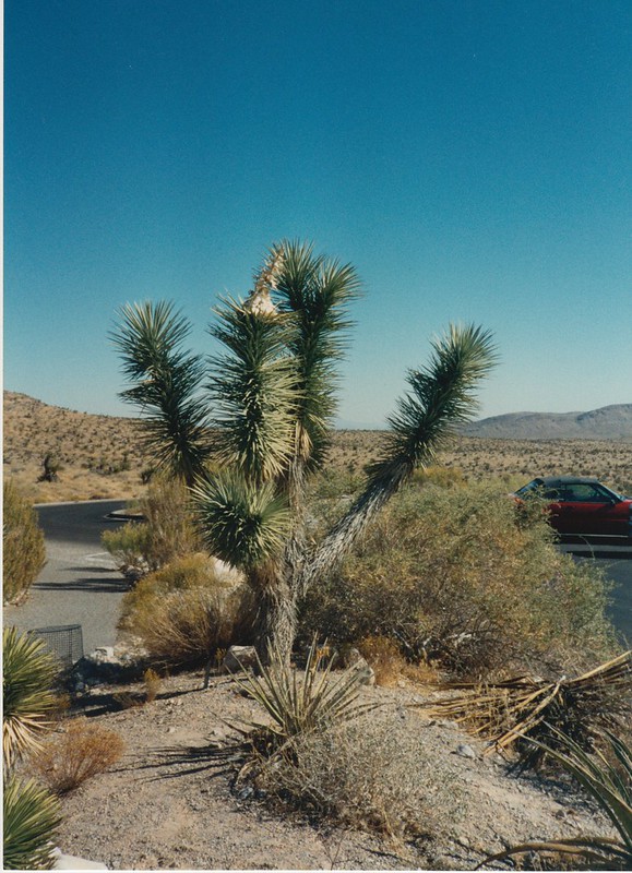
A few photos from the John Wilkie Rest Area, on I-40 near Fenner, CA, in the middle of the Mojave Desert. These were taken in early springtime, and many of the desert plants were flowering at the time. It's hard to tell in these photos since I wasn't really equipped to take close up photos back then, but the scenery was pretty striking and I figured these were worth posting even if you can't really see the flowers very well.

At the time I took these, I didn't make a note about where I was, so that took a little detective work. I rememberd this was at a rest area along I-40 in California, east of Barstow, and it turns out there are only two of those, so I fired up Google Street View and compared scenery with my photos. So I'm pretty sure this is the Wilkie rest area and not the other one, which is just a few miles outside of Barstow. I'd stayed the night in Barstow, so I can't imagine I would have pulled off the highway to take photos so soon after hitting the road for the day.

John Wilkie Rest Area, I-40 John Wilkie Rest Area, I-40 John Wilkie Rest Area, I-40 John Wilkie Rest Area, I-40 John Wilkie Rest Area, I-40 John Wilkie Rest Area, I-40 John Wilkie Rest Area, I-40 John Wilkie Rest Area, I-40

Little Colorado River Gorge

Little Colorado River Gorge
[View Larger Map]

Some photos of the Little Colorado River Gorge, which the Little Colorado River flows through on its way to the Grand Canyon. As you've probably gathered already from the photos, "little" is a relative term in this part of Arizona.

Little Colorado River Gorge Little Colorado River Gorge Little Colorado River Gorge Little Colorado River Gorge Little Colorado River Gorge Little Colorado River Gorge

Puʻukoholā Heiau

Pu'ukoholoa Heiau
View Larger Map

Old photos from Puʻukoholā Heiau National Historic Site, a ruined temple on the west coast of the Big Island of Hawaii. A video from Big Island TV shows a historical reenactment of ceremonies at the temple.

The park also includes an underwater temple dedicated to the shark gods. I didn't think to look for this at the time, but apparently they regularly swim just offshore, as seen in this YouTube video I came across.

Pu'ukoholoa Heiau

Please note that when a sign in Hawaii says "kapu" (i.e. "forbidden", and there are several such signs here), this is an actual no-trespassing sign, and they aren't just doing it to be cute.

Pu'ukoholoa Heiau Pu'ukoholoa Heiau Pu'ukoholoa Heiau

Sunset Crater

Sunset Crater
View Larger Map

A few photos of Sunset Crater National Monument, between Flagstaff, Arizona and the Grand Canyon. I stopped here sort of briefly after visiting the Wupatki ruins; I can see how it would be fascinating to visitors from a less volcanic part of the country, who may have never seen a cinder cone before. I took a few photos of it, and a few of the snowy San Francisco Peaks in the distance, before moving on to the next adventure.

Sunset Crater Sunset Crater Sunset Crater Sunset Crater Sunset Crater

Cochise Stronghold

Cochise Stronghold
[View Larger Map]

Photos from the Cochise Stronghold area of southern Arizona's Coronado National Forest. Spent an afternoon here scrambling around on rocks and trying, unsuccessfully, to take photos of the local fast-moving lizards. So here are some photos of the area's rugged hills instead; they aren't cute like lizards are, but at least they generally hold still for the camera.

Cochise Stronghold Cochise Stronghold Cochise Stronghold Cochise Stronghold Cochise Stronghold Cochise Stronghold Cochise Stronghold Cochise Stronghold Cochise Stronghold

Hoover Dam


View Larger Map

Photos of Hoover Dam, taken several years ago before the new bridge opened. I took these earlier on the same day I went to Red Rock Canyon, over on the other side of Vegas, and failed to take any photos of the city itself. In any case, the dam looks kind of cool in an Art Deco sort of way, and the hydropower keeps the lights on in Vegas, although the dam's turned out to be not so fabulous from an environmental standpoint.

As with Red Rocks, I'm pretty sure I need to go back and take some photos with a Real Camera, and in this case I also need photos of the bridge. And by "need", I mean it would be a logical extension of this weird ongoing photoblog hobby I've ended up with.

Hoover Dam Hoover Dam Hoover Dam

Borrego Palm Canyon


View Larger Map

Some photos of Borrego Palm Canyon, part of California's enormous Anza-Borrego Desert State Park. The surrounding area is nothing but dry, barren rocky hills, and then you come to this one little canyon with a stream running through it, its banks lined with palm trees, and it's shady and relatively cool. It's quite a pleasant oasis, even when it's full of tourists. Which it often is since there's a state park campground and a large parking lot nearby. Despite all that, it still kind of feels like you've stumbled across a secret oasis in the desert.

Borrego Palm Canyon

These are California fan palm trees, the only palm species native to the western USA. Palm trees are iconic in Southern California, but ornamental palm trees are often imports like the Canary Island date palm. Even California's native palm species isn't indigenous to the Los Angeles area; several years ago the city council decided that ornamental palm trees are undesirable, and the city plans to replace most of them with other trees that provide more shade and less mess. Except for major tourist areas, of course, because tourists demand palm trees.

Borrego Palm Canyon Borrego Palm Canyon Borrego Palm Canyon Borrego Palm Canyon

Red Rock Canyon


View Larger Map

A few photos from Red Rock Canyon, at the western edge of suburban Las Vegas. This is the dramatic and colorful bit of rugged scenery you often see while flying in to McCarran. These photos, though, were taken the first time I visited Vegas, while travelling on a sort of hippie tour bus, which seemed like a great idea at the time. I was a bit self-righteous back then and turned up my nose at Vegas itself -- an opinion I've long since been cured of -- and I took no photos of the city. In retrospect I wish I'd done that, since the place has changed dramatically since the early 1990s, and it's be fun to see what it used to be like. But hey, those were the days of film photography, 36 shots per roll at best, and I wasn't exactly rolling in dough at the time.

Red Rock Canyon

In any case, the tour bus spent an afternoon here and we hiked around a bit. My recollection is that the place was more interesting to photograph than it was to hike at. I keep meaning to go back with a Real Camera, but I somehow haven't gotten around to it yet. The Clark County bus system ends just short of Red Rock Canyon, and I never seem to end up renting a car when I'm in town. So maybe next time. Still, I think a few of these shots turned out ok even though I had a lame camera and had no idea what I was doing. Most of the credit here goes to the scenery, not to me.

Red Rock Canyon Red Rock Canyon Red Rock Canyon Red Rock Canyon Red Rock Canyon