Friday, December 28, 2012

Wupatki

Wupatki
View Larger Map

A few old photos from Wupatki National Monument, which protects a number of pueblo ruins just south of the Grand Canyon. When I visited, I was amazed by how well-preserved the ruins were; only later did I find out that some parts really were intact, and others had been reconstructed in the early 20th century. So I'm not entirely sure what we're looking at here.

Wupatki

There weren't a lot of other visitors while I was there; at one point, it was just myself and an older lady of a New Agey sort of persuasion. We chatted briefly, but it was obvious we were each getting something entirely different from being here. She said the ruins were a "power center", or something along those lines. I recall saying something inarticulate about the incredible age of the buildings and how well they were constructed. Which is pretty much what I'd say now, come to think of it. I mean, most of these ruins were houses, and a 700 year old house is exactly as mystical (or non-mystical) as a year old house is. Pretty sure that building here didn't require any help from crystal aliens or psychic dolphins or anything.

Wupatki

The archaeology of the desert Southwest is not really my forte, so rather than trying to explain the history of the place, let me just pass along a few links if you'd like to learn more about it. Several of these pages are hosted at Northern Arizona University, which is just down the road in Flagstaff.

Wupatki Wupatki

Fog, Tehachapi Pass

Tehachapi Pass
[View Larger Map]

A few old photos from Tehachapi Pass, in southern California. I drove through on a cold, foggy winter day, and the effect was quite spooky. Looking at the photos I ended up with, I think I failed to capture just how spooky it was. But in my defense, this was years ago, and I had a crappy film camera. Plus I was kind of busy driving a giant Ryder truck just then. I probably shouldn't have taken any photos at all, come to think of it, but it seemed like a good idea at the time.

Tehachapi Pass

One thing I didn't get any photos of was the famous wind farm in the pass. Giant windmills spinning silently in the fog may have been the spookiest part of the whole episode, but (as you might imagine) it was a bit windy at that point, so I had both hands firmly attached to the steering wheel, for a change.

Tehachapi Pass Tehachapi Pass Tehachapi Pass

Hanauma Bay

Hanauma Bay
[View Larger Map]

Some photos from Hanauma Bay Nature Preserve, on the island of Oahu, east of Honolulu. It's a popular spot for snorkeling, which we attempted to learn by doing, with mixed success. We did have the foresight to buy a waterproof single-use camera, which is how I took the photos you see here. The camera supposedly used special film that captured underwater scenes better; I'm still not sure what that meant, since this is the only time I've heard of special underwater film. It's possible our photo processor back at home bungled the job, since even the above-water shots came out an undersea blue sort of color, which I think is the exact opposite effect from what you'd want an undersea camera to do.

Hanauma Bay

This was the second time I'd been to Hanauma Bay. The previous time, when I was about 14, we were visiting relatives who lived nearby at the time. They taught us their little secret about the place, which was that the bay's fish absolutely loved eating frozen peas. We brought several bags of frozen peas and had a great time tossing them in the water, creating a feeding frenzy we were standing right in the middle of. This practice, and any other fish-feeding secrets you might come across, are now highly illegal, and rightly so. So just don't.

Gentle Reader(s) of roughly my parents' age may remember Hanauma Bay as the setting of the 1961 Elvis Presley film "Blue Hawaii":

Hanauma Bay

Since our attempt at snorkeling-by-guessing didn't go so well, most of these photos were taken by sticking the camera underwater and hoping it was pointed at a fish or two. This worked out ok surprisingly often, but not always. I've included a few shots of nothing but blue water, on the idea (or hope) that they might count as cool and abstract rather than crappy. I've studied just enough art theory that I can no longer reliably distinguish between the two, so I figured I'd toss them out there in case it turns out they don't totally suck.

Hanauma Bay Hanauma Bay Hanauma Bay Hanauma Bay Hanauma Bay Hanauma Bay Hanauma Bay Hanauma Bay Hanauma Bay

Wednesday, December 26, 2012

Cedar Mill Falls


[View Larger Map]

A slideshow from Cedar Mill Falls, a small-ish waterfall (roughly 32 feet high) cleverly concealed in Portland's western suburbs, at the intersection of NW 119th Avenue & Cornell. Cornell crosses Cedar Mill Creek just east of that intersection, and the falls are right on the south side of Cornell. These photos were taken from the sidewalk on Cornell, if that gives you any idea. Yet somehow the falls aren't visible when you're driving by on Cornell. I've done that fairly regularly for a long time, and I never knew there was a waterfall here until I stumbled across it in someone's database of northwest waterfalls. Initially I was skeptical, since I've seen the gentle ripples at Marshall Park described as waterfalls too, which is quite an exaggeration. The land's only been under public ownership since 2005 or so, and improvements for public access are only just starting to happen, which is probably why the place has such a low profile.

There's a boardwalk under construction which should eventually give a closer view of the falls. I can't find a current ETA on when it's supposed to be open; it's been delayed for years due to various permit tangles and financial issues and so forth, so they may have just stopped announcing completion dates at this point. It looks nearly done though, so I can't imagine it will be longer than next spring or so.

Just west of the falls is the historic 1869 house of John Quincy Adams Young, who built a cedar mill at this location, thus naming the area, as well as the creek and the waterfall. The house needs restoration and isn't open to the public yet, so there isn't a lot to see. Even in its current state, it's still kind of fascinating to see this one single pioneer-era house sandwiched in among contemporary parking lots and subdivisions and chain stores.

The creek passes under Cornell on what's marked as the "Larry Vincent Memorial Bridge". A 1981 Oregonian article tells the story: Vincent was 15 and a promising middle school cross country runner when he died in a truck accident in Eastern Oregon. His father, a landscape architect, was already involved in pedestrian improvements to the Cedar Mill neighborhood. After his son's death, he designed the footbridge at the falls as a living memorial to his son.

What Cedar Mill Falls lacks in sheer size it makes up for in convenience. The weather in the Columbia Gorge tends to be really awful in the winter, and it's kind of a long drive even when the weather's nice. In contrast, Cedar Mill Falls is right on a main road, in an inner suburban part of town. There's a church parking lot just west of the Young house. I parked there, briefly, while taking these photos. I didn't see any signs threatening to tow people who weren't there on church business, so you may be ok parking there too. Alternately, there are TriMet bus stops right at the intersection with NW 119th, so you could just take bus 47 or 48 to the falls if you prefer. The eastbound stop has Stop ID #1200, and the westbound one is #1201, if that helps at all.

Monday, December 24, 2012

Bunker HIll Monument


View Larger Map

Photos of, and from, the Bunker Hill Monument, in the historic Charlestown neighborhood of Boston, across the Charles River from downtown. I'd wandered across the river to see the USS Constitution, and decided I'd take in the Bunker Hill Monument while I was in the area. I was mostly interested in taking photos from an elevated location so I'd have some semi-panoramic shots of the city, and I'm surprised how few pics I took of the outside of the monument. It's your basic obelisk, along the lines of the Washington Monument, but it's a bit shorter and wider and projects a sense of extreme solidness. I don't know if that was intended to represent the spirit of the hill's doomed defenders, but it succeeds in doing that.

For those of you who slept through Revolutionary War trivia, this spot, the site of the famous battle, is actually Breed's Hill, not nearby Bunker Hill. The confusion started almost immediately and there's no disentangling it now. I just thought I'd pass this bit of trivia along because it's a favorite of annoying history pedants, and now you're either armed against such people, or armed to become one of them, whichever you prefer.

Honestly though, I'm more intrigued by the engineering aspects of the monument than about the battle it commemorates. It was completed in 1843, less than 70 years after the battle, which -- speaking as a West Coast native here -- makes it absurdly old for what it is. One of the nation's first railroads was constructed just to transport the monument's huge granite blocks. Inside, there's a 294 step spiral staircase to the top, which like the exterior gives a feeling of extreme solidness. In that respect the contrast with Oregon's Astoria Column couldn't be greater. I was embarrassingly tired once I reached the top. The windows aren't that great, but I got the photos I came for. Eventually I took the stairs back down, which was obviously a lot easier, and wandered off to find the nearest brewpub, which Boston has a few of. Mmmm... beer...

Terry Schrunk Plaza


View Larger Map

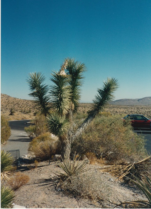
An accumulation of photos from Terry Schrunk Plaza, on 3rd avenue downtown across from the federal building. It's next door to the Plaza Blocks (Chapman and Lownsdale Squares) and looks like just another city park. But it turns out to be federal property, as it sits on top of the federal building's parking garage. More precisely, the park belongs to the General Services Administration's Public Buildings Service, and it's policed by the Federal Protective Service, part of the Homeland Security department. It would be interesting to see a list of GSA-run parks across the country, but so far I haven't encountered one.

The city vs. federal distinction usually doesn't matter a lot, but it came up during last year's Occupy Portland protests. The city temporarily tolerated campers in the two Plaza Blocks, but the feds absolutely prohibited anyone from camping overnight in Terry Schrunk Plaza, and people who tried were swiftly evicted.

This is a role reversal from the late, lamented pre-9/11 era, when the park was actually a favored spot for political rallies and marches. I'm not sure whether that was due to more lenient federal rules about protests, or just because the park's bowl amphitheater was a good place for speakers with megaphones.

The city vs. federal confusion is furthered by the fact that the park's named for a Portland mayor. And not just any mayor, but one who was investigated (but never indicted) by the feds on corruption charges. I suppose this is the sort of thing one does in this city, purely for the irony points.

The park also contains a display from Suzhou, China, a Portland sister city, which features a large Taihu rock. Prior to the rock's arrival, the park used to host the city's Liberty Bell replica, which now sits at the 4th Avenue entrance to city hall, just across the street. Incidentally, the current bell replaces a previous one that was destroyed in the still-unsolved 1970 Liberty Bell bombing.

Of a more Federal nature, the park has a very small plaque honoring Vietnam veterans, erected in 1974 when putting up a memorial of any size would have been rather unpopular here. (Although that was the same year the Hollywood District's veterans memorial flagpole went up.) There's also an Oklahoma City bombing memorial inscribed on stone from the Murrah federal building, and a very small memorial along with a tree honoring a few federal law enforcement officers who died in the line of duty.

The park actually opened in 1975, so I'm not sure whether the Vietnam plaque was moved from somewhere else, or whether it was added during construction. The Oregonian published an artist's conception for "Federal Plaza" as early as 1972, so it's possible there were construction delays. According to that image, even though it was the 1970s, and it certainly looks the part, the park's amphitheater was never intended to serve as a groovy federal jacuzzi. Although that's an urban legend I'd really like to spread around, if you feel like helping me out here. The park got its first big test less than a year after opening when it hosted a huge (for the time) Jimmy Carter campaign rally.

A very utilitarian sign gives the official name as "Terry Schrunk Federal Plaza", and instructs the viewer to contact Homeland Security's "Denver MegaCenter" about any security concerns. That page insists said MegaCenter is simply an alarm-monitoring facility. Maybe that's really all it is, and they picked a strange Orwellian-sounding name just because someone thought it sounded cool. Maybe if your project doesn't sound scary it doesn't get funded. Dunno.

On a more cheerful note, the park does have some great flowers in the springtime. The area around the amphitheater includes a stand of flowering cherry trees, and the southern end of the park is full of enormous rhododendron and azalea bushes. I have a few photos of each here, and I'm fairly certain that a lot of photos posted under artsy yet generic names like "azaleas (white)" or "april rhododendrons (iii)" were actually taken here, but I only took close ups and neglected to keep track of where they were from. Oh well. If I take more next year and remember where they're from, and upload them to the right Flickr photoset, they'll automatically show up in the slideshow you see above. Unless you're an iOS user or otherwise don't have Flash installed for some reason, in which case you're out of luck, at least until Flickr's Yahoo overlords catch wind of this shiny new HTML5 thing the cool kids keep talking about. That may take years, and then I'd probably have to go back and fix all the slideshows in all my old posts, which could take additional months depending on how motivated I'm feeling about it.

Pics: Downtown Tacoma


View Larger Map

A set of photos from downtown Tacoma, WA, which is full of old, historic, and often empty buildings. I took these photos several years ago and uploaded the set a while back, but never got around to creating a post around them. In large part this is because I don't know anything about any of the buildings you see here. I actually spent much of my childhood in Federal Way, just north of Tacoma, but as far as I can recall we never went anywhere near Tacoma's downtown. Nor do I recall going there at any point between then and the day I showed up with a digital camera. Nothing looked remotely familiar when I stopped by, which is actually a pretty reliable indicator. In any case, the first couple of links above have some info about the city's historic buildings, so you might want to follow those if you see anything interesting in the slideshow here.

There's one other structure I'd like to mention here, which isn't pictured because the city never managed to build it. Back in the mid-1990s, a pair of Russian "paper architects" were asked to design a pedestrian bridge connecting downtown Tacoma with the waterfront, far below. They came up with a fanciful wooden pier-like structure that quickly became a cause celebrƩ in town. Which, unfortunately, was not the same thing as having actual funding for the project. It was around this time that the Portland Art Museum hosted a show of their designs, Brodsky & Utkin: Paper Architecture in a Real World. Based on those designs it's hard to say how realistic, by which I mean buildable under the usual laws of physics, their Tacoma proposal may have been. Was still a cool idea though.

Sculpture Stage

Photos of Sculpture Stage, the stainless steel wall thingy in Waterfront Park, near the Saturday Market canopy & the new Naito Fountain. If you're like me, you may not have realized it's supposed to be art at all. It's by the same guy behind Land Form in Lair Hill Park. Both pieces date to about the same era, although there isn't an obvious resemblance between the two. For more about all that, I'll just point you to a snarky Portland Public Art post about the guy's various works around town.

Sculpture Stage

None of the links above mention this, but the piece adorns an outer wall of an old (but still operating) sewage pumping station. The station is in the middle of an inconveniently well-touristed area, so there's kind of a social convention to not see it and to pretend it's not there. You'd think the arts community would be less squeamish about this sort of thing, but it's still Portland, after all, not Paris, and the oddest things make us squeamish.

Sculpture Stage Sculpture Stage Sculpture Stage Sculpture Stage

Ya - Wa

Some photos of Ya-Wa, the sculpture at the entrance to the ODS Tower in downtown Portland. It's the pair of dead trees shackled to the building on both sides of the front door. Looks inspiring, huh?

I mentioned this one briefly, without photos, in a post wayyy back in January 2006, on a day I was feeling a bit snarky. This was apparently before the thing had been given a name, or at least before I knew what the name was:

  • "Untitled", at the ODS Tower, in which Judy Pfaff went all Abu Ghraib on a poor innocent tree. This is the best pic I could find. Most pics of the ODS Tower don't show the tree, and for good reason. Depressing and authoritarian as anything you've ever seen. Manages to surpass the "best" works of the most hardcore 60's brutalists, and gets extra brutalism points for incorporating an actual dead organism, instead of just working in grey concrete and rusting steel like in the old days. Someone should convince Dick Cheney to buy this thing and take it off our hands. It's right up his alley. On top of everything else, the artist couldn't even think of a name for the thing.
  • The name now is just an indian phrase for "there it is", which is barely a name if you ask me. Anyway, I'm not sure I'd be quite that harsh about it today; it's just art, and it's not even publicly-funded art, and I'm also not an ODS customer. So the only real stake I have in the matter is that my office is nearby, and I have to look at Ya-Wa a lot, and it depresses me. A brief mention of the piece in a post at Portland Public Art seems to blame the site rather than the art itself. I can see a reasonable argument there; the ODS Tower (sometimes nicknamed the "Odious Tower") is a seriously unimpressive chunk of architecture. And the other works featured on the artist's website aren't bad. So sure, I'm willing to spread the blame around a bit. Still don't like it though, regardless of whose fault it is.

    Ya - Wa Ya - Wa Ya - Wa

    Friendship Circle

    Some photos of Friendship Circle, the sculpture at the far north end of Portland's Waterfront Park. It's yet another local piece by Lee Kelly, the guy behind Leland One (aka Rusting Chunks No. 5), this time in collaboration with a composer. The sculpture commemorates Portland's longstanding sister city relationship with Sapporo, Japan, and it (supposedly) plays a 35 minute musical piece we're told was inspired by Asian temple music. As far as I can recall I've never actually heard this music, and I've been around the thing more than a few times. So all I can really say is that multiple sources insist it does this from time to time.

    Friendship Circle

    If you're looking at it and thinking, jeebus, this is one phallic-looking piece of art, you'll be pleased to know you aren't alone. The blog Culture Shock compiled a list of sorta-suggestive public artworks back in 2009, and this is #2 on the list. Also listed are Pod, aka "Satan's Testicle", Tikitotmoniki from the Pearl District, and Stack Stalk reppin' for the eastside. We've probably acquired a few more of these bad boys since that post went up, given that public art commissions still mostly go to male artists.

    Friendship Circle Friendship Circle Friendship Circle

    Ascension

    A couple of photos of Ascension, the series of ladder sculptures at the 1st Avenue side of Fire Station #1, near the Burnside Bridge in downtown Portland. The RACC public art database describes it:

    The ladders symbolize the direct connection between the buildings, the firefighters and equipment used to protect them. Not only do they function as a symbol of the fire bureau, but also as an abstract representation of striving and accomplishment. Together the ladders and columns tell a story of the past and how the present we continue to revere such goals and achievements.

    It's maybe not the most eye-catching artwork in town, and so far I haven't come across any mentions of it on the interwebs other than various maps and public art inventories. So I don't have much to pass along on that point. I did come across an interview with the artist, who explains that he got sick of dealing with bureaucracy and has moved on from seeking new public art commissions.

    Ascension

    Curiously, an image search turned up a completely different sculpture of a ladder, titled AscensiĆ³n. This one's by the Cuban artist Ernesto RancaƱo, and is covered in thorns for reasons the article about him doesn't explain. A piece at ARTslant comments about it:

    RancaƱo’s work also can be very aggressive. Ascension 2006 shows a white ladder with a thousand spiny protrusions that will slow, if not thwart altogether any inclination to ascend. Strangely, viewers are beckoned to climb.

    Pretty sure that would never fly as a public art piece, not in this country anyway. Because lawyers. Also, concerned parents.

    Ascension Ascension

    Wednesday, December 19, 2012

    rust, tanner springs

    rust, tanner springs rust, tanner springs rust, tanner springs

    moss, hawthorne bridge

    moss, hawthorne bridge moss, hawthorne bridge moss, hawthorne bridge moss, hawthorne bridge moss, hawthorne bridge moss, hawthorne bridge

    Old North Bridge


    View Larger Map

    Photos of the Old North Bridge in Concord, Massachusetts, site of the opening battle of the Revolutionary War. Gentle Reader(s) of a certain age might recall the Schoolhouse Rock version:

    That, along with all the time spent on the actual Revolutionary War in grade school history class, left me with certain expectations about the place. I'd read that it was a small bridge over a very small river, but somehow it was still smaller than I'd expected. It's an attractive location, though. Tranquil. Bucolic, even. Which is surprising considering that this is essentially part of suburban Boston. I was in the area for a technology conference back in July, and was staying a couple of miles north and east of Concord, and that area was just generic suburbia, with endless malls and fast food chains and subdivisions. Somehow the Concord area managed to avoid that sort of suburban sprawl.

    You might have noticed that the bridge doesn't appear to be particularly old. And you would be correct. A Concord Magazine article explains: There were bridges here long before the Revolution, which washed out due to flooding every few years and had to be replaced periodically. The historic> Old North Bridge fell into disrepair and was demolished shortly after the Revolution, and after that there was no bridge here until a replica was built for the centennial of the battle in 1875. It's been replaced a few times since then, more than once due to flooding. The current bridge was built in 1956 and restored in 2005. Much of the wood looks new. You wouldn't know it was a historic site at all if the 19th century monuments at either end weren't there.

    I suppose this counts as a blog post about a bridge, and over time I've developed a few conventions for those that are probably of no possible interest to anyone but myself. The first couple of posts had titles along the lines of "How to walk bridge X and not die", since several of them were and are scary for pedestrians. Since then I've taken to adding a "not dying" angle to a lot of bridge posts, except for the ones where I forgot or couldn't think of one. It's usually a bit of a stretch, to put it mildly. I can think of a couple of boring possibilities here, but what I'd really like to warn you about today is the danger of randomly travelling back in time to exactly the wrong day, while wearing a red coat or other brightly colored apparel. Because, y'know, mistaken identity.

    fountain, benson tower


    View Larger Map

    Some unremarkable photos of the fountain in front of the Benson Tower condo building in downtown Portland. Water features like this are actually kind of rare downtown; usually developers elect to put in retail space instead. So when I was putting together a list of downtown fountains, this one came to mind and I put it on a todo list as a definite maybe. I'm rather bad at removing things from todo lists even when they don't turn out to be that spectacular in real life (like this one), so I figured I might as well go ahead and do the post anyway.

    Fountain, Benson Tower

    The Benson Tower is so named because it used to be home to the historic Simon Benson House, which was moved to the Portland State campus a few years ago to make room for this shiny new condo tower. I mention this because I came across someone's old photo of the house at its original location, probably taken sometime in the late 1980s or early 1990s, around the time I was going to PSU. As you can see, the house was a ramshackle gothic horror at the time, and I'm still surprised they were able to move it without it crumbling into dust or exposing a hellmouth or something.

    Also pictured is the late, lamented TeleCafe, a tiny, literally hole-in-the-wall coffee joint, (sorta-)famed for having a real, live land-line telephone on every table. Which would actually be way more exotic and ironic now than it was then. I don't recall whether the coffee was any good or not. At some point in the 90s it changed hands and became something like "Bag End" or "Hobbit Hole" or something along those lines. It's just as well the condo builders came, in a way, since the owners of the Hobbit trademark are legendarily sue-happy, especially now that Part I of the huge Hollywood big-budget movie version is out now.

    The shiny new and relocated edition of the house is home to the PSU alumni association and has no room for a disreputable semi-underground coffee house. Here's another photo, this one showing the vacant lot before the Benson Tower went in. The Tip Top Cleaners building in the background was also demolished to make room for condos; I have no particular memories of it, except that I seem to recall it had a cool retro neon sign out front. FWIW.

    Fountain, Benson Tower Fountain, Benson Tower Fountain, Benson Tower Fountain, Benson Tower