Tuesday, September 28, 2010

Crystal Pool Falls

So here's another set of waterfall photos from McDowell Creek County Park, down in Linn County near Sweet Home. Crystal Pool Falls is not the main event at the park; I think it's about third highest of the four in the park, and there wasn't a well-maintained path to get close to the falls, nor was there a good place to set up my mini-tripod. And as I mentioned in my Royal Terrace Falls post, I visited at the wrong time of year and at the wrong time of day, so there wasn't enough water and the light was all wrong. In short, yeah, I already know these photos aren't so fabulous.

Crystal Pool Falls, McDowell Creek

So, as before, I'll be happy to point you at a few quality photos of the falls, from pdxrose, Jeff Fennell, Just Peachy!, Konejita, and LiefPhotos. Enjoy!

Crystal Pool Falls, McDowell Creek

Crystal Pool Falls, McDowell Creek

Crystal Pool Falls, McDowell Creek

Crystal Pool Falls, McDowell Creek

Crystal Pool Falls, McDowell Creek

Thursday, September 23, 2010

Benchmark Zero

If you go to Lownsdale Square in downtown Portland and look closely around the base of the old Spanish-American War monument, you'll eventually come across the tiny metal disk pictured above. You might have seen disks like it around town before; like the others, this disk is a surveying benchmark. Benchmarks are altitude references, basically adding a vertical dimension to go along with the latitude & longitude info provided by milestones and such.

The benchmark in Lownsdale Square isn't just a random one I bumped into. It reads "Initial Class A Benchmark No. 00", which seems to indicate that it's the fundamental datum that the others in town are measured relative to. Which is actually a bit confusing, since the city's history page about benchmarks mentions a different location, part of a building at the SW corner of Front & Washington. So I'm not sure how to explain the discrepancy here. I'll update this post if I happen to learn the answer.

In any case, the City of Portland has one system of benchmarks, and the city also has benchmarks for various nationwide systems as well. For example, contrast this benchmark with the one at the top of Elk Rock, which was emplaced by the US Coast & Geodetic Survey (now the National Geodetic Survey) rather than the City. For info on what all the markings on the latter disk represent, this forum thread seems to discuss them rather exhaustively. Coincidentally, it seems that Elk Rock tops out at almost exactly 200 feet above the height of benchmark 0 if I'm understanding things correctly. Benchmark 0 is 56.667 feet above sea level, while the one at Elk Rock is 257 feet.

PortlandMaps has a layer that shows both extant and missing benchmarks. This map shows the vicinity of benchmark no. 00, with five more extant ones and two missing ones within a 3 block radius. The Transportation Bureau offers a separate benchmark locator that can search by various criteria, including street name, benchmark number, and section / quarter section identifiers. The City of Lake Oswego's benchmark catalog is online too (with ~350 benchmarks), and info about Clark County's system is here, for readers in the 'burbs who don't want to miss out on all the geeky fun. The City of Portland benchmarks alone surely have to number in the thousands, so making a project out of finding them all seems a bit tedious and unrewarding.

Not everyone is as easily dissuaded as I am. It turns out there's an entire hobby around "benchmarking", which is sort of like geocaching without the caching. Geocaching.com has a page about Benchmark Zero including a comment thread with several exciting photos similar to the one you see here.

This point is curiously close to the putative zero point for the Stark Street Milestones, which is said to be at the Multnomah County Courthouse next door. The benchmark obviously came later though. It's affixed to a memorial for a war that happened decades after the milestones went in. The metal disc that replaced the original Willamette Stone also serves as a benchmark, as it turns out.

As you might imagine (if you've thought about it at all, which I hadn't until now), figuring altitude above sea level is more complex on water than on land, especially when you have both tides and varying river levels to worry about. For some info on how this works in our part of the world, see a paper from NOAA's National Ocean Service: "Vertical Control in a Tidally Influenced Complex River System". FWIW.
Wednesday, September 22, 2010

shadow corridor

breezeway between vdara & bellagio, las vegas

These two Vegas photos are from the short skybridge between the Bellagio & Vdara hotels, beneath the tram station to the Monte Carlo. Shown here are the shadows of said skybridge & tram station on the vast blank back wall of the new (as in, opening mid-December 2010) Cosmopolitan of Las Vegas hotel & casino. Not only is it a blank wall (and undecorated blank walls are awfully rare in Vegas), there's no obvious way to get to the Cosmopolitan from the skybridge, the tram, or either of the adjacent hotels. Unless you walk all the way out to the Strip, which is surprisingly far from here.

breezeway between vdara & bellagio, las vegas

Most of the properties on the west side of the Strip are part of the MGM Mirage empire, and the Cosmopolitan is one of the rare exceptions. Its developers managed to obtain a small wedge of land and built a pair of very tall towers on it -- which were once intended to be condominiums before the condo market imploded. Complicating the matter even further, an existing building on the site (the older Jockey Club timeshare resort) wouldn't or couldn't sell, and they ended up building around it instead. The towers appear to have great views of the Bellagio fountain and the Strip that would've otherwise gone to MGM's Aria & Vdara hotels. That plus the whole blank wall, no walkway thing suggests to me that relations between neighbors here are other than cordial. I don't actually know that for a fact, but it kind of stands to reason.

elephants, oregon zoo

elephants, oregon zoo

A few photos of elephants at the Oregon Zoo. I really wasn't trying for a melancholy effect here, but it's hard to see bars and not anthropomorphize a little.

elephants, oregon zoo

I'm also going to spare you my handwringing about elephants in zoos, although longtime readers might remember I reluctantly voted against the zoo's most recent bond measure for that reason. I'll just pass along articles at Scientific American and Time, and the 2008 study they're reporting on, "Compromised Survivorship in Zoo Elephants", originally published in Science.

elephants, oregon zoo

elephants, oregon zoo

elephants, oregon zoo

elephants, oregon zoo

elephants, oregon zoo

elephants, oregon zoo

elephants, oregon zoo

Monday, September 20, 2010

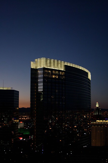
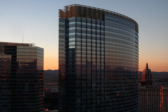
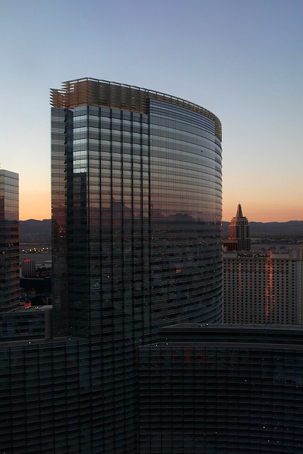
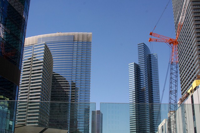
vdara hotel


View Larger Map

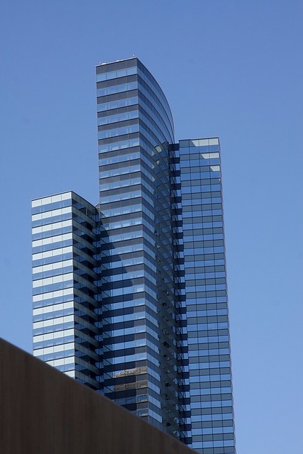
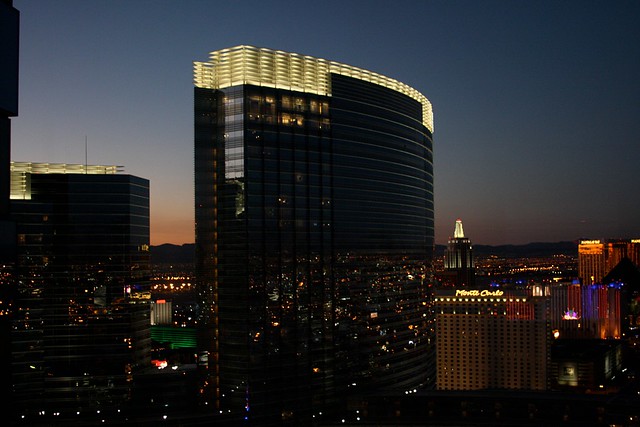
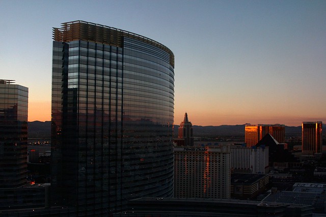
More photos -- daytime this time -- of the swanky new Vdara Hotel in Las Vegas. It's surprising how low key and low profile a 1500 room, 57 story hotel can be. It's set back away from the Strip between the Aria and the Bellagio, it doesn't contain a casino of its own, and the exterior is pleasant but distinctly un-flashy by Vegas standards (except for the Death Ray obviously). From the outside, it could just as easily be a nice business-oriented hotel in LA or maybe Atlanta. It doesn't even have the ubiquitous store selling hotel logo merchandise. The Aria next door has a huge store, but it sells nothing with the word "Vdara" on it. Or at least I didn't see anything, and I was looking.

I have a few room photos to share too, but they aren't ready to go just yet. It may not be completely obvious why I'm so fond of this hotel until I post those.

Vdara Hotel & Spa, Las Vegas Vdara Hotel & Spa, Las Vegas

Saturday, September 18, 2010

Lumia Fountain at the Aria

So-so camera phone video of the Lumia fountain in front of the shiny new Aria casino in Las Vegas. It's a fun piece of engineering wizardry, although you'll need to watch a better video to get the full effect. I recommend this one.