Showing posts with label yellowline. Show all posts

Monday, July 31, 2023

South Terminus

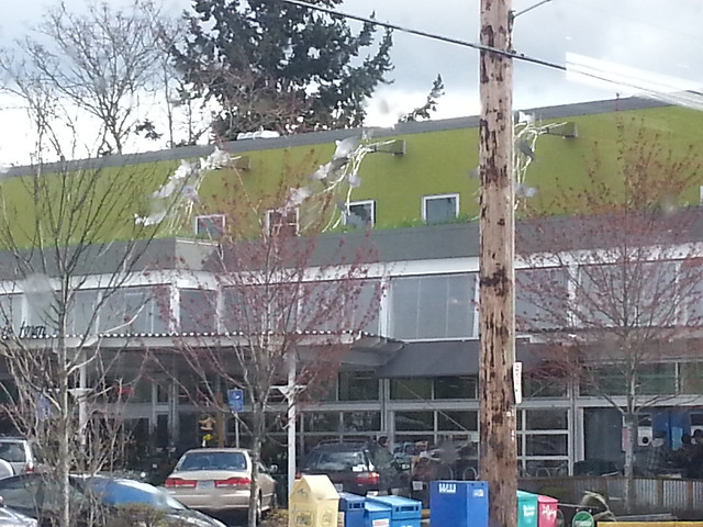
Next up we're visiting downtown Portland's "South Terminus", the little park/plaza at the south end of the downtown transit mall, where the MAX Green Line turns around and the Yellow Line becomes the Orange Line (and vice versa). The most notable feature of the place, from a distance, is a tall curved steel structure seen in most of the photos above, which exists to hide (and keep people out of) an electrical substation. The inner workings of it are further concealed by a fence and something called "coil drapery", and (most importantly) the south-facing side of the structure is covered in solar panels, which contribute a purely symbolic amount of electricity toward running the train.

North of all that, there's the actual turnaround area, which takes up most of the block and is just utilitarian train tracks and gravel. And because MAX trains have the turning radius of, well, trains, there was a crescent of land left over inside the loop, which became a small brick plaza and landscaped garden.

All of this was originally built in 2009 for the Green Line, and then "completed" in 2012, and reworked a bit in 2015 for the Orange Line, and further redesigned in 2017 for reasons we'll get to in a moment. If you're familiar with my ongoing projects and occasional obsessions here, you'd think I would have had a post up about it the day it opened, but no. I didn't even pay very close attention as it changed repeatedly over time.

The original design firm behind the project still has a project page up bragging about it, and -- to be fair -- the project got all sorts of rave reviews when the Green Line opened, like a 2009 Architect's Newspaper article, a breathless Oregonian article from January 2010, a similar Avada article, and a 2010 issue of FORM magazine. Though I should note that all of this publicity came even though the solar energy part of the project wouldn't be ready for another two years.

One of the selling points behind their design was, we're told, that "the solar panels identify both Portland and TriMet as leaders in sustainability". Solar project finally opened in 2012 and proved to be a bit controversial. Different articles tell us it either produces around 65,000 kilowatt-hours per year, or 67,000 kilowatts per year, depending on who's reporting and how much they know about electricity. Which is not a lot of power given what they paid for the system (although it cost less than half the original projections thanks to price drops for solar gear). Projections at the time were that the system would pay for itself in about 65 years, though a TriMet spokesman insisted it would be more like 22.5 years, which would mean it's over halfway paid for at this point, which is nice, I guess.

The original plan here was a bit more ambitious and would have augmented the trickle of solar power with a trickle of wind power from 22 little fun-sized wind turbines atop the power poles. Unfortunately(?) the startup that was chosen to build these Little Windmills That Could couldn't get the job done and the whole firm cratered shortly afterward. At that point the idea was quietly dropped.

At one point there was a bench somewhere in the park/plaza area with a builtin LED display so visitors could monitor the system's power output as electricity dribbled out of it. I vaguely remember seeing it, but it's not there now. I can only guess at the timeline but I imagine it was damaged beyond repair by bored vandals shortly after it went in, and then quietly removed during the next renovation, since that's what always happens around here. Or at least it's what always happens in public spaces when you don't give "normies" any reason to spend time there.

I do have a proposal here: At whatever point they redesign the park again, my suggestion would be to divert some of the plaza's solar bounty to power a wireless charging station. To me, charging your phone from those solar panels right over there makes for a much better demonstration than just watching LED numbers tick over in electrical units almost nobody really has a feel for. You might ask why, if that's really such a great idea, why didn't they build it that way in the first place? That's actually an easy one: The project was designed prior to 2009, and wireless charging was still a wacky sci-fi idea back then, shelved next to flying cars and atomic jetpacks. By early 2012 the technology had advanced from "works in the lab" to "getting hyped at CES", but a lot of ideas get hyped at trade shows but never ship in volume, much less catch on with the public. The first phones supporting the new Qi power standard finally shipped in September of that year.

There was also an online version of that power meter, so you could watch your tax dollars at work without getting off your couch, if you were so inclined. The site continued on for years, long after its brick-and-mortar version was hauled away. But it's gone now, because if you were designing a hip, fancy, cutting-edge website in 2009-2012, chances are you built it in Adobe Flash, the powerful full-featured programming language of the future. Over time that consensus shifted to "Flash is insecure and unfixable", and it was officially discontinued in all major browsers on New Years Eve 2021, thus breaking the site. Maybe somebody who cares enough will go back fix it at some point, but I wouldn't bet money on that. Old websites that survive in the long term usually do so by being very low maintenance, like the Space Jam and Mars Pathfinder sites, both from 1996.

All in all, the solar thing was exactly the sort of project Republicans have in mind when they sneer at people for "virtue signaling". But that's a bit unfair in this case; the idea is not to radiate civic virtue directly, but to persuade rich Californians to invest in luxury real estate here, thus boosting the local tax base and (in theory) paying for future civic virtue that way.

There was also a small piece of land left over that they couldn't use for turning around, as it was inside the minimum turning radius of any MAX car, so it became sort of a public mini-garden. also I could swear there used to be public access into the landscaped area. A page at Kavanagh Transit Photos confirms my memory of this, showing what the place looked like in 2009 when it was new. No fence around the place then.

We get a hint of the issues facing the park in a September 2013 nuisance complaint, which asserted the plaza was full of tall grass and weeds and animal feces at that point, which seems accurate if memory serves.

Like a lot of people who take up gardening as a hobby, after a few years of it TriMet evidently realized it couldn't keep up with the watering and weeding and in 2017 hired another landscaping firm to rework the design into something a bit more low-maintenance. Their page says, diplomatically, that nearby construction killed a lot of the original plants here. The page says something about designing a fence to keep people out during construction, maybe it became permanent at that point. The signs around the area say "Limited Access" rather than the usual "No Trespassing" or "No Public Access". I'm not really sure what "Limited Access" means here. It's an unfamiliar bit of officialese and I'm not sure how to interpret it. Maybe it's still officially open and there just aren't any entrances anymore. Maybe you're only allowed in on group tours, which are offered once every other decade.

Oh, and before all of this, there was a circa-1900 house here. It wasn't on the National Register of Historic Places, but was on the city's historic inventory as of 2002 (mentioned in some of the paperwork around moving the Simon Benson House, a National Register property) A little searching came back with a photo of that house, from an interesting Rose City Transit page about what various MAX stations looked like before they were MAX stations.

Sunday, May 29, 2016

Comets

The next bit of MAX line art we're looking at is Comets, an installation along the Vanport Bridge over the Columbia Slough & Columbia Blvd. TriMet's Yellow Line art guide describes it:

Spencer T. Houser and Chris Rizzo present two approaches to the nearly 4,000-foot light rail bridge. Ninety flaming comets inspired by the car culture of the '50s blaze northward from Kenton. Blue metal panels on the north end of the bridge allude to the Columbia River.

I imagine the blue panels on the north end of the bridge are officially a separate piece with a different title, but I don't know what it's called, and I don't think I have any good photos of the panels right now anyway.

Saturday, November 22, 2014

Vanport Bridge


View Larger Map

The next Columbia Slough bridge on our little tour is the newest, other than the recently replaced Vancouver Ave. bridge. The Vanport Bridge is the long elevated structure right next to the Denver Ave. bridge that carries the MAX Yellow Line over the slough, Columbia Boulevard, the Union Pacific rail line, and a long stretch of industrial land north of the slough. Altogether it's nearly 4000 feet long. It's a fairly utilitarian-looking structure, so TriMet has tried a few things to, I guess, humanize it a little. First, they had the public vote on names for the bridge back in 2003, before the line opened, and "Vanport Bridge" was the overwhelming winner of that contest. (Not to be confused with an entirely different Vanport Bridge in Pennsylvania, which carries Interstate 376 over the Ohio River somewhere near Pittsburgh.)

TriMet also spent a decent chunk of the MAX line's One Percent for Art money on public art to decorate the bridge. From TriMet's Yellow Line art guide:

Spencer T. Houser and Chris Rizzo present two approaches to the nearly 4,000-foot light rail bridge.
  • Ninety flaming comets inspired by the car culture of the '50s blaze northward from Kenton.
  • Blue metal panels on the north end of the bridge allude to the Columbia River.

Despite the art it hasn't yet become a beloved local landmark, so there isn't a lot of stuff about it out on the net. I did find a few mentions of it from TriMet and various engineering firms that had a hand in its construction:

Saturday, September 06, 2014

Voices of Remembrance

Portland's MAX Yellow Line ends at the Expo Center, the city's general-purpose large event space. Auto shows, dog shows, cat shows, trade shows, gun shows, swap meets, concerts, and so forth. The Cirque du Soleil sets up circus tents in the parking lot every so often. The Multnomah County Fair used to be held here, and the old Pacific-International livestock expo was held here for many years and lent its name to the place.

Riders exiting the train pass under a set of Japanese torii gates, each adorned with little metal tags jangling in the wind. This is Valerie Otani's Voices of Remembrance, the public art for this MAX station, and it commemorates a much darker episode in the Expo Center's history. From the local arts agency's description of the piece:

Five cedar gates commemorate the site where Japanese Americans were imprisoned during World War II. Stainless steel tags in the shape of tags people were required to wear, create sound giving voice to this history.

There are numerous accounts on the net about Oregon's deportations and the Expo Center's role in them, including articles at the Oregon Historical Society, OPB, BlueOregon, & Portland IndyMedia. The latter two include a survey of 1942 news stories from the Oregonian. I was thinking of doing that myself but I'd recommend reading those accounts instead. Japanese internment was a national shame; these articles point our our particular local shame: The unseemly enthusiasm Portland brought to the task, and the fact that almost nobody spoke out against the deportations. There are probably still a few people around who spent World War II rounding up law-abiding citizens, or guarding the camps, or stamping transit orders in the internment bureaucracy, although of course nobody will admit to it now.

There's also a good article about the gates at UltraPDX by artist Linda Wysong. (The article link goes to a Wayback Machine copy of the piece, as the UltraPDX site seems to be offline right now.)

This is not Portland's only monument to this ugly historical episode -- there's also the Japanese American Historical Plaza in Waterfront Park, as well as a few references along the "festival streets" in Chinatown. I think this one is by far the most effective of the lot, however. Next time you're at the Expo Center, take a moment to stop and look, and think about what happened here.

Wednesday, April 23, 2014

Waterline

As with the previous post, we're once again at the Delta Park/Vanport MAX station to look at another piece of Yellow Line public art. This one takes a bit more effort to find; the station includes a couple of overflow parking lots, the furthest next to the entrance to Portland International Raceway. The whole area is naturally low and marshy, and they must have concluded the parking lot would need a stormwater drainage feature. So a small wetland area was created and the lot built around it. This being a publicly funded transit project, some 1% For Art money was spent on sprucing up the new wetland area, and Waterline was born:

The artist was involved with much of the site design including grading, lighting, materials, and plant design. The visual focus is a basalt boulder that Is cut in half with stacked welded steel and acrylic and is lit with fiber optics at night.

That "Art of Stormwater" list from the city that I keep referring back to has a different take. (I apologize for this post being so quotation-heavy, but I figure I can either give you the original descriptions by people who knew what they were talking about, or I can try to paraphrase them as best I can, and I'm not really in a paraphrasing mood.)


Linda Wysong, Artist; 2004 Located near the Vanport site, Waterline integrates art, engineering, and the environment - reflecting the juxtaposition of the built and the natural environment in the managed landscape.

TriMet's Yellow Line art guide elaborates further:

  • Massive steel arcs allude to the engineered landscape and Liberty ships made by Vanport residents.
  • A glowing monolith of stone, steel and acrylic symbolizes the unity of human and natural worlds.

The "glowing monolith" resembles parts of Wysong's Shifting Assets along the Willamette stretch of Springwater Corridor. You can't really see the "glowing" part here since I took these during the day, but another of the city's stormwater art documents (since stormwater art is a thing apparently) has a nighttime photo of Waterline, showing the, uh, water line glowing. This saves me the trouble of going back to take my own nighttime photos. Which I probably wouldn't do anyway, on the theory that there are likely to be a few mosquitoes here at night for much of they year. I've gone on several times about (pseudo-)bravely risking a case of West Nile on behalf of this humble blog and its Gentle Reader(s). In reality, I think I'd like to avoid that, if at all possible.

Vanport

North Portland's Delta Park / Vanport MAX station features a number of steel tent-like shapes next to the platform stairs. These are collectively known as Vanport, and they're one of the public art installations at this stop:

This storm water swale treats water collected from the bridge and parking lot. The three Corten roof sculptures refer to the Vanport flood,

Michael Creger for bronze storm drain scupper on wall.
It's fair to say this is one of the more downbeat public artworks around town, focusing as it does on the deadly 1948 Vanport Flood. TriMet's Yellow Line art guide elaborates further:
Linda Wysong addresses the area's layered history with an emphasis on the city of Vanport, a large wartime housing project swept away by the flood of 1948.
  • CorTen steel sculptures recall rooftops adrift in the 1948 floodwaters.
  • Remnants from a Vanport foundation are set into the sidewalk.
  • A bronze railing features cast artifacts from the Chinookan culture, Vanport and the Portland International Raceway.
  • A cast-bronze scupper channels stormwater into the bioswale below.
  • Community maps overlay the current Delta Park site onto the city grid of Vanport, and show the location of the station within the local river systems.
  • Works by Douglas Lynch and Timothy Scott Dalbow are reproduced in porcelain enamel on steel.

Wysong also created a number of other things we've seen here before: Shifting Assets along the Springwater Corridor; and Portals and Eye River, near the east end of the Hawthorne Bridge, north of OMSI. Several of those pieces have water themes as well. She also created Waterline elsewhere at the Vanport MAX station, which will be the s

I should point out that the Yellow Line opened in 2004, a year before Hurricane Katrina. That, and not the Vanport flood, is probably the event that comes to mind now when you think of floodwaters and rooftops. If, by chance, the line had been delayed, or the hurricane had come a year earlier, this sculpture might have been considered sort of, I dunno, insensitive.

Tuesday, April 01, 2014

Flying Salmon

So, a while back I ran into a list the city put together titled "Landscapes for Rain: The Art of Stormwater". Which is exactly what it sounds like: Art that does something with rain, or sends some sort of positive message about rain. Those of you who follow the TV show "Portlandia" will find nothing surprising or unusual about this. It's a little, I dunno, twee, if you ask me, but nobody ever asks me.

One item on the list leaped out at me: Flying Salmon isn't just part of this weird stormwater art genre; it's also yet another example of Heroic Salmon Swimming Upstream, an endlessly overused and abused motif around here that local public art buyers can't seem to get their fill of. Flying Salmon is not just any set of random downspouts, either; it's part of a swanky New Seasons grocery store in rapidly gentrifying North Portland, right along Interstate Avenue. The snark practically writes itself. Here's how the city describes it:

Flying Salmon, New Seasons Arbor Lodge -
Ivan McLean, Sculptor; Richard Brown Architects AIA;
Lango Hansen, Lanscape Architects; 2005

The highlight of the sustainable approach to rain water collection at this New Seasons Market is the rooftop garden above the entry vestibule. 6400 N Interstate Ave., Portland Oregon. More information on the architects at www.langohansen.com.

I actually took these photos from a southbound MAX train. I'd just been to the Oregon Slough Railroad Bridge, where I'd been rained on quite a bit, and I was cold, and didn't feel like it was worth getting off the train for another damn photo of salmon art. It would be hard to beat the top photo anyway; maybe in picture quality if I'd brought the DSLR along, but composition-wise... well, it's heroic salmon atop an upscale grocery store, and there's a freakin' Subaru parked out front. I couldn't beat that if I tried. Incidentally, last December was the 45th anniversary of Subaru arriving in Portland. Back in 1968, nobody could have guessed what a big deal Subaru would become here. Of course they probably figured we'd be flying atomic jetpacks around the moon colonies by now, but I digress.

It turns out that Flying Salmon was created by the same guy who did Rational Exuberance, a big bright yellow sculpture that temporarily sat outside the Pearl District's Encore condo tower. That title, of course, is a play on a famous phrase by Alan Greenspan about the overheated real estate market, and the sculpture sat outside the last condo tower built before the real estate bubble popped in 2008. I'm still not clear on how much of the irony here was intentional, and how much was a fortuitous accident. In any case, I rather liked the art itself, it was just the title I was all snarky about. And to be honest I don't actually dislike Flying Salmon either. I'm sure it's a great set of downspouts and that it's exactly what New Seasons wanted. It's just that it exists in a larger milieu of rich white hipster preciousness, and that's what I keep rolling my eyes about. I've been rolling my eyes about it for years, actually, and so far it doesn't seem to be helping.

Flying Salmon Flying Salmon

Sunday, February 16, 2014

Icons of Transformation

Here's another stop on our occasional tour of the art along the MAX Yellow Line; I don't already have a full set of photos like I did with the Green Line last year, so posts are likely to show up with haphazard timing and in no particular order. Today's stop takes us to the Overlook Park station, which sits next to the park of the same name. The north and southbound stations each have a glass tower featuring a number of faces. TriMet's art guide for the Yellow Line says of them:

Fernanda D'Agostino was inspired by research on the healing power of light and nature.
  • Light towers modeled after roadside shrines in Poland feature portraits of community members overlaid with images of nature.
  • Art glass in the windscreen suggests the transforming power of nature.
  • Community map artist Margaret Eccles created a symbol for the relationship between good health and community.

D'Agostino's website bio has one line mentioning this project, which is how I know what it's called. The Yellow Line guide annoyingly doesn't mention key details like that.

The Polish theme is here thanks to the St. Stanislaus Polish Catholic church just north of the MAX station, while the health theme is due to the nearby Kaiser medical center. The more I read about the endless MAX design process, the more I realize just how much diplomacy and compromise went into the design of each station. (And how else would we get a hybrid Polish/healthcare themed station here, and a hybrid maritime/stormwater theme at the Prescott station?) A Catholic Sentinel article (which focuses primarily on the Polish aspect of the MAX station) gives an indication of what the project was like:

'I wanted to show how people's inner life, whoever they are, is really, really rich,' says D'Agostino, who worked with a 175-year-old German stained-glass company to produce the multi-colored and multi-layered panels.

'I wanted the towers to mean something to anybody whatever their spiritual life, whether they are a secular humanist, or a Catholic or a Jew. I was thinking of the spirit as people's inner life and I was getting into people's heads. .Ƃ .Ƃ . I was after what gives people a sense of wonder.'

Initial art committee meetings about two years ago presented a 'conundrum,' D'Agostino said. Prevalent in the committee were members of the Polish community, which has peopled St. Stanislaus Parish and a community hall on North Interstate Avenue for a century. But also in the group were representatives of Kaiser Permanente health clinics at the station site and who pushed for some kind of healthcare motif. Added to that were neighborhood leaders touting racial diversity and conservationists pointing to the area's reputation as a gateway to nature.

This is a city that loves process, or at least a city that's easily intimidated by people who love process. I imagine most artists (and most people in general) wouldn't be too thrilled about partnering with a micromanaging Committee of Concerned Citizens and Umpteen Other Stakeholders. I used to wonder why so many TriMet commissions go to the same five or six people, year in and year out; I'm sure tolerance for process pain is a big part of the answer. A track record of delivering on time and on budget probably doesn't hurt either. Possibly we ought to consider sending a few of them to the state legislature. I'm not saying we'd be better off, but I doubt we'd be any worse off.

Sunday, February 09, 2014

Fenwick Pocket Park

A couple of photos of tiny Fenwick Pocket Park, at N. Interstate Avenue & Fenwick Avenue, not far from the Kenton MAX station. This was yet another piece of the public art project around the MAX station, other parts being Paul Bunyan, the blue ox hooves nearby, and some cattle designs at the station platform. The main event here is a set of architectural elements salvaged from the old Portland Union Stockyards building, once located just north of the Kenton neighborhood until it was demolished in 1998. The Yellow Line art guide says:

Fenwick Pocket Park
  • Terracotta fragments came from the Portland Union Stockyards building.
  • A mosaic medallion from the building's entryway was restored and embellished with a border.

I suppose they had to create a separate nano-park for the stockyard stuff; siting it in the same place as the Babe the Blue Ox hooves would have been in poor taste.

fenwick2

The stockyards were once a huge regional operation, the largest stockyard in the Northwest, and the major employer in this part of the city, and now they've entirely vanished, gone the way of the old Forestry Center building, the cable car ramp in Goose Hollow, and the giant Richfield sign in the West Hills. A 1956 Oregon State University agricultural bulletin, "The Portland Union Stock Yards, A Case Study in Livestock Marketing" explained how the stockyards operated, toward the tail end of their heyday.

The essential points of the Chicago Stockyards system that have been followed so closely by the other 65 stockyards markets of the United States are: (1) one corporation owns all the pens, scales, and feeding and loading facilities; (2) anyone is permitted to buy or sell but sellers usually employ a commission man who is familiar with the market to do his selling; (3) anyone with proper financial and moral responsibility may engage in the commission business, subject to approval by the United States Packers and Stockyards Division.

In addition to providing a trading place, al of these stockyards still perform their original functions of loading, unloading, feeding, and watering all animals arriving or leaving regardless of whether they are offered for sale. At some stockyards, such as Ogden and SaltLake, more than half of the animals arriving are merely stopped for feed, water, and rest and are then reloaded for other destinations, al without being offered for sale. In contrast, at Seattle, San Francisco, and Los Angeles, very few animals are reloaded for other destinations.
detail, fenwick pocket park

A PSU history project about the Kenton neighborhood (in connection with the MAX Yellow Line) explains that the decline and eventual closure came as the industry no longer needed a centralized middleman. The effect on the surrounding neighborhood was predictable.

By mid-century, however, the industry began to change. Centralized stockyards declined in popularity and the businesses that had long defined the landscape and lives of Kenton began to close. In 1966 the Swift Meat Company closed its doors. Just a few short years later, the Portland Stockyards closed after suffering years of declining sales. The once solidly working-class neighborhood fell into decline. Crime increased as businesses shut their doors, and long-time residents moved in search of jobs.

The paper then moves on to some wide-eyed enthusiasm about the coming renaissance of Kenton with mass transit and gentrification for all. Whatever. Anyway, elsewhere I ran across a couple of vintage stockyards photos if you're curious at all. Though obviously photos can't convey what it must have smelled like.

fenwick4

I realize I'm pointing out this fact about cows at my peril; the last time I pointed out that cows don't smell so great, a bunch of angry Facebook people showed up to complain about the fancy city slicker who doesn't know where food comes from. Trust me, my uncle had cows when I was a kid. I know where cheeseburgers come from. Doesn't mean I'm going to pretend cows smell like expensive cologne or fresh cookies baking or something. I mean, go ahead and complain anyway, I won't stop you. I'll even refund every cent you paid me to read this, if it makes you feel any better. Deal?

Sunday, January 26, 2014

Prowform and Propform

A few photos of Prowform and Propform, a pair of public artworks at the Prescott St. MAX station. Prowform is a construction of tubes and vanes at the north end of the station, designed to sorta-resemble the prow of a ship (allegedly), while Propform is the rusty propeller shape in the nearby "Prescott Biozone". Said biozone is of the region's seemingly endless demonstration projects around trying to mange stormwater in an artsy and upscale sort of way. The city's Bureau of Environmental Services maintains a list of such projects, which describes Prowform and Propform thusly:

Brian Borrello and Valerie Otani, Artists; 2004 These sculptures, inspired by the historical ship building industry on Swan Island, are artful representations of the history of the area, as well as innovative approaches to managing stormwater.
MAX Yellow Line art guide says of the two, "A stainless steel "ship's prow" gathers rainwater and funnels it to a greenspace.", and "A rusted steel propeller sculpture flowers amidst a swirling pattern of grasses."

I'm not sure what the process was for choosing an overall theme for each MAX station. Generally they're supposed to reference the local neighborhood somehow, and they picked the maritime industries of Swan Island for this one. That's a reasonable choice. So far, so good. But they also had to include a positive environmental / educational message about stormwater management, for whatever reason, and figure out how to mash the two ideas together. These two themes don't have any obvious synergies, which may be why we ended up with a pair of nautical-themed downspouts. I'm not sure what else they could have made and still stayed within the prescribed themes, quite honestly.

It's odd that we have an actual genre of stormwater-themed art here. Maybe I'm the only person who thinks that, I dunno. In recent decades the city's Bureau of Environmental Services (the delicately-named sewer agency) has tackled the multi-billion-dollar Big Pipe and other big-ticket capital projects, and the 1% for Art rules apply to them as much as anyone else, so I suppose that makes for a large pot of money to draw from. For that kind of money we could probably have gotten ourselves a giant gold statue of South Park's Mr. Hankey, or maybe some Futurama sewer mutants, but for whatever reason the city prefers art that focuses strictly on the boring rainwater side of their business. Like Prowform and Propform, Eye River near OMSI has a focus on our heroic struggle against the endless, pitiless rains. Memorial Inscription near PSU isn't water-themed itself, but it's part of a mini-plaza that also includes educational displays so college students can learn important truths about the rain, our friend, constant companion, and eternal adversary. Or whatever.

Sunday, January 12, 2014

Second Growth

Here are a few photos of Second Growth, the art at the Albina/Mississippi MAX station. It follows a common design in recent TriMet art: A visual riff on the local neighborhood, set on top of a pole so casual vandals can't reach it. I think I'm going to start calling these things "lollipops". Anyway, TriMet's yellow line Art guide describes the concept behind the station:

Wayne Chabre created symbols of the indomitable spirit of the community.

  • A bronze, tree-like vine flowers with forms representing the arts of the area.
  • Bronze benches incorporate images from neighborhood industries.
  • The community map by Chabre and Jeanne McMenemy features lyrics of songs from cultures of historic importance to Albina.
  • Works by Jacob Pander and Bill Rutherford are reproduced in porcelain enamel on steel.

Second Growth is the bronze tree-like vine. The artist's website describes it:

This piece celebrates the history of the surrounding neighborhood, where jazz clubs flourished in the 20s & 30s; an area that is now largely industrial, but which continues to re-imagine itself. It is home to such diverse enterprises as a brewery and an art glass factory, two of several businesses that are represented in the sculpture.

Chabre also created Connections at the county office building on Hawthorne, which I rather liked. There's an obvious family resemblance between the two pieces.

A Daily Journal of Commerce story about Second Growth says "The piece of art – a plant bursting from the pavement and flowering into musical and art icons – is designed to symbolize the surrounding area’s urban renewal rebirth after years of battling neglect and racism." This interpretation is sort of... problematic. Redemption via urban renewal is not, strictly speaking, what really happened to NE Portland. Not during the heyday of urban renewal in the 60s and 70s, and not now in the era of transit-driven gentrification. I realize the DJC is a business paper focusing on the construction trade, but still. When the PDC bulldozers came to this part of town, they were not greeted as liberators. Call me crazy if you want, but I like to think that historical accuracy still matters.

Monday, December 23, 2013

North Denver Plaza

In yesterday's Paul Bunyan post, I mentioned that the rival Paul Bunyan statue at the Trees of Mystery has a Babe, the Blue Ox at his side, and ours doesn't. This is basically true, but when the MAX Yellow Line went in they added a sort of reference to Paul's bovine companion, in another little plaza right across Denver Ave. from Bunyan himself. TriMet's MAX yellow line art guide just says this:

N Denver Plaza
Brian Borrello's seating sculpture was inspired by Babe the Blue Ox.

The "seating sculpture" being four sorta-benches that look like blue hooves. This terse blurb at least names the mini-park and tells us who created the hooves. Turns out he's created several other things that have appeared here before: People's Bike Library of Portland on Burnside, downtown; Lents Hybrids at the Foster Rd. MAX station on the Green Line, and Silicon Forest at the MAX Yellow Line's Rose Quarter station.

So the question remains why we didn't get a blue ox in the first place. The Trees of Mystery has one, and it turns out a shorter Bunyan in Bemidji, Minnesota has a blue ox as well. The Oregonian database never mentions the idea, as far as I can tell, so we're left trying to guess. Obviously the expense and finding a place to put it would've been factors, but the other key thing is that the longtime largest employer in Kenton wasn't the timber industry, but the old Union Stockyards just to the north of here. If beef is what's for dinner, maybe you don't want to go portraying a giant ox as an intelligent, friendly and loyal companion. I can't prove that's the reason, but it makes a much better story than if it just cost too much, or there wasn't room for it, or that building an ox just didn't occur to anyone.

Paul Bunyan Plaza

Here are a few photos of Portland's famous Paul Bunyan statue, and the plaza he stands in. He was created for the city's mostly-forgotten 1959 Centennial Exposition, and stood at the corner of N. Interstate & Argyle for over half a century. He was moved a block south to the present location as part of the MAX Yellow Line project, and later received a "makeover" in 2009, restoring details that had faded over time. I've always thought the statue is kind of, I dunno, derpy-looking. And strangely bashful, despite being 31 feet tall and wielding a giant axe. The expression makes his current location kind of hilarious though; he stands looking north, gazing across the street at the Dancin' Bare strip club with a shy, hopeful look on his face. At least this scenario makes a kind of sense. Someday, once the city fully gentrifies the Kenton neighborhood, there will be a condo tower across the street, and the ground floor will have a doggie day spa, an upscale yoga studio, and a hot restaurant by the indie chef du jour. And Paul Bunyan will still be standing there with the same dopey look on his face, and it just won't add up. Even if he did have a mighty hankerin' for some Icelandic fusion banh mi, he'd never make it past the building concierge, giant axe or no.

I was originally going to compare our Bunyan unfavorably with the taller one down at the Trees of Mystery in Northern California. I seemed to remember (from seeing him years ago) that he was rougher and tougher and more manly-looking than ours, but a quick image search reveals that he's actually kind of crudely put together. Derpy or not, our guy still beats their guy in the looks department. Their guy comes out ahead in height (which admittedly is a big deal in the Bunyan universe), and having an actual blue ox, and being slightly animatronic, and having a guy inside who cracks jokes and joshes with visitors, and featuring in a This American Life episode about the guys who have this unusual job. We come out ahead in the department of not wiring a bumper sticker onto your car while you're in the gift shop, although supposedly they don't do that anymore either.

The Bunyan statue was announced on February 1st, 1959, a couple of weeks before the state's official 100th birthday. On May 20th, a construction photo showed the statue nearly completed. By early July, Portland was already feuding with Bangor, Maine, which had inaugurated a Bunyan of its own earlier the same year. It seems that Portland's was (allegedly) taller by a few scant inches, but the Bangor Bunyan stood upon a six-foot pedestal, and the Bunyans' backers bickered over whether the pedestal counted toward a statue's stature. The paper dubbed this the Battle of the Bunyans. The battle was settled decisively in 1961 when the obviously taller California Bunyan came along. It seems everyone was building a backyard Bunyan; It wasn't so much a Battle of the Bunyans as a Bunyan bubble. Which inevitably went the way of all bubbles, and the Trees of Mystery one remains the world's tallest to this day.

In any event, the statue remained Kenton's big local landmark through the ups and (primarily) downs of the following decades. He showed up in a 1976 article profiling the neighborhood as it was then. A few years later he made another appearance in a 1983 article about a study of the Kenton area, which described the prospects of revitalizing the neighborhood as "bleak, but not hopeless", whatever that means. A Bunyan photo ran in a 1985 article about Oregon roadside attractions. The MAX line sped either revitalization or gentrification, whatever you prefer to call it, but it's still not a place you'd ever confuse with the Pearl District or trendier parts of Inner NE closer to downtown.

As for the little plaza where our Bunyan now stands, I've found at least one city document using the "Paul Bunyan Plaza" name, and I'm not sure what else you'd call if if not that. It's not a city park strictly speaking; PortlandMaps says it's a piece of unused street right-of-way, I suppose left over from MAX construction, meaning the city Transportation Bureau owns the land. I don't know who empties the trash cans and so forth; I imagine it would be either TriMet or possibly neighborhood volunteers.

Friday, December 06, 2013

Silicon Forest

Here are a few photos of Silicon Forest, the solar powered earth-o-licious tree structures at the Interstate/Rose Quarter MAX station. TriMet's Yellow Line art guide describes it:

Brian Borrello presents a three-part metaphor for displacement and change.
  • Illuminated metal trees generate their own electricity from solar panels.
  • A virtual campfire flickers with light at night, surrounded by stainless steel stump seats.
  • Light filtering through colored glass on shelter roofs simulates the dappled light of a forest.
  • Concrete tree rings in the platform symbolize the forest once abundant on the site.
  • Custom guardrails feature branching tree limbs and roots.

So it was created by the same guy who created People's Bike Library of Portland, and the blue ox feet at the Kenton MAX stop, and a number of other public art doodads around town that I haven't covered yet. Apparently he designed the entire MAX station, not just the trees, but I didn't realize that at the time and only have photos of the trees.

The usual idea with MAX station art, on any of the various MAX lines, is that it's supposed to be somehow inspired by or related to the surrounding neighborhood. I don't really envy the task here. Today it's just sports arenas and mass transit, and making MAX art about being a MAX hub might be too self-referential even for Portland. Until the early 1960s there was a thriving majority-black neighborhood here, before the bulldozers of urban renewal came and swept it away. That would be an obvious choice for a theme, but the excesses of urban renewal aren't exactly a happy, self-esteem-boosting topic, and TriMet probably wouldn't go for that. Maybe "metaphor for displacement and change" is an oblique reference to the area's history, I'm not really sure.

In any case, the name "Silicon Forest" has been a nickname for the Portland-area tech industry, coined (and trademarked) by Lattice Semiconductor in 1984 and swiftly adopted by local boosters, by analogy with "Silicon Valley". Though a proper pedantic engineer (such as, um, myself) would point out that the industry's westside office parks typically replaced farmland, not forests, technically. We do, at least, have a decent claim on the "Silicon" part of the name, since the design & initial manufacturing of Intel chips happens here. And the Trail Blazers (who play in the nearby Moda Center) are owned by a certain Microsoft mega-billionaire, and Microsoft products generally rely on said Intel chips. As far as I know that's the one tech industry connection to this particular spot in Portland.

Tuesday, August 07, 2007

River Spirits


View Larger Map

So here's another of the munchkin-sized art parks along the MAX Yellow Line. This little spot of land is known as the Ainsworth Greenspace, because it sits at the corner of Ainsworth St. & Interstate Avenue. It's home to the sculpture you see here, "River Spirits"

TriMet describes the spot as:

Three tree totems with poetry written by students at Ockley Green Middle School surround a small plaza.


I wouldn't go quite so far as to describe them as totems, but I suppose they're sort of totem-ish, and they do have a sorta Northwest Indian theme, despite being made mostly out of rusting steel bits welded together.

River Spirits

One mildly curious thing is that although the place was created with your urban renewal transit dollars, it's not actually next to a MAX stop. You might catch a quick glimpse of it from the train as you speed by, but that's about it. Possibly someone just thought the corner could use a little sprucing up, and it's hard to disagree there. On one side you have a depressing 60's-era middle school that tends to bring up the rear in those pesky "No Child Left Behind" rankings. Right across the street there's a controversial and reportedly quite skeezy porn store.

River Spirits

I'm not 100% convinced the sprucing-up job is a success, though. If you number among this blog's femto-armada of Gentle Reader(s), you already know I'm not a huge fan of rust, not on cars, not on art, basically nowhere. Ok, so this particular sculpture has an intriguing texture if you look closely enough, or at least it does at present. But people look at you funny if you do that, and given the park's immediate neighborhood, you can sort of imagine why.

It's possible the place is a touch more cheery when the sun's out. Like that ever happens, I mean.

River Spirits

Look closely at the above photo for a moment. A little closer. There, that's good. You're getting sleeeeepy. So just relax and keep looking at the spiral. Now get out your credit cards and... No, I kid, I kid.

River Spirits

If you've been in Portland for any length of time, you've probably seen this face motif before in some form or other. It's derived from a locally iconic example of tribal rock art out in the Columbia Gorge. It's one of the very few such examples we've got around here, so we've sort of been beating it to death over the last decade or two, and it shows up everywhere, often without explanation. Like most people in the Northwest, I've never actually seen the original in person, although I think I saw it in HD on OPB once.

The other two river spirits are supposed to be a crow and a salmon. And sure, yes, they're proper native imagery and so forth, but when I see this stuff I always end up lamenting we don't have more interesting wildlife around these parts. Like snow monkeys, say, or wild parrots, or giant tortoises, or echidnas, just to name a few off the top of my head. I mean, salmon? Borrrrrringgggg.....

River Spirits

River Spirits

Thursday, June 14, 2007

Prescott Biozone

View Larger Map

If you've ridden the MAX Yellow Line very often, you might have noticed the big rusty propeller in a small vacant lot next to the Prescott MAX station. You might've wondered if it was left over from our city's seafaring heyday, or you might've just wondered what it was doing there now, or what it was supposed to be advertising. Wonder no longer (assuming you were wondering), for the answers you seek are here. If you weren't wondering, um, hello and welcome anyway, however you ended up at this obscure corner of the interwebs...

pbzone2

Anyway, it turns out this is not a historical artifact at all. It's Art, and the spot where it sits isn't a vacant lot at all, it's Nature. TriMet's guide to the Yellow Line's artworks calls this place "Prescott Biozone", which is quite the grand and optimistic title if you ask me.


Prescott Biozone
  • A rusted steel propeller
    sculpture flowers amidst a
    swirling pattern of grasses.
  • Three basalt basins
    collect water for birds.

As you can see in the photos, that's pretty much the whole story of the place: Propeller, grass, basins.

pbzone3

If you check this map for the overhead view, it sure looks like the Biozone is actually one of those traffic-calming sidewalk extension things, except with a propeller, grass, and some basins. That's what happens when you've got a nice pot of urban renewal cash to play with when you're building a MAX line, I guess. ART on FILE has a page about the place, although they don't mention anything about it being a Biozone. Unlike TriMet's brief blurb, they credit the designers, Brian Borello (who also did the blue ox hooves up at the Kenton MAX station) along with Valerie Otani. The page also offers a clearer description of the place:

In recognition of the shipbuilding industry the artists designed stainless steel “ship’s prow” forms that collect rainwater and then funnel it into a green space. A large rusted steel propeller sits near the station in a swirling pattern of grasses. The water running off of the blades of the propeller is captured in three basalt basins and used as water for birds.

So I suppose you'd really need to see the piece in action during a rainstorm to get the full effect. Fair enough. We've got no shortage of rainstorms much of the year, so I guess it's reasonable to put in art that relies on the rain. I started out thinking the place was dumb, and I didn't see the connection between the propeller (a reference to Swan Island, just down the hill to the west) and the whole ecology thing. Now it all makes a wee bit more sense, although I admit I'm taking their word for it. The basins might fill up just as well just letting them sit out in the rain, for all I know. PDX Magazine also mentions the place briefly, calling it "Brian Borello’s visual meditations on rain filtration at the N Prescott St Station".

As an aside, I would like to register my continued displeasure at a current fashion, where people will think something's "green" because it's covered in unmowed, tassely grass. The semi-accursed Tanner Springs Park is full of the stuff. Which to my mind constitutes active governmental persecution of those of us with grass allergies. And what's with all that stagnant basin water? West Nile, anyone? Anyone...?

Friday, June 01, 2007

photo friday: northern edition

bunyan1


View Larger Map

If you dropped by here yesterday (and don't feel bad if you didn't; nobody else did either), you might recall that I hopped the Yellow Line north to the Kenton neighborhood to play "weird guy wandering around with a camera" for a bit. Don't worry, we're done with roses for the moment. Here are a few other neighborhood attractions, starting with the, uh, famous Paul Bunyan statue. They just don't make roadside kitsch like this anymore, monumental in size but brightly colored, and with a big goofy grin. This makes him kind of hard to work with, camera-wise. You can either just take the stock photo above, or you can try to get a little creative:

bunyan2

But here's the best angle available, in which we learn exactly why Mr. Bunyan sports that goofy grin:

bunyan3

Perhaps you were wondering about the absent Blue Ox. This particular Bunyan never had one, even before they moved him to the current location (officially known as "Paul Bunyan Plaza") when MAX went in. Here's a 2002 Trib story about the move. The story notes:
Across Denver Avenue, a sculptor will install small statues in the shape of hooves representing Paul’s pal, Babe the Blue Ox. They will serve as seats.


So here are those hooves, which sit across Denver Ave. from Bunyan. We didn't get the full ox, and probably not for budgetary reasons, either. No self-respecting artist in this modern era would be caught dead building something that would go with the Bunyan statue. And doing just the hooves gives you a great opportunity to spout art jargon, too, stuff like "subverting the dominant paradigm". Which I suppose the hooves do, in a way.

bunyan4

TriMet's public art info for the Yellow Line says the mini-park with the hooves is called "N. Denver Plaza", not to be confused with Paul Bunyan Plaza across the street. So now you know.


Next stop, a few blocks to the east at the corner of Fenwick & Interstate, is what TriMet calls Fenwick Pocket Park, featuring a few salvaged architectural elements from the old Portland Union Stockyards building that used to be around here somewhere. Kenton started out as a company town, which explains the distinctive architecture in the business district along Denver Avenue. No, I don't have any photos of the business district. I ought to have taken some, but I was a bit overly narrowly-focused yesterday and just sort of didn't.

Suffice it to say that the business district still has a lot of its blue-collar, "old Portland" character... for now. Like downtown St. Johns, it's just too cute and too close in to avoid the gentrifiers for much longer. Like St. Johns, the process has already started. If you're curious, you may want to go have a look now. You'll be able to say you saw the place before it was all upscale coffee chains, swanky martini bars, and doggie day spas, like the rest of 21st century Portland.

When the city brings in artists to build monuments to your neighborhood's vanished working-class glory, you can be absolutely sure that you won't be a working-class neighborhood for too much longer. At least not if the city can help it.

fenwick1

fenwick2

detail, fenwick pocket park>

fenwick4

The bovine theme continues at the Kenton MAX station:

k-max1

Cow, Kenton MAX Station


A couple of blocks west of Bunyan is Kenton Park, which has your usual collection of sports fields, playgrounds, etc., nice enough but nothing to go out of your way to see. I understand the city's thinking about siting a skate park here. From the neighborhood association's board minutes: Tom reports that Dreamland will be sure to design a facility so that kids will be drawn to it and not to other areas of Downtown Kenton. It will be a small enough facility that it will not attract kids from all over the city.".

Which is an interesting and rather defensive way to put it. You could probably write a whole book about how and why communities decide to provide certain sports or recreational facilities and not others. Nearly every neighborhood park in the city provides a baseball diamond or two, and these get used maybe once in a blue moon. Meanwhile, we've heard for years about the Portland area's critical shortage of soccer fields. You'd think it wouldn't be too hard to convert a few baseball diamonds around town into soccer fields, but apparently it isn't quite that simple.

Conventional wisdom seems to go something like this: If you build basketball courts, you attract inner city gangs. If you build soccer fields, you get Hispanic folks, and skate parks pull in the teenagers, and we all know teenagers are nothing but trouble. Baseball fields, however, attract only wholesome, Midwestern, field-of-dreams types. Yes, even the screaming Little League dads are 100% pure and wholesome; what could be more American than erupting in a violent psychotic rage over whether the last pitch was a ball or a strike? Just thinking about that makes me want some apple pie. So even if your baseball field just sits there empty 99% of the time, it still elevates the neighborhood's moral character simply by existing. Or that's the theory, anyway.

Society's been willing to make a few concessions to the city's skateboarders in recent years. I suppose the thinking is that, unlike being an ethnic minority, being a teenager is something one grows out of eventually. If kids' anarchic impulses can just be channeled constructively for a few years, they may yet become productive, respectable, taxpaying members of society. Sure, older generations think it's a weird activity, and wonder why kids do it if nobody's even keeping score and don't have a coach screaming at them from the sidelines. But hey, teenagers are mysterious and inscrutable like that.

Kenton Park

Kenton Park